Category:1940s maps of Belarus
Countries of Europe: Austria · Belarus · Belgium · Bosnia and Herzegovina · Bulgaria · Denmark · Finland · France‡ · Germany · Greece · Hungary · Iceland · Republic of Ireland · Italy · Lithuania · Luxembourg · Netherlands‡ · Norway · Poland · Portugal‡ · Romania · Russia‡ · Spain‡ · Sweden · Switzerland · Turkey‡ · Ukraine · United Kingdom
‡: partly located in Europe
‡: partly located in Europe
Subcategories
This category has the following 4 subcategories, out of 4 total.
- 1940 maps of Belarus (18 F)
- 1941 maps of Belarus (1 F)
- 1943 maps of Belarus (1 F)
- 1949 maps of Belarus (1 F)
Media in category "1940s maps of Belarus"
The following 3 files are in this category, out of 3 total.
-
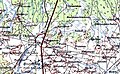 Байдакі на нямецкай мапе 1941 г.jpg 624 × 386; 115 KB
-
 Кухнаўшчына на нямецкай карце 1941 г.jpg 624 × 299; 66 KB
-
 Нямецкі план полацкага ўмацаванага раёна.jpg 642 × 1,000; 156 KB


