Category:1940s maps of Turkey
Countries of Asia: Afghanistan · Cambodia · People's Republic of China · Egypt‡ · India · Indonesia‡ · Iran · Iraq · Israel · Japan · Jordan · Lebanon · Malaysia · Mongolia · Nepal · Pakistan · Philippines · Russia‡ · Saudi Arabia · South Korea · Syria · Thailand · Turkey‡ · Vietnam
Limited recognition: Taiwan · State of Palestine
‡: partly located in Asia
Limited recognition: Taiwan · State of Palestine
‡: partly located in Asia
Countries of Europe: Austria · Belarus · Belgium · Bosnia and Herzegovina · Bulgaria · Denmark · Finland · France‡ · Germany · Greece · Hungary · Iceland · Republic of Ireland · Italy · Lithuania · Luxembourg · Netherlands‡ · Norway · Poland · Portugal‡ · Romania · Russia‡ · Spain‡ · Sweden · Switzerland · Turkey‡ · Ukraine · United Kingdom
‡: partly located in Europe
‡: partly located in Europe
Subcategories
This category has the following 4 subcategories, out of 4 total.
- 1942 maps of Turkey (5 F)
- 1943 maps of Turkey (1 F)
- 1946 maps of Turkey (1 F)
- 1949 maps of Turkey (4 F)
Media in category "1940s maps of Turkey"
The following 11 files are in this category, out of 11 total.
-
 1940 German military map - Übersichtskarte Bulgarien-Griechenland.jpg 24,892 × 32,442; 132.82 MB
-
 1940 German military map - Übersichtskarte Charkow-Batum.jpg 24,662 × 32,395; 123.02 MB
-
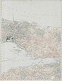 Konstantinopel - 47-41.jpg 3,816 × 5,010; 2.65 MB
-
 1940 German military map - Batum und Umgebung - Sheet 3.jpg 15,197 × 14,616; 47.91 MB
-
 1940 German military map - Batum und Umgebung - Sheet 4.jpg 18,561 × 14,428; 54.77 MB
-
 1940 German military map - Übersichtskarte Konya-Kairo.jpg 24,890 × 32,570; 130.85 MB
-
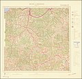
 1942 German military map - Syrien- Sheet Antakya (cropped).jpg 10,672 × 11,572; 24.76 MB
-

-
 1944 German military map - Europäische Türkei - Sheet Evrese.jpg 12,574 × 16,355; 38.73 MB
-
 23 Турция, Румыния и госубарства Балканского полуострова.jpg 3,404 × 2,753; 2.73 MB
-


.jpg)


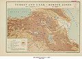
-_Border_Zones_-_DPLA_-_8a78017d24cf61fb97a8bd0dee6d3ddc.jpg)
_-_btv1b531215491_(2_of_6).jpg)