Category:1940s maps of the United Kingdom
Countries of Europe: Austria · Belarus · Belgium · Bosnia and Herzegovina · Bulgaria · Denmark · Finland · France‡ · Germany · Greece · Hungary · Iceland · Republic of Ireland · Italy · Lithuania · Luxembourg · Netherlands‡ · Norway · Poland · Portugal‡ · Romania · Russia‡ · Spain‡ · Sweden · Switzerland · Turkey‡ · Ukraine · United Kingdom
‡: partly located in Europe
‡: partly located in Europe
Constituent countries of the United Kingdom: England
Subcategories
This category has the following 11 subcategories, out of 11 total.
- 1945 maps of the United Kingdom (13 F)
E
Media in category "1940s maps of the United Kingdom"
The following 4 files are in this category, out of 4 total.
-
 Coalfields of Great Britain.jpg 769 × 1,303; 692 KB
-
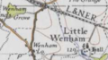 Map of Little Wenham, OS 1946.png 238 × 132; 54 KB
-
 Agricultural Map of Great Britain.jpg 25,014 × 38,998; 153.87 MB
-
 City of London Bomb Damage Map.jpg 1,988 × 2,780; 2.74 MB


