Category:Houses in Nottinghamshire
Ceremonial counties of England: Bedfordshire · Berkshire · Buckinghamshire · Cambridgeshire · Cheshire · Cornwall · Cumbria · Derbyshire · Devon · Dorset · Durham · East Riding of Yorkshire · East Sussex · Essex · Gloucestershire · Greater London · Greater Manchester · Hampshire · Herefordshire · Hertfordshire · Isle of Wight · Kent · Lancashire · Leicestershire · Lincolnshire · Merseyside · Norfolk · North Yorkshire · Northamptonshire · Northumberland · Nottinghamshire · Oxfordshire · Rutland · Shropshire · Somerset · South Yorkshire · Staffordshire · Suffolk · Surrey · Tyne and Wear · Warwickshire · West Midlands · West Sussex · West Yorkshire · Wiltshire · Worcestershire
City-counties: Bristol · City of London
Former historic counties: Huntingdonshire · Westmorland ·
Other former counties:
City-counties: Bristol · City of London
Former historic counties: Huntingdonshire · Westmorland ·
Other former counties:
Wikimedia category | |||||
| Upload media | |||||
| Instance of | |||||
|---|---|---|---|---|---|
| |||||
Subcategories
This category has the following 21 subcategories, out of 21 total.
Media in category "Houses in Nottinghamshire"
The following 182 files are in this category, out of 182 total.
-
 182 Beardall St, Hucknall - geograph.org.uk - 892824 (cropped).jpg 523 × 396; 52 KB
-
 182 Beardall St, Hucknall - geograph.org.uk - 892824.jpg 640 × 485; 74 KB
-
 19 and 21 Church Street - geograph.org.uk - 1014463.jpg 640 × 377; 107 KB
-
 1930s suburbia, Wollaton - geograph.org.uk - 1040735.jpg 640 × 469; 123 KB
-
 A Maple on Sycamore Road - geograph.org.uk - 2832.jpg 545 × 640; 65 KB
-
 A616 Kneesall - geograph.org.uk - 118071.jpg 640 × 438; 64 KB
-
 Beeston MMB 51.jpg 4,113 × 2,579; 2.91 MB
-
 Beeston MMB 75.jpg 4,035 × 2,634; 5.01 MB
-
 Beeston MMB 76.jpg 3,690 × 2,601; 3.08 MB
-
 Beeston MMB 79.jpg 4,195 × 2,559; 4 MB
-
 Beeston MMB 80.jpg 4,049 × 2,421; 3.81 MB
-
 Beeston MMB A8 Hetley Road.jpg 3,798 × 2,697; 4.16 MB
-
 Beeston MMB A9 Boundary Road.jpg 4,065 × 2,280; 3.73 MB
-
 Bestwood Village, Coronation Road - geograph.org.uk - 661614.jpg 640 × 480; 112 KB
-
 Bestwood Village, The Spinney - geograph.org.uk - 661606.jpg 640 × 429; 76 KB
-
 Bestwood Village, The Spinney - geograph.org.uk - 661609.jpg 640 × 480; 129 KB
-
 Bestwood Village, The Spinney - geograph.org.uk - 661611.jpg 640 × 437; 93 KB
-
 Far Street, Bradmore - geograph.org.uk - 667866.jpg 640 × 427; 87 KB
-
 Steeple Cottage - geograph.org.uk - 1771500.jpg 939 × 1,280; 257 KB
-
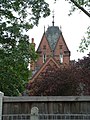
 Bradmore Church - geograph.org.uk - 1771503.jpg 1,280 × 1,023; 266 KB
-
 Black Horse, Caythorpe - geograph.org.uk - 1551415.jpg 640 × 479; 169 KB
-
 Main Street, Caythorpe - geograph.org.uk - 956081.jpg 640 × 480; 82 KB
-
 Christmas Day in West Bridgford - geograph.org.uk - 95302.jpg 640 × 480; 72 KB
-
 Collington Street, Beeston - geograph.org.uk - 1771800.jpg 640 × 480; 105 KB
-
 Cotmanhay - geograph.org.uk - 1409652.jpg 640 × 479; 146 KB
-
 Curates House - geograph.org.uk - 748119.jpg 640 × 480; 178 KB
-
 Dale Lane, Beeston - geograph.org.uk - 1768188.jpg 640 × 480; 58 KB
-
 Elkesley High Street and church - geograph.org.uk - 14305.jpg 600 × 333; 28 KB
-
 Empty streets (71 of 81).jpg 1,600 × 900; 1.1 MB
-
 Epperstone Manor - geograph.org.uk - 1628988.jpg 640 × 479; 113 KB
-
 Epperstone Manor - geograph.org.uk - 1629002.jpg 640 × 479; 100 KB
-
 Former Mapperley Brickworks - geograph.org.uk - 307645.jpg 640 × 426; 91 KB
-
 From Bilborough churchyard - geograph.org.uk - 606866.jpg 640 × 480; 99 KB
-
-
 All Saint's church - geograph.org.uk - 1659541.jpg 640 × 426; 67 KB
-
 Harlow Wood, private housing estate - geograph.org.uk - 57474.jpg 640 × 480; 94 KB
-
 Harrow Road - geograph.org.uk - 569474.jpg 640 × 480; 86 KB
-
 Heckdyke Grange - geograph.org.uk - 170960.jpg 640 × 480; 93 KB
-
 Holme, buttress and pantiled house - geograph.org.uk - 1718528.jpg 640 × 480; 104 KB
-
 House by Edwinstowe Churchyard - geograph.org.uk - 1590519.jpg 640 × 480; 96 KB
-

-
 House on Wood Lane , Gotham - geograph.org.uk - 1298905.jpg 640 × 480; 193 KB
-
 Houses and shop due for demolition (geograph 2790082).jpg 640 × 427; 97 KB
-
 Houses on Buckingham Drive - geograph.org.uk - 1614871.jpg 640 × 479; 119 KB
-
 Houses on Main Street, Gamston - geograph.org.uk - 939651.jpg 619 × 640; 80 KB
-
 Houses on Netherfield Lane - geograph.org.uk - 521449.jpg 640 × 480; 77 KB
-
 Houses on Saxondale Drive - geograph.org.uk - 1615706.jpg 640 × 479; 104 KB
-
 Houses on Winthorpe Road - geograph.org.uk - 241153.jpg 640 × 486; 79 KB
-
 Housing at Upper Saxondale - geograph.org.uk - 1614848.jpg 640 × 479; 124 KB
-
 Housing at Upper Saxondale - geograph.org.uk - 1614851.jpg 640 × 479; 106 KB
-
 Keepers Cottage - geograph.org.uk - 1761630.jpg 640 × 480; 99 KB
-
 Kimbolton.jpg 264 × 515; 18 KB
-
 Knowle Lane, Swingate - geograph.org.uk - 617039.jpg 640 × 466; 58 KB
-
 Limelane House - geograph.org.uk - 35043.jpg 640 × 480; 106 KB
-
 Millwell House - geograph.org.uk - 376994.jpg 640 × 427; 83 KB
-
 Millwell House - geograph.org.uk - 67688.jpg 640 × 480; 78 KB
-
 Modernised 'prefab' home, Bulwell - geograph.org.uk - 46138.jpg 640 × 443; 83 KB
-
 Newlands - geograph.org.uk - 179388.jpg 640 × 480; 80 KB
-
 Nottingham MMB I4 Meriden Avenue.jpg 3,876 × 2,664; 3.96 MB
-
 Nottingham MMB I5 Wensor Avenue.jpg 3,596 × 2,376; 2.89 MB
-
 Nottingham MMB K7 Nottingham Canal.jpg 3,827 × 2,589; 3.72 MB
-
 Prefab style home, Bulwell - geograph.org.uk - 46136.jpg 640 × 480; 80 KB
-
 Quaker House .jpg 1,758 × 1,950; 391 KB
-
 Quaker House Skegby .jpg 1,758 × 1,950; 1.01 MB
-
 Quaker House, Mansfield Road, Skegby.jpg 1,758 × 1,950; 1 MB
-
 Quaker House, Skegby .jpg 1,758 × 1,950; 938 KB
-
 Rampton Hospital - geograph.org.uk - 211315.jpg 640 × 427; 61 KB
-

-
 Sutton-on-Trent - Vine House.JPG 2,272 × 1,704; 1.17 MB
-
 Swingate near Sycamore Crescent - geograph.org.uk - 617036.jpg 640 × 466; 70 KB
-
 Terraced houses ready for demolition - geograph.org.uk - 121120.jpg 640 × 423; 82 KB
-
 The Barns nr Babworth - geograph.org.uk - 773869.jpg 640 × 420; 69 KB
-
 The entrance to Babbington Hall - geograph.org.uk - 616598.jpg 640 × 466; 59 KB
-
 The Hut - geograph.org.uk - 588844.jpg 640 × 427; 56 KB
-
 The top of Swingate - geograph.org.uk - 617024.jpg 630 × 452; 33 KB
-
 Thoroton Dovecote - geograph.org.uk - 946582.jpg 640 × 427; 89 KB
-
 Thoroton Dovecote - geograph.org.uk - 946587.jpg 640 × 427; 89 KB
-
 University Park MMB «66.jpg 3,996 × 1,782; 2.34 MB
-
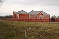
 Winkburn Old School 2.jpg 4,032 × 3,024; 5.94 MB
-
 Winthorpe Level Crossing - geograph.org.uk - 339690.jpg 640 × 431; 95 KB
-
 A fine array of pots - geograph.org.uk - 1195756.jpg 640 × 479; 128 KB
-
 A House called Kevin - geograph.org.uk - 1078051.jpg 640 × 423; 121 KB
-
-
 Agnes Villas - geograph.org.uk - 1197657.jpg 640 × 467; 91 KB
-
 Airedale Court, Chilwell - geograph.org.uk - 632141.jpg 640 × 365; 60 KB
-
 Alwyn Court - geograph.org.uk - 1176222.jpg 640 × 480; 149 KB
-
 Ancaster Gardens, Wollaton - geograph.org.uk - 1040849.jpg 640 × 474; 83 KB
-
 Apartments and Car Park - geograph.org.uk - 745859.jpg 640 × 427; 152 KB
-
 Apartments on Church Street, Beeston - geograph.org.uk - 1246899.jpg 640 × 478; 156 KB
-
-
 Archers Field - geograph.org.uk - 838516.jpg 640 × 426; 120 KB
-
 Babbington Hall - geograph.org.uk - 616356.jpg 640 × 466; 68 KB
-
 Bayford Drive - geograph.org.uk - 213615.jpg 640 × 396; 48 KB
-
 Belconnen Road - geograph.org.uk - 18538.jpg 640 × 480; 284 KB
-
 Bramblewood Estate - geograph.org.uk - 674427.jpg 640 × 480; 110 KB
-

-
 Bryn House - geograph.org.uk - 44014.jpg 640 × 480; 100 KB
-
 Bunny Hill Top - geograph.org.uk - 7991.jpg 640 × 450; 156 KB
-
 Cartwright Way, Beeston - geograph.org.uk - 1145633.jpg 640 × 426; 92 KB
-
 Charnwood Street - geograph.org.uk - 487279.jpg 640 × 360; 83 KB
-
 Charnwood Street - geograph.org.uk - 487287.jpg 640 × 359; 83 KB
-
 Clifford Avenue, Beeston - geograph.org.uk - 673082.jpg 640 × 427; 179 KB
-

-
 Cranston Road, Bramcote Hills - geograph.org.uk - 482762.jpg 640 × 428; 117 KB
-
 Croxley Gardens, Assarts Farm Estate - geograph.org.uk - 612588.jpg 640 × 480; 79 KB
-
 Curious house by the river - geograph.org.uk - 679457.jpg 640 × 458; 97 KB
-
 Earthquake damage - geograph.org.uk - 708670.jpg 640 × 427; 79 KB
-
 Ellicar House - geograph.org.uk - 605571.jpg 640 × 427; 63 KB
-
 Former Inn - geograph.org.uk - 759993.jpg 640 × 427; 59 KB
-
 Foxwood House - geograph.org.uk - 34982.jpg 640 × 480; 138 KB
-
 Georgian town houses - geograph.org.uk - 332700.jpg 640 × 427; 85 KB
-
 Grey House - geograph.org.uk - 92439.jpg 640 × 427; 86 KB
-
 Gunthorpe riverside - geograph.org.uk - 652821.jpg 640 × 480; 117 KB
-
 Hainton House - geograph.org.uk - 94696.jpg 640 × 480; 119 KB
-
 Hayden Villa, Linby - geograph.org.uk - 431530.jpg 640 × 480; 115 KB
-
 Hermitage House - geograph.org.uk - 663711.jpg 640 × 427; 88 KB
-
 Hidden behind a bank - geograph.org.uk - 778115.jpg 640 × 427; 149 KB
-
 Highfield House - geograph.org.uk - 507862.jpg 480 × 640; 108 KB
-
 House in Normanton on Soar - geograph.org.uk - 552282.jpg 640 × 449; 135 KB
-
 House near Babbington Hall - geograph.org.uk - 616492.jpg 640 × 466; 105 KB
-
 House with tower - geograph.org.uk - 715809.jpg 543 × 640; 55 KB
-
 Houses at New Kingston - geograph.org.uk - 14895.jpg 640 × 404; 128 KB
-
 Houses in Budby - geograph.org.uk - 454143.jpg 640 × 480; 130 KB
-
 Houses in South Leverton - geograph.org.uk - 458989.jpg 640 × 480; 122 KB
-

-

-
 Housing north of Mill Lane - geograph.org.uk - 243759.jpg 640 × 480; 112 KB
-
 I remember when all of this was school - geograph.org.uk - 463148.jpg 640 × 480; 118 KB
-
 Innes Close, Carlton - geograph.org.uk - 312719.jpg 640 × 427; 85 KB
-
 Isolated house - geograph.org.uk - 403635.jpg 640 × 480; 122 KB
-
 Isolated House - geograph.org.uk - 4238.jpg 640 × 527; 87 KB
-
 Isolated Street - geograph.org.uk - 148834.jpg 640 × 480; 84 KB
-
 Keepers Close - geograph.org.uk - 661605.jpg 640 × 480; 77 KB
-
 Kent Road, Porchester Gardens - geograph.org.uk - 87818.jpg 640 × 480; 90 KB
-
 Killarney Park - geograph.org.uk - 35010.jpg 640 × 480; 112 KB
-
 Kirkwood - geograph.org.uk - 360404.jpg 427 × 640; 89 KB
-
 Lawrence Avenue, Colwick. - geograph.org.uk - 312620.jpg 640 × 421; 101 KB
-
 Lea Pools, Arnold - geograph.org.uk - 32051.jpg 640 × 480; 133 KB
-
-
 Little Hayes - geograph.org.uk - 182037.jpg 640 × 480; 107 KB
-
 Lombard Street houses - geograph.org.uk - 338160.jpg 640 × 427; 71 KB
-
 Lonely Semi - geograph.org.uk - 213401.jpg 640 × 480; 74 KB
-
 Modern Mansion - geograph.org.uk - 221256.jpg 640 × 480; 76 KB
-
 Moor Farm , Bramcote Hills - geograph.org.uk - 622485.jpg 626 × 459; 96 KB
-
 Moor Lane, Normanton on Soar - geograph.org.uk - 551993.jpg 640 × 501; 96 KB
-
 Morton Grange - geograph.org.uk - 50239.jpg 640 × 480; 163 KB
-
 National Coal Board Housing, Cotgrave - geograph.org.uk - 161560.jpg 640 × 427; 123 KB
-
 Near Wilford Hill - geograph.org.uk - 36213.jpg 640 × 426; 130 KB
-
-
 New housing at Bilborough - geograph.org.uk - 667733.jpg 640 × 427; 71 KB
-
 Norwood Lodge - geograph.org.uk - 287008.jpg 640 × 480; 162 KB
-
 Old House, Sutton Bonington - geograph.org.uk - 10402.jpg 640 × 480; 179 KB
-
 Old House, Sutton Bonington - geograph.org.uk - 10404.jpg 640 × 480; 138 KB
-
 Orston Hall - geograph.org.uk - 132185.jpg 640 × 480; 176 KB
-
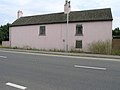 Pink House - geograph.org.uk - 194745.jpg 640 × 480; 79 KB
-
 Pre-war houses - geograph.org.uk - 67858.jpg 640 × 480; 166 KB
-
 Rampton Prebend - geograph.org.uk - 334670.jpg 640 × 427; 72 KB
-
 Red Brick Gothic - geograph.org.uk - 452904.jpg 480 × 640; 102 KB
-
 Rockley Nr Retford - geograph.org.uk - 83231.jpg 640 × 482; 78 KB
-
 Rondesbosch - geograph.org.uk - 94697.jpg 640 × 480; 119 KB
-
 Sacrista Prebend - geograph.org.uk - 334673.jpg 640 × 427; 71 KB
-
 Southwold Drive - geograph.org.uk - 622767.jpg 640 × 427; 107 KB
-
 Spring Hill, Swingate - geograph.org.uk - 616563.jpg 640 × 466; 46 KB
-
 Station Road - geograph.org.uk - 588813.jpg 640 × 427; 62 KB
-
 The demise of Abbey House - geograph.org.uk - 33643.jpg 640 × 480; 97 KB
-
 The Duke's study - geograph.org.uk - 415712.jpg 640 × 427; 64 KB
-
 The Fairways - geograph.org.uk - 663991.jpg 640 × 427; 64 KB
-
 The Fairways - geograph.org.uk - 663993.jpg 640 × 427; 55 KB
-
 The Hermitage - geograph.org.uk - 237862.jpg 640 × 427; 84 KB
-
 The Old Nurseries, Norwell - geograph.org.uk - 450322.jpg 640 × 480; 78 KB
-
 The Old Rectory - geograph.org.uk - 661591.jpg 480 × 640; 167 KB
-
 The Sycamores - geograph.org.uk - 97442.jpg 640 × 427; 80 KB
-
 The Vicarage - geograph.org.uk - 97431.jpg 640 × 427; 87 KB
-
 The White House - geograph.org.uk - 44060.jpg 640 × 480; 146 KB
-
 Tindale Bank Gatehouse - geograph.org.uk - 170873.jpg 640 × 480; 94 KB
-

-
 Watermeadows - geograph.org.uk - 113847.jpg 640 × 427; 71 KB
-
 Westholme Nr South Leverton Notts - geograph.org.uk - 90144.jpg 640 × 482; 96 KB
-
 Wharf Farm - geograph.org.uk - 338081.jpg 640 × 427; 59 KB
-
 Wigsley Road - geograph.org.uk - 94677.jpg 640 × 480; 137 KB
-
 Windmill Court, Sneinton - geograph.org.uk - 336722.jpg 640 × 427; 174 KB
-
 Workers houses on Barracks Farm - geograph.org.uk - 35035.jpg 640 × 480; 89 KB
.jpg)


.jpg)


.jpg)