Category:Houses in Tyne and Wear
Ceremonial counties of England: Bedfordshire · Berkshire · Buckinghamshire · Cambridgeshire · Cheshire · Cornwall · Cumbria · Derbyshire · Devon · Dorset · Durham · East Riding of Yorkshire · East Sussex · Essex · Gloucestershire · Greater London · Greater Manchester · Hampshire · Herefordshire · Hertfordshire · Isle of Wight · Kent · Lancashire · Leicestershire · Lincolnshire · Merseyside · Norfolk · North Yorkshire · Northamptonshire · Northumberland · Nottinghamshire · Oxfordshire · Rutland · Shropshire · Somerset · South Yorkshire · Staffordshire · Suffolk · Surrey · Tyne and Wear · Warwickshire · West Midlands · West Sussex · West Yorkshire · Wiltshire · Worcestershire
City-counties: Bristol · City of London
Former historic counties: Huntingdonshire · Westmorland ·
Other former counties:
City-counties: Bristol · City of London
Former historic counties: Huntingdonshire · Westmorland ·
Other former counties:
Wikimedia category | |||||
| Upload media | |||||
| Instance of | |||||
|---|---|---|---|---|---|
| |||||
Subcategories
This category has the following 12 subcategories, out of 12 total.
Media in category "Houses in Tyne and Wear"
The following 130 files are in this category, out of 130 total.
-

-

-

-
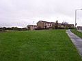
 Back Lane behind Beach Avenue - geograph.org.uk - 360096.jpg 640 × 479; 84 KB
-
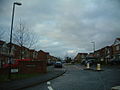
 Boyd Road Wallsend from Holy Cross - geograph.org.uk - 566287.jpg 640 × 425; 54 KB
-

-
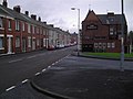
 Elm Terrace, The Green, Wallsend - geograph.org.uk - 596992.jpg 640 × 425; 83 KB
-

-
 Flats - geograph.org.uk - 78018.jpg 640 × 475; 121 KB
-
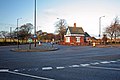
 Gate House - geograph.org.uk - 69468.jpg 640 × 475; 126 KB
-
 St Mark's - geograph.org.uk - 197742.jpg 640 × 468; 67 KB
-
 Harehills Tower, Kenton - geograph.org.uk - 72587.jpg 640 × 480; 55 KB
-
 Hawthorn Villas, The Green, Wallsend - geograph.org.uk - 596997.jpg 640 × 425; 124 KB
-
 House in Killingworth Village - geograph.org.uk - 69469.jpg 640 × 475; 133 KB
-
 Houses and Shops - geograph.org.uk - 78023.jpg 640 × 475; 112 KB
-

-
 Houses in Farringdon - geograph.org.uk - 199526.jpg 640 × 480; 98 KB
-
 Houses in Lealholm Road, Newcastle - geograph.org.uk - 115109.jpg 640 × 480; 155 KB
-
 Kenton Bar - geograph.org.uk - 69429.jpg 640 × 475; 116 KB
-
 Last Block Standing - geograph.org.uk - 71272.jpg 640 × 480; 69 KB
-
 Littledene - geograph.org.uk - 70766.jpg 640 × 480; 70 KB
-
 Longbenton Estate - geograph.org.uk - 69413.jpg 640 × 475; 83 KB
-
 Looking Towards Wallsend - geograph.org.uk - 228294.jpg 640 × 480; 100 KB
-
 Wesley Memorial Church, Low Fell.JPG 3,264 × 2,448; 1.68 MB
-
 Manorfields - geograph.org.uk - 222810.jpg 640 × 475; 88 KB
-
 Marden House - geograph.org.uk - 78743.jpg 640 × 475; 146 KB
-
 Montagu Estate - geograph.org.uk - 71886.jpg 640 × 480; 55 KB
-
 More New Estates - geograph.org.uk - 204784.jpg 640 × 480; 72 KB
-
 Morley Avenue - geograph.org.uk - 204872.jpg 640 × 480; 111 KB
-
 New Housing - geograph.org.uk - 201761.jpg 640 × 480; 78 KB
-
 New Housing Estate - geograph.org.uk - 199342.jpg 640 × 480; 76 KB
-
 New York Road - geograph.org.uk - 78756.jpg 640 × 475; 105 KB
-
 Old House Overlooks Pelaw Station - geograph.org.uk - 201800.jpg 640 × 480; 89 KB
-
 Old Houses in Shiremoor - geograph.org.uk - 78723.jpg 640 × 475; 106 KB
-
 Old stone house at Byermoor - geograph.org.uk - 3155664.jpg 4,608 × 3,456; 5.16 MB
-
 Over Crawcrook - geograph.org.uk - 113436.jpg 640 × 480; 85 KB
-
 P4020179.JPG 4,288 × 3,216; 3.38 MB
-
 Percy Park Road, Tynemouth - geograph.org.uk - 406015.jpg 640 × 468; 72 KB
-
 Percy Park, Tynemouth - geograph.org.uk - 299417.jpg 640 × 480; 52 KB
-
 Percy Park, Tynemouth - geograph.org.uk - 406011.jpg 640 × 454; 71 KB
-
 Post-War Cul-de-Sac - geograph.org.uk - 66720.jpg 640 × 480; 55 KB
-
 Proud Terracing on Sunderland Road - geograph.org.uk - 71314.jpg 640 × 480; 66 KB
-
 Ravenswood Road - geograph.org.uk - 87616.jpg 640 × 475; 92 KB
-
 Redbrick Terrace - geograph.org.uk - 87640.jpg 640 × 480; 124 KB
-

-
 Ryhope Road, Sunderland - geograph.org.uk - 404660.jpg 640 × 467; 60 KB
-
 Selby Gardens - geograph.org.uk - 78783.jpg 640 × 475; 91 KB
-
 South Parade - geograph.org.uk - 204880.jpg 640 × 480; 70 KB
-
 South Street - geograph.org.uk - 78721.jpg 640 × 475; 98 KB
-
 Splendid Property - geograph.org.uk - 76901.jpg 640 × 480; 123 KB
-
 Springwell Village - geograph.org.uk - 74440.jpg 640 × 480; 84 KB
-
 St John's Avenue - geograph.org.uk - 66580.jpg 640 × 480; 63 KB
-
 St John's Road - geograph.org.uk - 71855.jpg 640 × 480; 125 KB
-
 St Peters - geograph.org.uk - 24173.jpg 640 × 480; 67 KB
-
 Student Accommodation - geograph.org.uk - 170313.jpg 640 × 480; 40 KB
-
 Taylor Gardens - geograph.org.uk - 201774.jpg 640 × 480; 107 KB
-
 Taylor Gardens 2 - geograph.org.uk - 201776.jpg 640 × 480; 124 KB
-
 Terrace in Shiremoor - geograph.org.uk - 78712.jpg 640 × 475; 118 KB
-
 The Birches - geograph.org.uk - 71841.jpg 640 × 480; 67 KB
-

-
 The New Estate - geograph.org.uk - 228291.jpg 640 × 480; 106 KB
-
 Traditional Terraces - geograph.org.uk - 75183.jpg 640 × 475; 100 KB
-
 Tynemouth Road - geograph.org.uk - 154136.jpg 640 × 475; 100 KB
-
 Victoria Terrace - geograph.org.uk - 175952.jpg 480 × 640; 88 KB
-
 Walker Road Residential - geograph.org.uk - 212499.jpg 640 × 480; 77 KB
-
 Wark Avenue - geograph.org.uk - 78715.jpg 640 × 475; 73 KB
-
 Wensleydale Avenue, Penshaw - geograph.org.uk - 175935.jpg 640 × 480; 41 KB
-
 West Denton Way - geograph.org.uk - 72652.jpg 640 × 480; 68 KB
-
 Where's The Chippy^ - geograph.org.uk - 201763.jpg 640 × 480; 79 KB
-
 Wiltshire Drive - geograph.org.uk - 69438.jpg 640 × 475; 74 KB
-
 Wiltshire Drive - geograph.org.uk - 69440.jpg 640 × 475; 69 KB
-
 Wiltshire Gardens "Maisonettes" 2007 - geograph.org.uk - 591561.jpg 640 × 425; 67 KB
-
 Wood and Hainingwood Terraces - geograph.org.uk - 204802.jpg 640 × 480; 77 KB
-
 Wynn Gardens - geograph.org.uk - 201830.jpg 640 × 480; 95 KB
-
 Angus Close - geograph.org.uk - 75164.jpg 640 × 475; 77 KB
-
 Bamburgh Road - geograph.org.uk - 69462.jpg 640 × 475; 72 KB
-
 Battle Hill - geograph.org.uk - 78035.jpg 640 × 475; 99 KB
-
 Benton Lane - geograph.org.uk - 75187.jpg 640 × 475; 94 KB
-
 Bishops Wood - geograph.org.uk - 113370.jpg 640 × 480; 72 KB
-
 Blue House - geograph.org.uk - 652882.jpg 640 × 425; 80 KB
-
 Bluebell Dene Newbiggin Hall - geograph.org.uk - 431607.jpg 640 × 480; 103 KB
-
 Bolbec Road - geograph.org.uk - 72583.jpg 640 × 480; 56 KB
-
 Brack Terrace Bill Quay - geograph.org.uk - 65515.jpg 640 × 480; 63 KB
-
 Brack terrace Old and New - geograph.org.uk - 198080.jpg 640 × 480; 66 KB
-
 Bradshaw Street - geograph.org.uk - 87606.jpg 640 × 475; 94 KB
-

-
 Broadpark - geograph.org.uk - 65530.jpg 640 × 480; 71 KB
-
 Bungalows on Gosforth Terrace - geograph.org.uk - 201740.jpg 640 × 480; 84 KB
-

-
 Coxon Street Really Doesn't Exist - geograph.org.uk - 199325.jpg 640 × 480; 54 KB
-
 Crocuses and Percy Park - geograph.org.uk - 728094.jpg 640 × 426; 111 KB
-
 Cromwell Terrace - geograph.org.uk - 204813.jpg 640 × 480; 95 KB
-
 Cromwell Terrace Gable End - geograph.org.uk - 204806.jpg 640 × 480; 85 KB
-
 Croxdale Gardens - geograph.org.uk - 204786.jpg 640 × 480; 99 KB
-
 Croxdale Terrace - geograph.org.uk - 201769.jpg 640 × 480; 85 KB
-
 Dean Terrace - geograph.org.uk - 76928.jpg 640 × 480; 66 KB
-
 Derelict Flats - geograph.org.uk - 78039.jpg 640 × 475; 61 KB
-
 Disused factory becomes town houses - geograph.org.uk - 591581.jpg 640 × 425; 67 KB
-
 Down Hill Farm, Boldon - geograph.org.uk - 133262.jpg 640 × 480; 69 KB
-
 Eighton Banks - geograph.org.uk - 221065.jpg 640 × 480; 47 KB
-
 Eighton Banks - geograph.org.uk - 94788.jpg 640 × 480; 137 KB
-
 Ethel Street - geograph.org.uk - 71915.jpg 640 × 480; 73 KB
-
 Flat Conversion On Gosforth Terrace - geograph.org.uk - 201743.jpg 640 × 480; 114 KB
-
 Flats and Shops - geograph.org.uk - 78020.jpg 640 × 475; 101 KB
-
 Flats at Kenton Bar - geograph.org.uk - 69514.jpg 640 × 475; 96 KB
-
 Forest Hall - geograph.org.uk - 69474.jpg 640 × 475; 81 KB
-
 Grangeside Court - geograph.org.uk - 78751.jpg 640 × 475; 86 KB
-
 Grosvenor-Sunderland Road Junction - geograph.org.uk - 76893.jpg 640 × 480; 86 KB
-
 Hainingwood Terrace - geograph.org.uk - 204805.jpg 640 × 480; 78 KB
-
 Hall Terrace - geograph.org.uk - 204862.jpg 640 × 480; 87 KB
-
 Hareydene, Newbiggin Hall - geograph.org.uk - 69501.jpg 640 × 475; 136 KB
-
 Heddon Hall - geograph.org.uk - 103965.jpg 640 × 427; 143 KB
-

-
 House on a hill - geograph.org.uk - 76518.jpg 640 × 346; 45 KB
-
 House. - geograph.org.uk - 513232.jpg 640 × 480; 93 KB
-
 Houses in Newbiggin Hall - geograph.org.uk - 69503.jpg 640 × 475; 113 KB
-
 Houses in Palmersville - geograph.org.uk - 69461.jpg 640 × 475; 98 KB
-
 Housing in North Hendon - geograph.org.uk - 87620.jpg 640 × 480; 61 KB
-
 Housing, Heworth - geograph.org.uk - 24183.jpg 640 × 480; 60 KB
-
 Hoyson Villas - geograph.org.uk - 204819.jpg 640 × 480; 87 KB
-
 Hylton Red House - geograph.org.uk - 87617.jpg 640 × 475; 104 KB
-
 Ingleborough Drive - geograph.org.uk - 113408.jpg 640 × 480; 107 KB
-
 Killingworth New Town - geograph.org.uk - 75160.jpg 640 × 475; 92 KB
-
 Lady Beatrice Terrace - geograph.org.uk - 172974.jpg 640 × 195; 21 KB
-
 Mulberry Park Housing Estate - geograph.org.uk - 466911.jpg 640 × 480; 93 KB
-

-
 Ouseburn House , Newcastle Upon Tyne - geograph.org.uk - 537064.jpg 640 × 480; 71 KB
-
 Rowan avenue - geograph.org.uk - 348692.jpg 640 × 426; 112 KB
-
 Sherburn Estate - Rowlands Gill - geograph.org.uk - 509803.jpg 640 × 480; 79 KB
-
 Sherburn Estate - Rowlands Gill - geograph.org.uk - 509814.jpg 640 × 480; 91 KB


