Category:Houses in Somerset
Ceremonial counties of England: Bedfordshire · Berkshire · Buckinghamshire · Cambridgeshire · Cheshire · Cornwall · Cumbria · Derbyshire · Devon · Dorset · Durham · East Riding of Yorkshire · East Sussex · Essex · Gloucestershire · Greater London · Greater Manchester · Hampshire · Herefordshire · Hertfordshire · Isle of Wight · Kent · Lancashire · Leicestershire · Lincolnshire · Merseyside · Norfolk · North Yorkshire · Northamptonshire · Northumberland · Nottinghamshire · Oxfordshire · Rutland · Shropshire · Somerset · South Yorkshire · Staffordshire · Suffolk · Surrey · Tyne and Wear · Warwickshire · West Midlands · West Sussex · West Yorkshire · Wiltshire · Worcestershire
City-counties: Bristol · City of London
Former historic counties: Huntingdonshire · Westmorland ·
Other former counties:
City-counties: Bristol · City of London
Former historic counties: Huntingdonshire · Westmorland ·
Other former counties:
Wikimedia category | |||||
| Upload media | |||||
| Instance of | |||||
|---|---|---|---|---|---|
| |||||
Subcategories
This category has the following 32 subcategories, out of 32 total.
*
A
- Airey houses in Somerset (1 F)
- Alfoxton House (2 F)
- Avishays, Chaffcombe (9 F)
B
- Bungalows in Somerset (3 F)
- Burwalls (9 F)
C
- Houses in Chard, Somerset (6 F)
D
- Houses in Dunster (6 F)
F
- Fyne Court (17 F)
J
M
P
- Portbury railway station (11 F)
S
- Strode House, Barrington Court (21 F)
T
V
W
- Houses in Weston-super-Mare (11 F)
Media in category "Houses in Somerset"
The following 200 files are in this category, out of 290 total.
(previous page) (next page)-
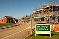
 "Hartley Meadow" housing development - geograph.org.uk - 172564.jpg 640 × 420; 65 KB
-
 18 Church Street, Dunster.jpg 3,608 × 2,848; 4.71 MB
-
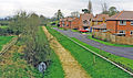
 70s estate - geograph.org.uk - 270247.jpg 640 × 480; 124 KB
-
 A gentle stroll down West Street - geograph.org.uk - 924773.jpg 640 × 480; 91 KB
-
 A Gentleman's House at Brislington by Samuel Hieronymus Grimm 1789.jpg 976 × 688; 197 KB
-
 A Lopen house in winter - geograph.org.uk - 93203.jpg 640 × 435; 76 KB
-
 Allerford, The Pack Horse Bridge - geograph.org.uk - 211754.jpg 640 × 480; 119 KB
-
 Allerford.jpg 448 × 640; 81 KB
-
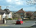
 Ansford Lodge, Higher Ansford (geograph 4509995).jpg 800 × 600; 139 KB
-

-
 Approaching Rock - geograph.org.uk - 353007.jpg 640 × 480; 69 KB
-
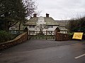
 Ashbrittle, Waldron's Farm - geograph.org.uk - 119771.jpg 640 × 427; 145 KB
-
 Ashwood Drive, Yeovil - geograph.org.uk - 542943.jpg 640 × 469; 128 KB
-
 Avishays - geograph.org.uk - 245007.jpg 640 × 480; 85 KB
-
 Balidon House Bow Window - geograph.org.uk - 1139700.jpg 640 × 367; 81 KB
-
 Bathampton - geograph.org.uk - 178612.jpg 640 × 400; 85 KB
-
 Bawler Road, Monkton Heathfield (2021).JPG 1,366 × 910; 369 KB
-
 Bickham - geograph.org.uk - 269829.jpg 640 × 480; 88 KB
-
 Church Road, Bridgwater (2018).JPG 1,366 × 820; 489 KB
-
 Silver Street, Bridgwater (2018).JPG 1,366 × 910; 420 KB
-
 Wembdon Road, Bridgwater (2018).JPG 1,366 × 910; 536 KB
-

-
 Building on Compass Hill, Taunton - geograph.org.uk - 803554.jpg 640 × 480; 69 KB
-
 Canal View, Bathpool (2021).JPG 1,366 × 1,024; 400 KB
-

-
 Charitylanebabington.jpg 640 × 482; 74 KB
-
 Chewstokebridge2.JPG 1,114 × 636; 159 KB
-
 The Church of the Immaculate Conception and Marine Parade, Clevedon (4832307296).jpg 3,888 × 2,592; 1.64 MB
-
 Clevedon MMB 03 The Beach.jpg 2,304 × 1,728; 1.07 MB
-
 Clevedon triangle-1 - panoramio.jpg 2,284 × 574; 402 KB
-
 Clevedon triangle-2 - panoramio.jpg 1,429 × 490; 189 KB
-
 Clutton Hill, at the top of Clutton Hill - geograph.org.uk - 1162747.jpg 640 × 499; 213 KB
-

-
 Compton Durville Manor House.jpg 4,608 × 3,456; 6.49 MB
-
 Court Place, West Monkton (2021).JPG 1,366 × 910; 302 KB
-
 Crabb House, Tellisford - geograph.org.uk - 438993.jpg 640 × 477; 87 KB
-
 Cranmere, Creech St Michael (2021).JPG 1,366 × 1,024; 806 KB
-
 Cranmore, new housing - geograph.org.uk - 915361.jpg 640 × 424; 195 KB
-
 Bull Street,Creech St Michael (2020).JPG 1,366 × 910; 593 KB
-
 Vicarage Lane, Creech St Michael (2020).JPG 3,456 × 2,304; 2.96 MB
-
 Cricketstthomaswlidlifepark.jpg 640 × 432; 87 KB
-
 Curvalion House, Creech St Michael (2021).JPG 1,366 × 910; 904 KB
-
 Des Res. - geograph.org.uk - 162981.jpg 640 × 479; 128 KB
-
 Dillons, Creech St Michael (2021).JPG 1,366 × 910; 601 KB
-

-
 Douglas Macmillan's house - geograph.org.uk - 460376.jpg 640 × 477; 95 KB
-
 Dulverton, Bath Meadow Drive - geograph.org.uk - 197323.jpg 640 × 427; 167 KB
-
 Dunster nunnery.jpg 2,471 × 3,707; 3.91 MB
-
 East of Wellow - geograph.org.uk - 644699.jpg 603 × 640; 89 KB
-
 Eastbourne Road, Taunton - geograph.org.uk - 654962.jpg 640 × 480; 68 KB
-
 Ebenezer Cottage, Holywell - geograph.org.uk - 4309879.jpg 640 × 427; 77 KB
-
 Edbrooke House - geograph.org.uk - 455351.jpg 640 × 480; 202 KB
-
 Exton House - geograph.org.uk - 1406615.jpg 640 × 428; 103 KB
-
 Fiveways House.jpg 4,032 × 3,024; 2.08 MB
-
 2019 at Flax Bourton station site - old station house.JPG 1,366 × 910; 666 KB
-
 Fowler's house, Hinton St George - geograph.org.uk - 548544.jpg 640 × 480; 96 KB
-
 Geograph 3182998 Holnicote House.jpg 640 × 427; 184 KB
-
 George And Dragon And White Lion Inns.jpg 4,080 × 3,072; 1.93 MB
-
 Greenham , Bishop's Hill and Houses - geograph.org.uk - 1332705.jpg 640 × 480; 77 KB
-
 Greenham Hall - geograph.org.uk - 1267298.jpg 640 × 480; 98 KB
-
 Hartnell's Farm development, Monkton Heathfield (2021).JPG 1,366 × 910; 405 KB
-
 Haydon House - geograph.org.uk - 231244.jpg 640 × 480; 96 KB
-
 Haydon House, near Taunton - geograph.org.uk - 135613.jpg 640 × 480; 100 KB
-
 Henstridge station site geograph-3670076-by-Ben-Brooksbank.jpg 2,344 × 1,385; 4.17 MB
-
 High Street, Dunster - geograph.org.uk - 500894.jpg 640 × 435; 119 KB
-
 Horsecombe Brow - geograph.org.uk - 764318.jpg 640 × 503; 95 KB
-
 House at Cowbridge Cross. - geograph.org.uk - 108182.jpg 640 × 480; 101 KB
-
 House at Podimore - geograph.org.uk - 442203.jpg 640 × 480; 171 KB
-
 House at Rock - geograph.org.uk - 353026.jpg 640 × 480; 74 KB
-
 House at the edge of Chargot Wood - geograph.org.uk - 271398.jpg 640 × 473; 111 KB
-
 House in Stone Allerton, Somerset - geograph-3866729.jpg 1,024 × 766; 172 KB
-
 House on Lullington Lane - geograph.org.uk - 733191.jpg 640 × 464; 109 KB
-
 House on Tuckerton Lane - geograph.org.uk - 381180.jpg 640 × 480; 94 KB
-
 House opposite Lancin Farm - geograph.org.uk - 1530202.jpg 640 × 480; 196 KB
-
 Houses in Beckington - geograph.org.uk - 439077.jpg 640 × 477; 104 KB
-
 Houses in Norton Fitzwarren - geograph.org.uk - 1002061.jpg 640 × 480; 58 KB
-
 Houses in Shurton - geograph.org.uk - 1435255.jpg 640 × 480; 106 KB
-
 Houses on Hoares Lane - geograph.org.uk - 280012.jpg 640 × 478; 73 KB
-
 Kings Drive, Westonzoyland - geograph.org.uk - 1801936.jpg 640 × 440; 69 KB
-
 Kite flying - geograph.org.uk - 671491.jpg 426 × 640; 46 KB
-
 Lane - geograph.org.uk - 425329.jpg 640 × 426; 165 KB
-
 Langford Estate.jpg 4,032 × 3,024; 4.48 MB
-
 Langport 01.jpg 5,152 × 3,864; 4.27 MB
-
 Langport 03.jpg 5,152 × 3,864; 4.31 MB
-
 Langport 04.jpg 5,152 × 3,864; 4.24 MB
-
 Lansdown Crescent - geograph.org.uk - 460012.jpg 640 × 480; 66 KB
-
 Launcherley Farm - geograph.org.uk - 204879.jpg 640 × 480; 83 KB
-
 Lisieux Way, Churchinford - geograph.org.uk - 1185543.jpg 640 × 480; 63 KB
-
 Little Barwick House - Barwick - geograph.org.uk - 1456791.jpg 640 × 480; 72 KB
-
 Lydford Hall - East Lydford (2) - geograph.org.uk - 424629.jpg 480 × 640; 191 KB
-
 Lydford Hall - East Lydford - geograph.org.uk - 424402.jpg 640 × 480; 138 KB
-
 Malmsmead Ford Exmoor. - panoramio.jpg 4,500 × 2,992; 8.61 MB
-
 Malt House, Perry Green - geograph.org.uk - 120973.jpg 640 × 426; 117 KB
-
 Manning's Close, Monkton Heathfield (2021).JPG 1,366 × 910; 318 KB
-
 Mill House Apratments, Norton Fitzwarren (2021).JPG 1,366 × 1,024; 423 KB
-
 Mill House, Creech St Michael (2021).JPG 1,366 × 1,024; 500 KB
-
 Mill Lane, Creech St Michael (2021).JPG 1,366 × 820; 480 KB
-
 Modern housing off the A3098 - geograph.org.uk - 1774522.jpg 640 × 536; 89 KB
-
 New development in West Street - geograph.org.uk - 577066.jpg 640 × 511; 67 KB
-

-
 New-build house - geograph.org.uk - 373721.jpg 640 × 480; 67 KB
-
 North Coker House - geograph.org.uk - 930442.jpg 640 × 480; 67 KB
-
 Norton Court - geograph.org.uk - 136605.jpg 640 × 426; 120 KB
-
 Collett Road, Norton Fitzwarren (2021).JPG 1,366 × 910; 334 KB
-
 Langford Mills, Norton Fitzwarren (2021).JPG 1,366 × 910; 386 KB
-
 Morse Road, Norton Fitzwarren (2021).JPG 1,366 × 910; 277 KB
-
 Norton Fitzwarren Bus Gate.JPG 1,366 × 910; 325 KB
-
 Norton Fitzwarren church from Morse Road (2021).JPG 1,366 × 910; 312 KB
-
 Old Mansion, Nash, c.1894.jpg 1,609 × 2,575; 1.18 MB
-
 Old Rectory Hardington Mandeville - geograph.org.uk - 507739.jpg 640 × 480; 110 KB
-
 Pensford church and viaduct. - panoramio.jpg 1,936 × 2,896; 1.14 MB
-
 Pool House, East End, Stoke St Michael - geograph.org.uk - 137652.jpg 640 × 480; 153 KB
-
 Portishead MMB 04 Battery Point.jpg 1,600 × 1,200; 756 KB
-
 Portishead MMB 19 Lower Burlington Road.jpg 2,416 × 4,251; 3.17 MB
-
 Prospect Farm - geograph.org.uk - 204877.jpg 640 × 480; 143 KB
-
 Rear of Thomas Street (west side) - geograph.org.uk - 616008.jpg 480 × 640; 76 KB
-
 Red Cot, Stretcholt - geograph.org.uk - 120391.jpg 640 × 426; 126 KB
-
 Refurbished - geograph.org.uk - 209011.jpg 640 × 480; 109 KB
-

-
 Wellington, Rockwell Green - geograph.org.uk - 163615.jpg 640 × 427; 128 KB
-
 Rockwell Green from Oaken Ground. 1976 - geograph.org.uk - 62852.jpg 640 × 379; 136 KB
-
 Rookham house - geograph.org.uk - 222700.jpg 600 × 450; 93 KB
-
 Rose Cottage, North Barrow - geograph.org.uk - 710786.jpg 640 × 480; 139 KB
-
 Round Pond House - geograph.org.uk - 68788.jpg 640 × 480; 136 KB
-
 Rowden-house.jpg 665 × 1,000; 662 KB
-
 Royston Water - geograph.org.uk - 1183510.jpg 640 × 480; 96 KB
-
 Ruined manor house, Vallis, 1893.jpg 2,449 × 1,582; 1.08 MB
-
 Ruishton church.jpg 480 × 640; 87 KB
-
 Runnymede Road, Yeovil - geograph.org.uk - 541110.jpg 640 × 438; 79 KB
-
 Rutland House, East Dundry - geograph.org.uk - 136497.jpg 640 × 426; 128 KB
-
 Southstoke Hall - geograph.org.uk - 947601.jpg 640 × 462; 88 KB
-
 St Andrew's Walk, Wells - geograph.org.uk - 577055.jpg 640 × 512; 97 KB
-
 Stawley, house at Kittisford Mill - geograph.org.uk - 145821.jpg 640 × 427; 160 KB
-
 Stone house in Castle Cary - geograph.org.uk - 460381.jpg 640 × 477; 123 KB
-
 Stone house in Nunney - geograph.org.uk - 440653.jpg 640 × 477; 109 KB
-
 Stourton House, Preston, Somerset c.1894.jpg 2,498 × 1,440; 966 KB
-
 Sunhill Park in Infra Red - panoramio.jpg 2,288 × 1,520; 2.23 MB
-
 Sutton Court.JPG 1,280 × 960; 323 KB
-
 St Teresa's Church, Taunton.jpg 640 × 480; 329 KB
-
 St. Teresa of Lisieux - geograph.org.uk - 165373.jpg 640 × 414; 57 KB
-
 Tellisford House - geograph.org.uk - 114761.jpg 640 × 480; 130 KB
-
 The Mill, Foxcote - geograph.org.uk - 731993.jpg 640 × 460; 151 KB
-
 The Priory, South Stoke - geograph.org.uk - 947636.jpg 640 × 480; 80 KB
-
 The Priory, Westonzoyland - geograph.org.uk - 1472428.jpg 640 × 480; 215 KB
-
 The Round House - geograph.org.uk - 182322.jpg 640 × 425; 101 KB
-
 Tin roofed house for sale - geograph.org.uk - 710809.jpg 640 × 480; 208 KB
-
 Upper Godney. Old School House.jpg 6,000 × 4,000; 6.75 MB
-
 Variety of building styles - geograph.org.uk - 486217.jpg 640 × 477; 84 KB
-
 Vicars Close Wells. - panoramio.jpg 2,307 × 1,485; 1.47 MB
-
 View down Broomstreet valley - geograph.org.uk - 449501.jpg 584 × 425; 98 KB
-
 Watchet - First 60918 (YG02DLJ).jpg 1,024 × 768; 398 KB
-
 Waterloo Crescent Charlton Horethorne - geograph.org.uk - 557397.jpg 640 × 480; 141 KB
-
 Wellington, Quantock Road - geograph.org.uk - 159203.jpg 640 × 427; 174 KB
-
 Wellington, Sylvan Road - geograph.org.uk - 159143.jpg 640 × 427; 129 KB
-
 Wemberham House - geograph.org.uk - 89843.jpg 640 × 426; 131 KB
-
 West End Terrace, Norton Fitzwarren (2020).JPG 1,366 × 910; 474 KB
-
 Wheelers Road, Midsomer Norton - geograph.org.uk - 126999.jpg 640 × 430; 104 KB
-
 White house at Birchanger. - geograph.org.uk - 109027.jpg 640 × 449; 100 KB
-
 Williamsmithshouse.jpg 640 × 480; 154 KB
-
 Williton Victoria Square.JPG 768 × 1,024; 189 KB
-
 'Furzewood' - house on West Hill, Wincanton, Somerset.jpg 640 × 480; 77 KB
-
 Windwhistle - geograph.org.uk - 222730.jpg 600 × 399; 45 KB
-
 Wisteria-clad house in Westcombe - geograph.org.uk - 585250.jpg 640 × 480; 168 KB
-
 Wraxall 2009 MMB 00 «03.jpg 2,400 × 1,600; 1.79 MB
-
 Wyke House, Wyke Champflower - geograph.org.uk - 131432.jpg 553 × 425; 106 KB
-
 Yallands Hill, Monkton Heathfield (2021).JPG 1,366 × 910; 421 KB
-
 2014 at Yatton station - Station House 1.JPG 1,366 × 1,024; 279 KB
-
 2014 at Yatton station - Station House 2.JPG 1,366 × 1,024; 447 KB
-
 Youngwood Green - geograph.org.uk - 133001.jpg 640 × 426; 96 KB
-
 A house at Walrond's Park - geograph.org.uk - 504419.jpg 640 × 480; 154 KB
-
 A New House - geograph.org.uk - 96696.jpg 640 × 338; 67 KB
-
 Abbey Manor Estate - geograph.org.uk - 1159928.jpg 640 × 428; 49 KB
-
 Abbey Manor Park Housing Estate - geograph.org.uk - 1159930.jpg 640 × 428; 45 KB
-
 Barrington Rd Burnham on Sea - geograph.org.uk - 840332.jpg 640 × 480; 71 KB
-
 Bathealton, Lower Poleshill - geograph.org.uk - 153964.jpg 640 × 427; 206 KB
-
 Batts House, North Petherton - geograph.org.uk - 344428.jpg 640 × 480; 69 KB
-
 Bishops Lydeard, Cotford St Luke - geograph.org.uk - 159238.jpg 640 × 427; 154 KB
-
 Bishops Lydeard, Cotford St Luke - geograph.org.uk - 159243.jpg 640 × 427; 129 KB
-
 Broadlands House - geograph.org.uk - 575462.jpg 640 × 426; 84 KB
-
 Burford - geograph.org.uk - 191622.jpg 640 × 480; 86 KB
-
 Cadbury Way, Keynsham - geograph.org.uk - 363799.jpg 640 × 469; 51 KB
-
 Cary Fitzpaine House - geograph.org.uk - 542981.jpg 640 × 480; 84 KB
-
 Castle House and Gate Cottage - geograph.org.uk - 157339.jpg 640 × 426; 115 KB
-
 Cathay Lane, Cheddar, Somerset - geograph.org.uk - 275209.jpg 640 × 427; 156 KB
-
 Catsgore House - geograph.org.uk - 444015.jpg 578 × 640; 192 KB
-
 Chapel House, Lamyatt - geograph.org.uk - 492370.jpg 640 × 480; 80 KB
-
 Charcroft House - geograph.org.uk - 1408609.jpg 640 × 480; 94 KB
-
 Charlcombe Rise. - geograph.org.uk - 117669.jpg 640 × 480; 62 KB
-
 Church House, Beckington - geograph.org.uk - 681240.jpg 640 × 584; 155 KB
-
 Churchstanton, Churchinford - geograph.org.uk - 206369.jpg 640 × 427; 211 KB
-
 Churchstanton, Hunter's Lodge - geograph.org.uk - 206374.jpg 640 × 427; 201 KB
-
 Commercial Road, Shepton Mallet - geograph.org.uk - 378360.jpg 640 × 480; 96 KB
-

-

-
 Council Houses in Bishop's Lydeard. - geograph.org.uk - 148340.jpg 640 × 480; 100 KB
-

-
 Court House, near Standerwick - geograph.org.uk - 651351.jpg 640 × 436; 79 KB
-
 Deane Drive, Galmington - geograph.org.uk - 174399.jpg 640 × 425; 64 KB
-
 Elborough Housing Park - geograph.org.uk - 74429.jpg 640 × 480; 73 KB
-
 Elbow Corner, Pylle - geograph.org.uk - 469790.jpg 640 × 480; 113 KB


.jpg)


.JPG)

.JPG)
.JPG)
.JPG)


.JPG)


.jpg)


.JPG)

.JPG)

.JPG)
.JPG)

.JPG)

.JPG)


.JPG)


_-_geograph.org.uk_-_424629.jpg)


.JPG)
.JPG)
.JPG)
.JPG)


.JPG)
.JPG)
.JPG)

.JPG)


_-_geograph.org.uk_-_616008.jpg)


.jpg)


.JPG)


.JPG)


