Category:1510s maps of Africa
Temperate regions: North America · South America · Africa · Europe · Asia · – Polar regions: – Other regions:
Subcategories
This category has the following 6 subcategories, out of 6 total.
Media in category "1510s maps of Africa"
The following 6 files are in this category, out of 6 total.
-
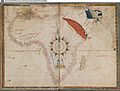
 Piri reis harita.jpg 511 × 668; 380 KB
-

-
 Maggiolo, Vesconte — BSB Cod.icon. 135 — Afrika Bsb00002700 00003.jpg 1,920 × 1,459; 557 KB
-
 Prima Africae tabula (7537881378).jpg 2,000 × 1,493; 2.94 MB
-
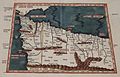 Tabula Prima Aphricae.jpg 800 × 515; 82 KB
-
 Wolfenbüttel - Herzog August Bibliothek - Portulanenkarte.jpg 2,592 × 1,944; 2.15 MB

_(14802354213).jpg)
.jpg)

