Category:1580s maps of Africa
Temperate regions: North America · South America · Africa · Europe · Asia · – Polar regions: – Other regions:
Subcategories
This category has the following 6 subcategories, out of 6 total.
- 1580 maps of Africa (5 F)
- 1581 maps of Africa (3 F)
- 1584 maps of Africa (3 F)
- 1585 maps of Africa (empty)
E
- 1580s maps of Egypt (10 F)
Media in category "1580s maps of Africa"
The following 13 files are in this category, out of 13 total.
-

-

-
-

-

-

-
 Affricae Tabula Nova.jpg 9,679 × 8,386; 19.07 MB
-
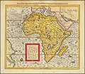
 Africa (1588) a closer view.jpg 800 × 600; 172 KB
-
 Africae tabvla nova - DPLA - 6f19f2af13deeaa70270dc6deef4262a.jpg 1,000 × 775; 259 KB
-
-
 Northern Africa and Arabia (1589).jpg 800 × 569; 181 KB
-
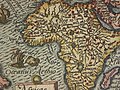
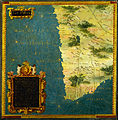 Stefano Bonsignori - Namibia, Botswana and South Africa - Google Art Project.jpg 6,619 × 6,752; 21.56 MB
-
 Tunisia1588.jpg 800 × 600; 167 KB
.jpg)
.jpg)
.jpg)
.jpg)
.jpg)
.jpg)

_a_closer_view.jpg)

.jpg)
.jpg)

