Category:1550s maps of Africa
Temperate regions: North America · South America · Africa · Europe · Asia · – Polar regions: – Other regions:
Subcategories
This category has the following 4 subcategories, out of 4 total.
- 1550 maps of Africa (6 F)
- 1552 maps of Africa (3 F)
- 1558 maps of Africa (7 F)
E
- 1550s maps of Egypt (3 F)
Media in category "1550s maps of Africa"
The following 12 files are in this category, out of 12 total.
-
 Fotothek df tg 0005112 Geographie ^ Karte.jpg 800 × 659; 285 KB
-
 1554 Africa Delle Navigationi et Viaggi.jpg 705 × 505; 146 KB
-
 Bodleian Libraries, Western half of Africa.jpg 675 × 992; 113 KB
-
 1558 map of the East African Coast by Diogo Homem.jpg 688 × 1,010; 158 KB
-
-
 Africa RMG F1747.tiff 7,338 × 4,821; 101.21 MB
-
 Africa XXV. Nova Tabula.jpg 4,505 × 3,622; 4.32 MB
-
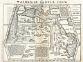 Aphricae Tabula IIII.jpg 1,431 × 1,078; 2.11 MB
-

-
 Diego Homem - Africa.jpg 8,738 × 12,079; 30.24 MB
-
 Hispanien RMG F1730.tiff 7,417 × 4,831; 102.51 MB
-
 NW Africa and Canary Islands RMG F1414.tiff 6,510 × 5,409; 100.74 MB


