Category:17th-century maps of Korea
Countries of Asia: Afghanistan · Armenia‡ · Azerbaijan‡ · People's Republic of China · Cyprus‡ · Egypt‡ · Georgia‡ · India · Indonesia‡ · Iran · Iraq · Japan · Jordan · Lebanon · Mongolia · Oman · Pakistan · Philippines · Russia‡ · Singapore · Sri Lanka · Syria · Thailand · Turkey‡ · Vietnam · Yemen
Limited recognition: Abkhazia‡ · Taiwan · State of Palestine
‡: partly located in Asia
Limited recognition: Abkhazia‡ · Taiwan · State of Palestine
‡: partly located in Asia
Subcategories
This category has the following 4 subcategories, out of 4 total.
I
M
Media in category "17th-century maps of Korea"
The following 37 files are in this category, out of 37 total.
-
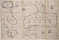
 "Imperii Sinarum nova descriptio" (22066589759).jpg 3,728 × 2,897; 2.16 MB
-
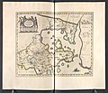
 "Xantung, Sinarum Imperii provincia quarta." (21632336863).jpg 3,691 × 3,025; 2.09 MB
-
 Sea of japan in ricci world map.jpg 1,035 × 777; 1.1 MB
-
 Ortelius map of Japan engraved 25 years later.jpg 865 × 650; 137 KB
-
 Bodleian Libraries, Japoniae Insvlae descritio.jpg 1,000 × 675; 167 KB
-
 Map of Japan by Abraham Ortelius.jpeg 3,068 × 2,362; 2.3 MB
-
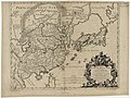
 John-Speed-The-Kingdome-of-China-1626-2544.jpg 2,024 × 1,640; 3.98 MB
-
 1646 map of Japan and Kore by Robert Dudley.pdf 4,543 × 2,918; 1.9 MB
-

-

-
 AMH-6721-KB Map of China and Korea.jpg 2,400 × 2,187; 1,001 KB
-
 Atlas maior 1655 - vol 10 - Novus Atlas Sinensis - China - P1080382.JPG 2,560 × 1,920; 3.28 MB
-
 Iaponia Regnum.jpg 14,860 × 11,288; 23.37 MB
-
 Imperii Sinarum nova descriptio - btv1b53179352v (1 of 2).jpg 9,820 × 7,274; 8.36 MB
-
 Novvs atlas Sinensis. LOC 2002625249-1.jpg 7,768 × 6,126; 5.72 MB
-
 Novvs atlas Sinensis. LOC 2002625249-1.tif 7,768 × 6,126; 136.15 MB
-

-
 CaronMap.jpg 514 × 350; 140 KB
-

-
 Xantvng - Atlas Maior, vol 11, map 16 - Joan Blaeu, 1667 - BL 114.h(star).11.(16).jpg 4,000 × 3,428; 1.94 MB
-
 Iaponia Regnvm - Atlas Maior, vol 11, map 28 - Joan Blaeu, 1667 - BL 114.h(star).11.(28).jpg 4,000 × 3,363; 1.86 MB
-
-
 Paradigma XV Provinciarum et CLV Urbium Capitalium Sinensis Imperij.jpg 2,670 × 3,782; 1.94 MB
-
 CEM-36-NE-corner.jpg 2,560 × 1,920; 2.02 MB
-
 CEM-36-Regno-della-China-2355.jpg 2,421 × 1,904; 1.98 MB
-
 Matteo Ricci's way from Macau to Beijing.jpg 2,421 × 1,904; 4.68 MB
-
 Atlas Van der Hagen-KW1049B13 033-IMPERII SINARVM NOVA DESCRIPTO.jpeg 5,500 × 4,292; 3.52 MB
-
 Mea du japon1704.jpg 2,328 × 1,701; 1.78 MB
-
 Atlante Veneto Volume 2 113.jpg 7,048 × 10,568; 7.98 MB
-
 Atlante Veneto Volume 2 121.jpg 10,420 × 7,186; 7.38 MB
-
 L'Asie divisée en ses principales régions... - par le Sr Sanson... - btv1b55000424t.jpg 11,419 × 7,126; 11.62 MB
-
 AMH-5645-KB Map of China.jpg 2,400 × 1,875; 625 KB
-
 Atlas Van der Hagen-KW1049B13 039-XANTVNG SINARVM IMPERII PROVICIA QUARTA.jpeg 5,500 × 4,523; 3.67 MB
-
 Atlas Van der Hagen-KW1049B13 053-IAPONIA REGNVM.jpeg 5,500 × 4,120; 2.99 MB
-
 Hae dong paldo bongwha mountain map 1700.jpg 1,000 × 1,400; 674 KB
-
 Imperii Sinarum nova descriptio - btv1b5963029q.jpg 7,232 × 5,592; 6.17 MB
-
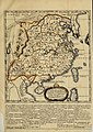
 Xantung, sinarum imperii provincia quarta - (tiré du P. Martini) - btv1b5963044d.jpg 5,896 × 4,832; 4.73 MB
.jpg)
.jpg)


.jpg)


.jpg)

,_NG-501-86.jpg)

.11.(12).jpg)
.11.(16).jpg)
.11.(28).jpg)


_-_btv1b5963044d.jpg)