Category:1860s maps of Chile
Countries of the Americas: Argentina · The Bahamas · Belize · Bolivia · Brazil · Canada · Chile · Colombia · Costa Rica · Cuba · Ecuador · Guatemala · Jamaica · Mexico · Panama · Paraguay · Peru · Saint Vincent and the Grenadines · United States of America · Uruguay · Venezuela
Other areas: Puerto Rico
Other areas: Puerto Rico
Media in category "1860s maps of Chile"
The following 14 files are in this category, out of 14 total.
-
-

-

-
 'The Children of Captain Grant' by Édouard Riou 057.jpg 800 × 478; 100 KB
-
 Chile.1862.djvu 4,312 × 5,819; 4.3 MB
-

-
 Le Tour du monde-01-p228.jpg 822 × 614; 156 KB
-
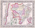
 Map of Brazil, Bolivia, Paraguay, and Uruguay; Map of Chili WDL145.png 1,320 × 1,024; 2.92 MB
-

-
 Patagonie, Detroit de Magellan, Terres Australes.jpg 3,018 × 3,835; 1.75 MB
-
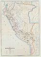 PERU MAPA 1865.JPG 6,556 × 9,208; 3.31 MB
-
 PERU MAPA2800px 1865.JPG 2,800 × 3,933; 1.97 MB
-
 Republique Argentine, Uruguay, Chili et Paraguay 1862.jpg 3,030 × 3,835; 2.27 MB
-
 Rio imperial 1867.JPG 4,676 × 3,432; 2.21 MB

%27_(11081871524).jpg)
%27_(11242263415).jpg)

.jpg)


