Category:1865 maps of Massachusetts
States of the United States: California · Georgia · Illinois · Iowa · Kentucky · Louisiana · Massachusetts · Minnesota · Missouri · New York · Pennsylvania · South Carolina · Texas · Virginia · Washington – Washington, D.C.
| ← 1860 1861 1862 1863 1864 1865 1866 1867 1868 1869 → |
Media in category "1865 maps of Massachusetts"
The following 12 files are in this category, out of 12 total.
-
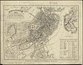
 1865 Boston horsecar map.png 3,019 × 3,500; 24.63 MB
-
 1865 Boston railroads map.jpg 7,966 × 6,823; 95.33 MB
-
 1865 Sharp map PembertonSq Boston.png 812 × 623; 1.01 MB
-
 Map of Boston, 1865 (2674506999).jpg 2,000 × 1,565; 2.97 MB
-

-

-
 Plan of real estate on Cambridge Street near Bowdoin Square... (2674562967).jpg 1,349 × 2,000; 1.91 MB
-
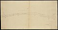 Plan of Tremont Street from Park to Boylston (2675329130).jpg 2,000 × 1,042; 1.46 MB
-
 Plan of Tremont Street, from West to Boylston (2675328158).jpg 2,000 × 1,127; 1.44 MB
-

-
 Railroad map of all street and steam railroads in Boston and vicinity (3855463335).jpg 2,000 × 1,736; 3.84 MB
-
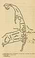 Sparrow-Hawk wreck site map.jpg 398 × 664; 166 KB


.jpg)
.jpg)
.jpg)
.jpg)
.jpg)
.jpg)
.jpg)
