Category:1863 maps of Massachusetts
States of the United States: Alabama · Georgia · Illinois · Louisiana · Maryland · Massachusetts · Michigan · Mississippi · Nevada · North Carolina · Pennsylvania · South Carolina · Tennessee · Texas · Virginia · West Virginia – Washington, D.C.
| ← 1860 1861 1862 1863 1864 1865 1866 1867 1868 1869 → |
Media in category "1863 maps of Massachusetts"
The following 5 files are in this category, out of 5 total.
-
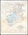 1863 map of Stony Brook drainage basin.jpg 6,384 × 8,098; 10.94 MB
-

-

-
 Plan of Boston (2674498847).jpg 2,000 × 1,471; 2.64 MB
-
 Plan of Boston (2675111335).jpg 2,000 × 1,490; 2.43 MB

.jpg)
.jpg)
.jpg)
.jpg)