Category:1873 maps of Massachusetts
States of the United States: California · Hawaii · Illinois · Louisiana · Massachusetts · Michigan · New Jersey · New Mexico · New York · Ohio · Pennsylvania · West Virginia
| ← 1870 1871 1872 1873 1874 1875 1876 1877 1878 1879 → |
Media in category "1873 maps of Massachusetts"
The following 25 files are in this category, out of 25 total.
-

-
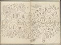
 1873 map GloucesterMA byFranklinLith BPL 10186.png 930 × 713; 1.04 MB
-

-

-
 Annexation map (2674177515).jpg 2,000 × 1,889; 3.34 MB
-
 City of Gloucester, Mass. (2676094458).jpg 2,000 × 1,452; 2.81 MB
-

-
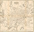 Map of the city of Worcester, Worcester Co., Mass. LOC 2011592135.jpg 5,561 × 5,174; 4.27 MB
-
 Map of the city of Worcester, Worcester Co., Mass. LOC 2011592135.tif 5,561 × 5,174; 82.32 MB
-
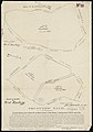
 Map of the town of Abington Plymouth County, Mass. (3855697677).jpg 1,440 × 2,000; 2.47 MB
-
-
 Plan of Falmouth Heights, Falmouth Mass., April 1st 1873 (3369692883).jpg 2,000 × 1,346; 2.7 MB
-
 Plan of Falmouth Heights, Falmouth Mass., April 1st 1873 LOC 2008624182.jpg 10,156 × 6,534; 12.02 MB
-
 Plan of Falmouth Heights, Falmouth Mass., April 1st 1873 LOC 2008624182.tif 10,156 × 6,534; 189.86 MB
-
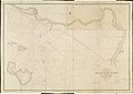
 Plan of Lagoon Heights, Martha's Vineyard, Mass. LOC 91685206.jpg 10,705 × 8,193; 12.69 MB
-
 Plan of Lagoon Heights, Martha's Vineyard, Mass. LOC 91685206.tif 10,705 × 8,193; 250.93 MB
-
-

-
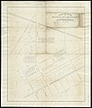
 Plan of the town of Brighton (3120019781).jpg 2,000 × 1,411; 1.96 MB
-
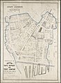
 Plan of the town of West Roxbury (2674681845).jpg 2,000 × 1,477; 2 MB
-
 The city of Boston (2674150405).jpg 2,000 × 1,417; 2.53 MB
-
 The city of Boston. LOC 75694553.tif 10,032 × 6,960; 199.76 MB
-
 Town of Hingham Plymouth County, Mass. (3369691253).jpg 1,373 × 2,000; 2.24 MB
-
 Town of North Bridgewater Plymouth County Mass. (3886417807).jpg 1,251 × 2,000; 2.06 MB
-
 Trustees sale (2675500384).jpg 1,398 × 2,000; 1.88 MB
)%27_(11066115914).jpg)


.jpg)
.jpg)
.jpg)

.jpg)
.jpg)
.jpg)


.jpg)
.jpg)
.jpg)
.jpg)
.jpg)
.jpg)
.jpg)
.jpg)