Category:1874 maps of Massachusetts
States of the United States: California · Illinois · Massachusetts · Michigan · New Hampshire · New York · Ohio · Pennsylvania · Texas · Utah · Vermont
| ← 1870 1871 1872 1873 1874 1875 1876 1877 1878 1879 → |
Subcategories
This category has only the following subcategory.
Media in category "1874 maps of Massachusetts"
The following 20 files are in this category, out of 20 total.
-

-
 146 of 'Cassell's History of the United States ... Illustrated' (11104130714).jpg 1,762 × 2,385; 1.06 MB
-
 1874 plan of Worcester and Shrewsbury Railroad.jpg 12,098 × 4,098; 7.14 MB
-
 A gazetteer of the state of Massachusetts; (1874) (14585961398).jpg 2,191 × 1,625; 619 KB
-
 Beers' fire insurance district map of the city of Boston. LOC 77691673.jpg 12,580 × 9,097; 16.45 MB
-
 Beers' fire insurance district map of the city of Boston. LOC 77691673.tif 12,580 × 9,097; 327.42 MB
-
 Chart of the Vineyard Sound and Nantucket Shoals (10212586913).jpg 800 × 521; 67 KB
-
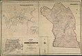
 City of Fall River. LOC 2015586100.jpg 4,248 × 4,830; 2.71 MB
-
 City of Fall River. LOC 2015586100.tif 4,248 × 4,830; 58.7 MB
-
 Copley Square map 1874.png 1,658 × 1,185; 2.76 MB
-
 Historic fields and mansions of Middlesex (1874) (14784262715).jpg 1,738 × 2,431; 2.66 MB
-
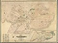
 Map of Boston for 1874 (9138827478).jpg 691 × 800; 150 KB
-
 Map of the City of Holyoke, published by Loomis and Kirtland (1874).png 4,482 × 4,000; 28.54 MB
-
 Map of the Town of Melrose, Middlesex County, Massachusetts ... - btv1b53102644w.jpg 16,178 × 10,981; 24.66 MB
-
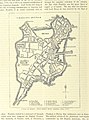
 Map of the town of Middleborough, Plymouth Co. Mass. (3887216458).jpg 2,000 × 1,384; 2.31 MB
-
 Map of the town of Natick, Middlesex Co. Mass. (3886419537).jpg 1,661 × 2,000; 2.17 MB
-
 Map of the town of Plymouth, Plymouth Co. Mass. (3886419125).jpg 1,494 × 2,000; 2.25 MB
-
 Map of the town of Wakefield Middlesex Co. Mass. (7557373754).jpg 2,048 × 1,528; 443 KB
-
-
 Plan of lands situated at Arlington Heights, Mass. (3120134621).jpg 2,000 × 1,750; 3.17 MB
.jpg)
.jpg)
_(14585961398).jpg)

.jpg)


_(14784262715).jpg)
.jpg)
.png)

.jpg)
.jpg)
.jpg)
.jpg)
.jpg)
.jpg)