Category:1910s maps of Ireland
Countries of Europe: Albania · Armenia‡ · Austria · Azerbaijan‡ · Belarus · Belgium · Bosnia and Herzegovina · Bulgaria · Croatia · Cyprus‡ · Czech Republic · Denmark · Finland · France‡ · Georgia‡ · Germany · Greece · Hungary · Iceland · Republic of Ireland · Italy · Lithuania · Luxembourg · Netherlands‡ · Norway · Poland · Portugal‡ · Romania · Russia‡ · Serbia · Slovakia · Slovenia · Spain‡ · Sweden · Switzerland · Turkey‡ · Ukraine · United Kingdom
Limited recognition: Abkhazia‡
‡: partly located in Europe
Limited recognition: Abkhazia‡
‡: partly located in Europe
Media in category "1910s maps of Ireland"
The following 13 files are in this category, out of 13 total.
-
 "The Irish Question - Showing the Political Divisions" by Charles H. Owens (1919).jpg 4,772 × 6,602; 5.19 MB
-
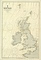
 Admiralty Chart No 2 The British Islands, Published 1913 02.jpg 8,616 × 12,553; 10.08 MB
-
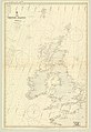
 Admiralty Chart No 2 The British Islands, Published 1913.jpg 8,315 × 12,302; 11.98 MB
-
 1913 Seachtain na Gaeilge poster.jpg 3,679 × 2,718; 5.82 MB
-
 A history of England (1916) (14780415491).jpg 1,940 × 2,864; 778 KB
-
 A short history of England and the British Empire (1915) (14580729077).jpg 1,904 × 2,728; 851 KB
-
 EB1911 Cork and Queenstown map.jpg 1,074 × 712; 408 KB
-
 EB1911 Ireland - geological map.jpg 866 × 1,352; 395 KB
-
 EB1911 Ireland.jpg 2,584 × 3,703; 6.25 MB
-
 Guide to Galway, Connemara and the West of Ireland (1912) (14802203163).jpg 1,748 × 3,670; 1.36 MB
-
 Pre anglo norma invasion irish ancient schools map.jpg 2,001 × 2,601; 2.44 MB
-

-

.jpg)


_(14780415491).jpg)
_(14580729077).jpg)


_(14802203163).jpg)

_(14775522001).jpg)
.jpg)