Category:1910s maps of Denmark
Countries of Europe: Albania · Armenia‡ · Austria · Azerbaijan‡ · Belarus · Belgium · Bosnia and Herzegovina · Bulgaria · Croatia · Cyprus‡ · Czech Republic · Denmark · Finland · France‡ · Georgia‡ · Germany · Greece · Hungary · Iceland · Republic of Ireland · Italy · Lithuania · Luxembourg · Netherlands‡ · Norway · Poland · Portugal‡ · Romania · Russia‡ · Serbia · Slovakia · Slovenia · Spain‡ · Sweden · Switzerland · Turkey‡ · Ukraine · United Kingdom
Limited recognition: Abkhazia‡
‡: partly located in Europe
Limited recognition: Abkhazia‡
‡: partly located in Europe
Media in category "1910s maps of Denmark"
The following 13 files are in this category, out of 13 total.
-
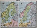
 Sverigekarta 1 nordisk familjebok.jpg 8,574 × 2,686; 14.75 MB
-
 Admiralty Chart No 152 North Sea Denmark Esbjerg to Hanstholm, Published 1911.jpg 5,984 × 8,131; 5.15 MB
-
 Britannica Denmark.png 2,233 × 3,114; 380 KB
-

-
 Sønderjylland i middelalderen.png 1,046 × 1,413; 3.84 MB
-
 Danmarkskart 1914.jpg 600 × 714; 566 KB
-
-
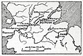
 Boundaries of Germany Under Terms of Treaty 0492 original.jpg 3,288 × 4,761; 9.18 MB
-
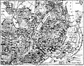 Central Copenhagen 1911.jpg 1,120 × 887; 461 KB
-
 Map of Denmark 4816044028 o.jpg 2,290 × 3,024; 916 KB
-
 Sverigekarta 2 nordisk familjebok.jpg 8,514 × 2,651; 21.36 MB
-
-


_-_btv1b53063482t.jpg)


_(14761858376).jpg)


.jpg)
.jpg)