Category:1910s maps of Slovenia
Countries of Europe: Albania · Armenia‡ · Austria · Azerbaijan‡ · Belarus · Belgium · Bosnia and Herzegovina · Bulgaria · Croatia · Cyprus‡ · Czech Republic · Denmark · Finland · France‡ · Georgia‡ · Germany · Greece · Hungary · Iceland · Republic of Ireland · Italy · Lithuania · Luxembourg · Netherlands‡ · Norway · Poland · Portugal‡ · Romania · Russia‡ · Serbia · Slovakia · Slovenia · Spain‡ · Sweden · Switzerland · Turkey‡ · Ukraine · United Kingdom
Limited recognition: Abkhazia‡
‡: partly located in Europe
Limited recognition: Abkhazia‡
‡: partly located in Europe
Media in category "1910s maps of Slovenia"
The following 3 files are in this category, out of 3 total.
-
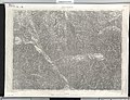 Dravograd BV043868631.jpg 14,406 × 11,102; 30.29 MB
-
 Metulum-Hypothesen 1913.jpg 2,608 × 2,308; 1.03 MB
-
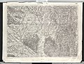 Lendava BV043900321.jpg 14,406 × 11,102; 28.97 MB


