Category:1920s maps of Austria
Countries of Europe: Albania · Armenia‡ · Austria · Azerbaijan‡ · Belarus · Belgium · Bosnia and Herzegovina · Bulgaria · Croatia · Czech Republic · Denmark · Estonia · Finland · France‡ · Georgia‡ · Germany · Greece · Hungary · Iceland · Republic of Ireland · Italy · Latvia · Lithuania · Luxembourg · Montenegro · Netherlands‡ · Norway · Poland · Portugal‡ · Romania · Russia‡ · Serbia · Slovenia · Spain‡ · Sweden · Switzerland · Turkey‡ · Ukraine · United Kingdom
‡: partly located in Europe
‡: partly located in Europe
States of Austria:
Subcategories
This category has only the following subcategory.
Media in category "1920s maps of Austria"
The following 4 files are in this category, out of 4 total.
-
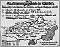 Abstimmungsgebietekaernten.jpg 1,200 × 932; 643 KB
-
 Wien - btv1b8459767t.jpg 9,408 × 7,302; 12.42 MB
-
 Plan von Wien - btv1b84597650.jpg 7,746 × 8,544; 11.83 MB
-
 Links und rechts, der Bahn in Österreich - btv1b52505254p (2 of 2).jpg 14,293 × 1,861; 3.17 MB


.jpg)