Category:1920s maps of Portugal
Countries of Europe: Albania · Armenia‡ · Austria · Azerbaijan‡ · Belarus · Belgium · Bosnia and Herzegovina · Bulgaria · Croatia · Czech Republic · Denmark · Estonia · Finland · France‡ · Georgia‡ · Germany · Greece · Hungary · Iceland · Republic of Ireland · Italy · Latvia · Lithuania · Luxembourg · Montenegro · Netherlands‡ · Norway · Poland · Portugal‡ · Romania · Russia‡ · Serbia · Slovenia · Spain‡ · Sweden · Switzerland · Turkey‡ · Ukraine · United Kingdom
‡: partly located in Europe
‡: partly located in Europe
Subcategories
This category has the following 2 subcategories, out of 2 total.
- 1928 maps of Portugal (1 F)
- 1929 maps of Portugal (1 F)
Media in category "1920s maps of Portugal"
The following 5 files are in this category, out of 5 total.
-
 Admiralty Chart No 1238 Cape Roca to Cape Blanco, Published 1929.jpg 11,067 × 16,202; 53.5 MB
-
 Botánica descriptiva BHL11322102.jpg 2,482 × 1,718; 522 KB
-
 España y Portugal - E. López, editor - btv1b8458571q.jpg 7,796 × 6,262; 6.92 MB
-
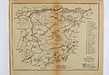
 Map of the portuguese and spanish railways.jpg 2,313 × 1,821; 753 KB
-


