Category:1943 maps of the world
Media in category "1943 maps of the world"
The following 29 files are in this category, out of 29 total.
-
 1943 map of showing the Air Routes Around The World.jpg 29,381 × 17,537; 64.35 MB
-
 1943 map of the world during World War II - verso.jpg 20,132 × 14,345; 56.58 MB
-
 1943 map of the world during World War II.jpg 20,115 × 14,423; 72.1 MB
-
 3 years of war, 1944.jpg 5,477 × 3,852; 7.37 MB
-
 Air age octovue map of the world, 1943.jpg 8,624 × 4,985; 4.18 MB
-
 Air empire, air freedom (1943).jpg 3,068 × 1,908; 889 KB
-
 Air map of the World, 1943.jpg 2,810 × 1,890; 2.59 MB
-
 Air map, 1943.jpg 1,578 × 1,933; 696 KB
-
 Freedom of the air, 1943.jpg 635 × 730; 198 KB
-
 Global time zones, 1943.jpg 1,827 × 2,391; 986 KB
-
 Invasion and total war victory maps (35048888611).jpg 2,000 × 877; 1.83 MB
-
 Japanese WW2 World Map.jpg 2,425 × 1,289; 451 KB
-
 Map of world 1943.jpg 4,128 × 2,580; 2.52 MB
-
 NatGeo world hemispheres 1943.jpg 4,917 × 2,583; 5.46 MB
-
 NatGeo World map 1943.jpg 4,961 × 3,202; 7.43 MB
-
 Ocean currents 1943 (borderless).png 2,577 × 1,306; 2.75 MB
-
 Ocean currents 1943 (borderless)3.png 2,577 × 1,306; 2.41 MB
-
 Ocean currents 1943 for colorblind users.png 2,577 × 1,306; 3.15 MB
-
 Ocean currents 1943.jpg 2,639 × 1,406; 5.14 MB
-
 Ocean currents 1943.png 2,639 × 1,406; 4.89 MB
-
 Polar map of the world, 1943.jpg 1,674 × 2,225; 1.09 MB
-
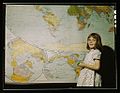 Rural school girl, San Augustine County, Texas1a35423v.jpg 1,024 × 791; 304 KB
-
 Star Weekly Map of the Axis Encirclement. January 9, 1943.jpg 4,806 × 3,411; 3.6 MB
-
 Target Berlin (1943).jpg 4,020 × 5,343; 4.23 MB
-
 Target Tokyo (1943).jpg 4,015 × 5,339; 4.04 MB
-
 The "Time and Tide" Map of The Atlantic Charter.jpg 8,500 × 6,504; 12.58 MB
-
 THE TRADE AGREEMENTS PROGRAM - NARA - 515669.jpg 3,000 × 1,889; 589 KB
-
 The World at war, 1943.jpg 3,492 × 2,613; 3.39 MB
-
 The World, a polar projection (1943).jpg 3,008 × 2,500; 2.15 MB


.jpg)


.jpg)


.png)
3.png)


.jpg)
.jpg)


.jpg)