Category:1952 United States Senate election maps
Media in category "1952 United States Senate election maps"
The following 28 files are in this category, out of 28 total.
-
 1952 Florida U.S. Senate.png 992 × 955; 311 KB
-

-

-
-

-
 1952 United States Senate Election in Massachusetts by Town.svg 810 × 502; 182 KB
-
 1952 United States Senate election in Massachusetts results map by municipality.svg 2,100 × 1,300; 1.56 MB
-

-

-

-
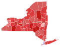 1952 United States Senate election in New York results map by county.svg 744 × 577; 297 KB
-
 1952 United States Senate Election in Pennsylvania by County.svg 810 × 471; 50 KB
-

-

-

-
 1952 United States Senate Election in West Virginia by County.svg 512 × 486; 12 KB
-

-

-
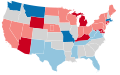 1952 United States Senate elections results map.svg 959 × 593; 58 KB
-

-

-

-
 Arizona Senate Election Results by County, 1952.png 2,000 × 2,332; 218 KB
-
 Arizona Senatorial Election Results by County, 1952.svg 277 × 323; 15 KB
-
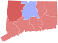
 Connecticut Senate Election Results by County, 1952.png 2,000 × 1,628; 112 KB
-
 Massachusetts Senate Election Results by County, 1952.png 2,000 × 1,174; 114 KB
-
 North Dakota Senate Election Results by County, 1952.png 2,000 × 1,194; 187 KB
-
 Pennsylvania Senate Election Results by County, 1952.png 2,000 × 1,166; 233 KB


