Category:1996 United States Senate election maps
Media in category "1996 United States Senate election maps"
The following 58 files are in this category, out of 58 total.
-
 1996 MA Senate.png 2,400 × 1,492; 116 KB
-
 1996 NM senate election.png 215 × 239; 23 KB
-

-
-

-

-

-
-

-

-
 1996 United States Senate election in Iowa results map by county.svg 810 × 532; 31 KB
-

-

-

-
 1996 United States Senate Election in Massachusetts by Town.svg 810 × 502; 182 KB
-

-
 1996 United States Senate election in Massachusetts results map by municipality.svg 2,100 × 1,300; 1.56 MB
-

-

-

-

-
-
-

-

-

-

-

-

-

-

-

-

-
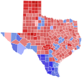 1996 United States Senate election in Texas results map by county.svg 810 × 769; 104 KB
-

-

-
-
 1996 United States Senate elections results map.svg 959 × 593; 83 KB
-

-

-

-

-
 1996 Virginia Senate election by precinct.svg 810 × 358; 8.96 MB
-
 1996 virginia senate election map.png 833 × 364; 34 KB
-
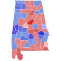
 96ALSenateCounties.PNG 379 × 600; 54 KB
-
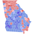
 96GASenateCounties.PNG 517 × 599; 90 KB
-
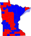 96MNSenateCounties.PNG 527 × 600; 55 KB
-
 96MTSenateCounties.PNG 800 × 461; 79 KB
-
 96ORSenSpecialElectionCounties.PNG 800 × 596; 80 KB
-
 96SDSenateCounties.PNG 800 × 492; 76 KB
-
 96TXSenateCounties.PNG 599 × 583; 178 KB
-
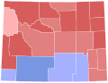
 Colorado 2002 senate.PNG 275 × 217; 20 KB
-
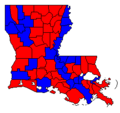 LASen96Counties.png 246 × 231; 3 KB
-
 MN US Senate 1996.svg 810 × 810; 5.69 MB
-

-
 96NESenateCounties.PNG 800 × 368; 62 KB
-
 New mexico 96.png 539 × 599; 38 KB
-
 Virginia (Senate Election, 1996).PNG 887 × 433; 26 KB


.PNG)