Category:Aerial photographs of airports in Illinois
States of the United States: Alabama · Alaska · Arizona · Arkansas · California · Colorado · Connecticut · Delaware · Florida · Georgia · Hawaii · Idaho · Illinois · Indiana · Iowa · Kansas · Kentucky · Louisiana · Maine · Maryland · Massachusetts · Michigan · Minnesota · Mississippi · Missouri · Montana · Nebraska · Nevada · New Hampshire · New Jersey · New Mexico · New York · North Carolina · North Dakota · Ohio · Oklahoma · Oregon · Pennsylvania · Rhode Island · South Carolina · South Dakota · Tennessee · Texas · Utah · Vermont · Virginia · Washington · West Virginia · Wisconsin · Wyoming
Puerto Rico
Puerto Rico
English: Aerial photographs of airports in the state of Illinois, United States
Subcategories
This category has only the following subcategory.
Media in category "Aerial photographs of airports in Illinois"
The following 31 files are in this category, out of 31 total.
-
 Benton Municipal Airport - USGS 6 April 1998.jpg 1,200 × 1,600; 299 KB
-
 Chanute AFB-12apr1998.jpg 780 × 736; 169 KB
-
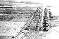
 Chanute Field - 1939.jpg 600 × 479; 91 KB
-
 Chanute Field IL - 1918.jpg 600 × 400; 55 KB
-
 CMI-Airport.jpg 240 × 180; 7 KB
-
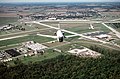
 F-GLZI Chicago Executive (PWK) (7154453294).jpg 1,952 × 1,208; 854 KB
-
 George Army Airfield IL 1953.jpg 669 × 774; 120 KB
-
 Joliet Regional Airport, Joliet, Illinois (11004361593).jpg 4,000 × 3,000; 2.32 MB
-
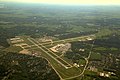 KTrimble-KPIA Aerial 2017-08-12 7500msl.jpg 4,312 × 2,860; 4.28 MB
-
 Lawrenceville-Vincennes International Airport IL 2006 USGS.jpg 690 × 664; 124 KB
-

-
 Meigs field USGS 2002.jpg 7,000 × 7,000; 44.74 MB
-
 Midway Airport (USGS).png 1,680 × 1,050; 3.42 MB
-
 Midwayhigh.jpg 320 × 240; 51 KB
-
 MWA airport seen from a departing plane 2.jpg 3,413 × 2,694; 1.3 MB
-
 MWA airport seen from a departing plane.jpg 3,104 × 1,854; 549 KB
-
 N916DN De Kalb Taylor DKB ILLINOIS (7160195416).jpg 1,308 × 908; 437 KB
-
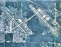
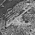
 Palwaukee Municipal Airport (USGS).png 1,680 × 1,050; 3.05 MB
-
 QuadCityIntlAirport Aerial.jpg 875 × 400; 63 KB
-
 Quincy Regional Airport-Baldwin Field.png 385 × 521; 257 KB
-
 Scott AFB - 2008.jpg 753 × 586; 177 KB
-
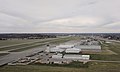
 Scott AFB Aircraft.jpg 2,840 × 1,870; 2.37 MB
-
 Scott AFB airship hangar.jpg 653 × 435; 86 KB
-
 Scott afb IL - 2 April 1998.jpg 910 × 546; 163 KB
-
 Scott AFB, TC-6 over Hangar in the 1920s (cropped).jpg 2,672 × 2,005; 612 KB
-
 Scott AFB, TC-6 over Hangar in the 1920s.jpg 4,000 × 2,776; 1.17 MB
-
 Scott Field - 1930.jpg 701 × 497; 76 KB
-
 Scott Field - 1943.jpg 699 × 489; 70 KB
-
 Scott field LTA hangar.jpg 300 × 183; 24 KB
-
 SpruceCreekFlyInAerial.jpg 800 × 800; 202 KB
-
 Waukegan Regional Airport - USGS 17 April 1998.jpg 1,800 × 1,800; 542 KB


_(7154453294).jpg)

.jpg)


.png)


.jpg)
.png)


.jpg)


