Category:Aerial photographs of airports in Minnesota
States of the United States: Alabama · Alaska · Arizona · Arkansas · California · Colorado · Connecticut · Delaware · Florida · Georgia · Hawaii · Idaho · Illinois · Indiana · Iowa · Kansas · Kentucky · Louisiana · Maine · Maryland · Massachusetts · Michigan · Minnesota · Mississippi · Missouri · Montana · Nebraska · Nevada · New Hampshire · New Jersey · New Mexico · New York · North Carolina · North Dakota · Ohio · Oklahoma · Oregon · Pennsylvania · Rhode Island · South Carolina · South Dakota · Tennessee · Texas · Utah · Vermont · Virginia · Washington · West Virginia · Wisconsin · Wyoming
Puerto Rico
Puerto Rico
English: Aerial photographs of airports in the state of Minnesota, United States
Media in category "Aerial photographs of airports in Minnesota"
The following 19 files are in this category, out of 19 total.
-
 20080312-StPaulDowntownAirport.jpg 3,072 × 2,304; 2.26 MB
-

-
 Bemidji Airport, MN, 1949.jpg 5,368 × 5,352; 2.43 MB
-
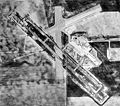 Crookston Municipal Airport-MN-19Apr1991-USGS.jpg 752 × 663; 153 KB
-
 Duluth-apt-17may1991.jpg 1,139 × 573; 285 KB
-
 Lake Elmo Airport - Minnesota.jpg 501 × 491; 69 KB
-
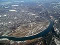
 Minneapolis St Paul International - panoramio.jpg 858 × 643; 703 KB
-

-
 MSP 2012.jpg 2,560 × 1,920; 4.94 MB
-
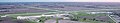
 MSP Runway 17-35 (33671870062).jpg 1,600 × 2,400; 1.26 MB
-
 MSP-airport-aerial-2006-11-08.jpg 1,938 × 1,379; 869 KB
-
 MSPAirportAerial.jpg 420 × 350; 60 KB
-
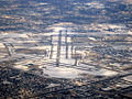 MSPrunways.jpg 1,024 × 768; 754 KB
-
 Princeton Municipal Airport (Minnesota) - USGS 21 April 1991.jpg 1,400 × 2,000; 432 KB
-
 Rochester International Airport 01.jpg 4,575 × 868; 2.17 MB
-
 Rochester International Airport 02.jpg 6,672 × 1,204; 4.43 MB
-
 RST-Airport-Rochester-Minnesota.jpg 913 × 568; 129 KB
-
 Rushford airport.jpg 3,971 × 2,971; 9.25 MB
-
 South St. Paul Municipal Airport.jpg 2,274 × 1,815; 853 KB


.jpg)


_-_USGS_21_April_1991.jpg)


