Category:Maps of Huron County, Michigan
Counties of Michigan: Alcona · Alger · Allegan · Alpena · Antrim · Arenac · Baraga · Barry · Bay · Benzie · Berrien · Branch · Calhoun · Cass · Charlevoix · Cheboygan · Chippewa · Clare · Clinton · Crawford · Delta · Dickinson · Eaton · Emmet · Genesee · Gladwin · Gogebic · Grand Traverse · Gratiot · Hillsdale · Houghton · Huron · Ingham · Ionia · Iosco · Iron · Isabella · Jackson · Kalamazoo · Kalkaska · Kent · Keweenaw · Lake · Lapeer · Leelanau · Lenawee · Livingston · Luce · Mackinac · Macomb · Manistee · Marquette · Mason · Mecosta · Menominee · Midland · Missaukee · Monroe · Montcalm · Montmorency · Muskegon · Newaygo · Oakland · Oceana · Ogemaw · Ontonagon · Osceola · Oscoda · Otsego · Ottawa · Presque Isle · Roscommon · Saginaw · Sanilac · Schoolcraft · Shiawassee · St. Clair · St. Joseph · Tuscola · Van Buren · Washtenaw · Wayne · Wexford
Wikimedia category | |||||
| Upload media | |||||
| Instance of | |||||
|---|---|---|---|---|---|
| Category combines topics | |||||
| Huron County | |||||
county in Michigan, United States   | |||||
| Instance of | |||||
| Named after | |||||
| Location | Michigan | ||||
| Capital | |||||
| Inception |
| ||||
| Population |
| ||||
| Area |
| ||||
| Different from | |||||
| official website | |||||
 | |||||
Subcategories
This category has the following 2 subcategories, out of 2 total.
A
O
Media in category "Maps of Huron County, Michigan"
The following 40 files are in this category, out of 40 total.
-
 Bay Port, MI location.png 3,000 × 1,200; 240 KB
-
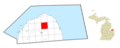
 Bingham Township (Huron), MI location.png 3,000 × 1,200; 236 KB
-
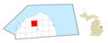
 Bloomfield Township (Huron), MI location.png 3,000 × 1,200; 239 KB
-
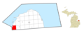
 Brookfield Township (Huron), MI location.png 3,000 × 1,200; 236 KB
-
 Caseville, MI location.png 3,000 × 1,200; 218 KB
-
 Chandler Township (Huron), MI location.png 3,000 × 1,200; 238 KB
-
 Colfax Township (Huron), MI location.png 3,000 × 1,200; 238 KB
-
 Dwight Township, MI location.png 3,000 × 1,200; 237 KB
-
 Grant Township (Huron), MI location.png 3,000 × 1,200; 237 KB
-
 Hume Township, MI location.png 3,000 × 1,200; 237 KB
-

-

-

-

-

-

-

-

-

-

-

-
 Huron County, MI census map.png 2,250 × 1,150; 351 KB
-
 Huron Township (Huron), MI.png 3,000 × 1,200; 237 KB
-
 Kinde, MI location.png 3,000 × 1,200; 218 KB
-
 Lincoln Township (Huron), MI location.png 3,000 × 1,200; 239 KB
-
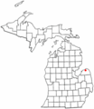
 Map of Michigan highlighting Huron County.svg 6,256 × 7,325; 205 KB
-
 Meade Township (Huron), MI location.png 3,000 × 1,200; 237 KB
-
 Michigan Senate District 25 (2010).png 3,200 × 3,450; 687 KB
-
 MIMap-doton-Kinde.PNG 261 × 300; 13 KB
-
 Oliver Township (Huron), MI location.png 3,000 × 1,200; 238 KB
-
 Paris Township, MI location.png 3,000 × 1,200; 236 KB
-
 Port Austin Township, MI location.png 3,000 × 1,200; 236 KB
-
 Port Austin, MI location.png 3,000 × 1,200; 239 KB
-
 Rubicon Township, MI location.png 3,000 × 1,200; 239 KB
-
 Sand Beach Township, MI location.png 3,000 × 1,200; 237 KB
-
 Sebewaing Township, MI location.png 3,000 × 1,200; 237 KB
-
 Sebewaing, MI location.png 3,000 × 1,200; 238 KB
-
 Sheridan Township (Huron), MI location.png 3,000 × 1,200; 237 KB
-
 Sherman Township (Huron), MI location.png 3,000 × 1,200; 236 KB
-
 Sigel Township, MI location.png 3,000 × 1,200; 238 KB


.png)

,_MI_location.png)
,_MI_location.png)
,_MI_location.png)
,_MI_location.png)
,_MI_location.png)
,_MI_location.png)
,_MI.png)
,_MI_location.png)
,_MI_location.png)
,_MI_location.png)
,_MI_location.png)
,_MI_location.png)