Category:Maps of Leipzig
Districts of Saxony:
Deutsch: Karten von Leipzig.
Hornjoserbsce: Geografiske karty Lipska.
Wikimedia category | |||||
| Upload media | |||||
| Instance of | |||||
|---|---|---|---|---|---|
| Category combines topics | |||||
| Leipzig | |||||
largest city in Saxony, Germany | |||||
| Pronunciation audio | |||||
| Instance of | |||||
| Location |
| ||||
| Located in or next to body of water | |||||
| Head of government |
| ||||
| Population |
| ||||
| Area |
| ||||
| Elevation above sea level |
| ||||
| Different from | |||||
| official website | |||||
 | |||||
Subcategories
This category has the following 10 subcategories, out of 10 total.
C
E
- Election maps of Leipzig (12 F)
K
- Kreisamt Leipzig (4 F)
M
- Messtischblatt Leipzig (5 F)
O
S
- Site plans of Leipzig (25 F)
T
Media in category "Maps of Leipzig"
The following 38 files are in this category, out of 38 total.
-
Abschnitt Weiße Elster bei Zwenkau.jpg 1,080 × 1,542; 880 KB
-
ATNET 8.jpg 2,241 × 1,492; 1.08 MB
-
Dölitz-Dösen.jpg 763 × 600; 88 KB
-
Fluren Seehausen.jpg 605 × 456; 36 KB
-
Garnisonsumgebungskarte Leipzig (1911).jpg 10,858 × 9,265; 18.87 MB
-
GDR Stasi Office.jpg 2,848 × 2,136; 1.47 MB
-
GRL 2011 Karte neu.png 3,543 × 3,495; 4.49 MB
-
GRL karte 2023.pdf 1,239 × 1,239; 1.02 MB
-
Karte Gruener Ring Leipzig.svg 661 × 624; 301 KB
-
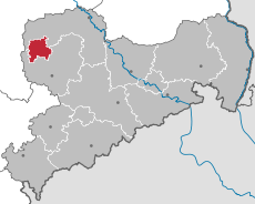
L (St) in Sachsen.svg 738 × 572; 58 KB
-
L-KG70.gif 200 × 200; 4 KB
-
Lage Lindenau-Leipzig.png 200 × 200; 7 KB
-
Sachsen rbleipzig.png 800 × 640; 13 KB
-
Leipzig - Abtnaundorfer Straße - Park 01 ies.jpg 5,616 × 3,744; 18.57 MB
-
Leipzig - Bowmanstraße - Lindenauer Wehr 02 ies.jpg 5,455 × 3,637; 16.6 MB
-
Leipzig - Bowmanstraße - Lindenauer Wehr 03 ies.jpg 5,597 × 3,733; 17.58 MB
-
Leipzig - Johannapark 03 ies.jpg 5,616 × 3,744; 16.71 MB
-
Leipzig topo with landmarks.jpg 535 × 528; 124 KB
-
Leipzig topo.jpg 535 × 528; 162 KB
-
Leipzig Wikivoyage.svg 2,034 × 2,161; 2.95 MB
-
LSG Lößnig-Dölitz.jpg 1,000 × 1,217; 187 KB
-
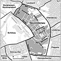
Neulindenau.jpg 736 × 738; 127 KB
-
Plan von Leipzig - btv1b84601002.jpg 7,428 × 9,546; 12.43 MB
-
POLITIK GRL 2012 Flyer.jpg 3,543 × 3,543; 4.01 MB
-
Leipzig Süd-FH Bombenopfer Gräberfeld Plan (2).JPG 3,415 × 4,026; 3.01 MB
-
Leipzig Süd-FH Bombenopfer Gräberfeld Plan.JPG 3,888 × 5,184; 5.67 MB
-
Leipzig Süd-FH Lageplan Kriegsopfer.JPG 5,184 × 3,888; 6.08 MB
-
Südfriedh. Lzg. Plan.jpg 1,510 × 2,000; 532 KB
-
Tagebauverlauf Cospuden.jpg 1,000 × 670; 281 KB
-
Tagebauverlauf Zwenkau.jpg 1,000 × 674; 321 KB
-
Verwaltung Leipzig.svg 2,034 × 2,161; 1.99 MB
-
Waterknot of Leipzig (1780, 1908 und 2000) topo.gif 1,239 × 999; 1.52 MB
-
Waterknot of Leipzig Elsterbecken.jpg 1,239 × 1,000; 161 KB
-
Waterknot of Leipzig Elstermühlgraben (Leipzig).jpg 1,239 × 1,000; 162 KB
-
Waterknot of Leipzig Mühlpleiße.jpg 1,239 × 1,000; 161 KB
-
Waterknot of Leipzig Pleißemühlgraben.jpg 1,239 × 1,000; 162 KB
-
Weisse Elster Flussverlauf.png 763 × 1,617; 1.9 MB
-
Übersichtskarte WikiCon 2017.png 1,918 × 1,356; 1.55 MB


