Category:Maps of Saxony
Federal states of Germany:
Wikimedia category | |||||
| Upload media | |||||
| Instance of | |||||
|---|---|---|---|---|---|
| Category combines topics | |||||
| Saxony | |||||
state in Germany | |||||
| Audio | |||||
| Pronunciation audio | |||||
| Instance of | |||||
| Named after | |||||
| Location |
| ||||
| Capital | |||||
| Legislative body | |||||
| Highest judicial authority |
| ||||
| Head of government |
| ||||
| Legal form | |||||
| Inception |
| ||||
| Highest point | |||||
| Population |
| ||||
| Area |
| ||||
| Elevation above sea level |
| ||||
| Follows |
| ||||
| Replaces |
| ||||
| Budget |
| ||||
| Different from | |||||
| official website | |||||
 | |||||
Subcategories
This category has the following 22 subcategories, out of 22 total.
!
*
- Geological maps of Saxony (23 F)
+
- Location maps of Saxony (5 F)
L
M
O
P
S
- Sachsenring circuit maps (9 F)
Media in category "Maps of Saxony"
The following 86 files are in this category, out of 86 total.
-
Sachsen rbdresden.png 800 × 640; 13 KB
-
Saxony map portal.png 400 × 303; 4 KB
-
30144-Ottendorf-Okrilla-1978-Wachberghöhe-Brück & Sohn Kunstverlag.jpg 1,394 × 1,000; 515 KB
-
32056-Seifhennersdorf-1998-Räuberhauptmann Johannes Karasek-Brück & Sohn Kunstverlag.jpg 3,512 × 2,492; 4.12 MB
-
32626-Nossen-2002-Mehrbild-Eiscafe Zwergenland Eula-Brück & Sohn Kunstverlag.jpg 3,504 × 2,484; 4.13 MB
-
50 of 'Thüringen. Ein geographisches Handbuch, etc' (11300620293).jpg 1,496 × 1,413; 473 KB
-
Ballungsraum dresden gemeinden.png 458 × 353; 13 KB
-
Backsteingotik Sachsen.png 402 × 295; 256 KB
-
Brick Gothic Czechia.png 534 × 337; 402 KB
-
Das Zehntgebiet des Meißner Dekans..jpg 1,436 × 1,532; 937 KB
-
Dekanat Torgau.jpg 3,030 × 1,203; 1.49 MB
-
Df dk 0011639 klein.jpg 1,291 × 1,034; 935 KB
-
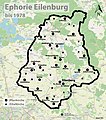
Ephorie Eilenburg.jpg 1,424 × 1,606; 785 KB
-
Euregio Egrensis.png 1,732 × 2,076; 629 KB
-
FestungKönigstein-Plan.svg 2,000 × 1,400; 403 KB
-
Flag map of Saxony.svg 1,983 × 1,400; 58 KB
-
G5241.png 823 × 649; 126 KB
-
GDR location map Oct1949 - Jul1952 SN.svg 1,075 × 1,273; 743 KB
-
Halle Prag Salzweg Übersichtskarte 600.jpg 696 × 700; 440 KB
-
HerbrigOrgel Karte 09.pdf 1,752 × 1,239; 208 KB
-
Karte des Deutschen Reichs (Vogel) - Section 19 - Dresden.png 4,980 × 4,170; 13.33 MB
-
Karte IRLS Zwickau.jpg 1,044 × 1,276; 257 KB
-
Karte Oberlausitzer Grenzlandring.png 1,610 × 1,196; 496 KB
-
Karte von Ostelbien.png 811 × 937; 118 KB
-
Karte Wald in Sachsen OSM 2019.jpg 5,900 × 4,519; 9.48 MB
-
Karte Winterstein (Sächsische Schweiz).png 1,253 × 750; 107 KB
-
Karte Winterstein in der Sächsischen Schweiz.jpg 1,024 × 1,018; 442 KB
-
Kirchenkreis Eilenburg.jpg 2,537 × 1,963; 1.3 MB
-
Kirchenkreis Torgau-Delitzsch.jpg 3,760 × 1,961; 2.46 MB
-
Kulturdenkmale in Gablenz.jpg 1,483 × 1,212; 445 KB
-
Kulturdenkmale in Kromlau.jpg 1,394 × 547; 289 KB
-
Kulturdenkmale in Wossinka.jpg 1,900 × 1,146; 367 KB
-
KZ Flossenbürg - Außenlager Königstein.PNG 1,268 × 880; 2.55 MB
-
Landesliga Sachsen.png 2,051 × 1,351; 714 KB
-
LausitzLage.png 259 × 219; 5 KB
-
Lv sachsen.gif 282 × 218; 3 KB
-
Map for the Silesian and Seven Years Wars.jpg 1,672 × 1,238; 438 KB
-
Mitteldeutschland.png 188 × 235; 8 KB
-
MoritzburgPlan.png 805 × 529; 137 KB
-
Naturraumkarte Oberlausitz.png 4,129 × 2,633; 10.13 MB
-
NossenPlan.png 760 × 527; 69 KB
-
Saxonia, Thuringia, Misnia (NYPL b15404146-1632175).jpg 7,230 × 5,428; 6.52 MB
-
Oeder TafelIX.jpg 4,570 × 3,360; 3.65 MB
-
Planungsregionen Sachsen.png 458 × 353; 11 KB
-
Poststraßen .png 400 × 500; 174 KB
-
Regklam modellregion.jpg 2,314 × 2,082; 2.06 MB
-
Rossbach in Bohmen und Oelsnitz (Im Sachsen). NYPL1226286.tiff 5,571 × 4,792; 76.38 MB
-
Sachsen in German Democratic Republic 1949 - 1952.svg 618 × 789; 574 KB
-
Sachsen Landschaften.jpg 1,010 × 766; 169 KB
-
Sachsen Naturregionen.png 1,739 × 1,340; 34 KB
-
Sachsen Pfeile.png 960 × 540; 251 KB
-
Sachsen Uebersicht.png 260 × 199; 14 KB
-
Sachsen.Königstein.jpg 1,713 × 1,095; 436 KB
-
Sachsen.Landschaften.jpg 2,206 × 1,739; 300 KB
-
Sachsen1930.png 1,717 × 1,200; 11 KB
-
Sachsen2.gif 1,249 × 1,068; 657 KB
-
Sachsen2008-064a.jpg 327 × 406; 159 KB
-
Sachsen3.png 1,249 × 1,068; 594 KB
-
SachsenLandschaften.jpg 1,726 × 1,374; 794 KB
-
Saechsische schweiz map 1860.jpg 1,544 × 1,025; 444 KB
-
Saechsische Schweiz map de.png 1,079 × 661; 1.2 MB
-
Saxony Bezirke map.png 800 × 583; 165 KB
-
Schneckenstein-revier1928.jpg 733 × 800; 200 KB
-
Schwarze Elster Fluss Version 9.gif 1,011 × 741; 300 KB
-
Schwarze Elster Flusssystem 1.gif 646 × 537; 159 KB
-
SchwerpunktSachsenNossen280810FotoAndreKaiser.JPG 534 × 712; 84 KB
-
SchwerpunktSachsenNossenDetail280810FotoAndreKaiser.JPG 712 × 534; 89 KB
-
Silbermann-Karte.svg 3,235 × 2,028; 206 KB
-
Stadtwerke Konzessionsgebiete.jpg 1,771 × 1,395; 492 KB
-
Sächsische Schweiz Klettergebiete 2.png 1,474 × 897; 2.78 MB
-
Sächsische Schweiz Klettergebiete.png 1,499 × 913; 1.21 MB
-
Tagebau Espenhain.jpg 1,000 × 662; 407 KB
-
Talsperre poehl landkarte vsthf.png 671 × 589; 29 KB
-
Talsperre poehl landkarte.png 671 × 589; 29 KB
-
Talsperre Pöhl.png 671 × 589; 31 KB
-
Uhyst-Karte.jpg 2,736 × 3,648; 1.54 MB


