Category:Maps of Thuringia
Federal states of Germany:
Districts of Thuringia:
Wikimedia category | |||||
| Upload media | |||||
| Instance of | |||||
|---|---|---|---|---|---|
| Category combines topics | |||||
| Thuringia | |||||
federated state in the center of Germany  Erfurtkatedralen og Severikirken    | |||||
| Pronunciation audio | |||||
| Instance of | |||||
| Named after |
| ||||
| Location |
| ||||
| Capital | |||||
| Legislative body | |||||
| Highest judicial authority | |||||
| Head of government |
| ||||
| Inception |
| ||||
| Highest point | |||||
| Population |
| ||||
| Area |
| ||||
| Elevation above sea level |
| ||||
| Follows | |||||
| Replaces |
| ||||
| Budget |
| ||||
| official website | |||||
 | |||||
Subcategories
This category has the following 31 subcategories, out of 31 total.
- Location maps of Thuringia (5 F)
*
D
- Drainage basin maps of Helme (4 F)
E
L
- Linguistic maps of Thuringia (7 F)
M
- Maps of Kyffhäuser (15 F)
- Maps of Thuringian Highland (6 F)
O
P
Media in category "Maps of Thuringia"
The following 106 files are in this category, out of 106 total.
-
 11 of 'Thüringen. Ein geographisches Handbuch, etc' (11215746903).jpg 1,700 × 1,597; 954 KB
-

-
 1904 Abwasserbelastung Orlasenke.jpg 1,396 × 798; 498 KB
-
 223 of 'Thüringen. Ein geographisches Handbuch, etc' (11300048824).jpg 1,363 × 1,138; 530 KB
-
 224 of 'Thüringen. Ein geographisches Handbuch, etc' (11299363154).jpg 1,376 × 1,143; 537 KB
-
 238 of 'Thüringen. Ein geographisches Handbuch, etc' (11301157446).jpg 1,498 × 1,368; 368 KB
-
 37 of 'Thüringen. Ein geographisches Handbuch, etc' (11217078263).jpg 1,573 × 1,732; 587 KB
-
 50 of 'Thüringen. Ein geographisches Handbuch, etc' (11300620293).jpg 1,496 × 1,413; 473 KB
-
 92 of 'Thüringen. Ein geographisches Handbuch, etc' (11215414294).jpg 1,568 × 1,752; 601 KB
-
 AbgPlanUmg.png 419 × 387; 322 KB
-
 Arbeitslosigkeit TH 0407.PNG 710 × 606; 75 KB
-

-
 Beratungsstellen der Verbraucherzentrale Thüringen e.V.gif 660 × 540; 19 KB
-
 Gemeinden Thüringen Bevölkerungsdichte.png 3,480 × 2,920; 407 KB
-
 BWahlkreis 189.svg 430 × 350; 40 KB
-
 BWahlkreis 190.svg 430 × 350; 40 KB
-
 BWahlkreis 191.svg 430 × 350; 40 KB
-
 BWahlkreis 192.svg 430 × 350; 40 KB
-
 BWahlkreis 193.svg 430 × 350; 40 KB
-
 BWahlkreis 194.svg 430 × 350; 40 KB
-
 BWahlkreis 195.svg 430 × 350; 40 KB
-
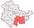 BWahlkreis 196.svg 430 × 350; 40 KB
-
 BWahlkreis 197.svg 430 × 350; 40 KB
-
 Dialekte-Henneberg.PNG 738 × 599; 129 KB
-
 Dorfplan Oberweißenbach.JPG 1,591 × 1,125; 205 KB
-
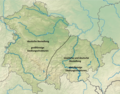
 Einzugs- und Flussgebietskarte Gera.png 838 × 1,015; 973 KB
-
 Einzugs- und Flussgebietskarte Helbe.png 886 × 665; 738 KB
-
 Einzugs- und Flussgebietskarte Helme.png 1,134 × 763; 1,016 KB
-
 Einzugs- und Flussgebietskarte Ilm (Saale).png 1,051 × 972; 1.24 MB
-
 Einzugs- und Flussgebietskarte Loquitz.png 774 × 552; 530 KB
-
 Einzugs- und Flussgebietskarte Schwarza (Saale).png 830 × 609; 654 KB
-
 Einzugs- und Flussgebietskarte Unstrut.png 1,501 × 1,439; 2.68 MB
-
 Einzugs- und Flussgebietskarte Wipper (Unstrut).png 968 × 640; 705 KB
-
 Euregio Egrensis.png 1,732 × 2,076; 629 KB
-
 Evangelisch Thüringen.png 3,480 × 2,920; 611 KB
-
 Ekd-thueringen.png 204 × 278; 12 KB
-
 Flag map of Thuringia.svg 943 × 747; 67 KB
-
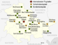 Thüringen Flughäfen und Landeplätze.png 1,500 × 1,181; 405 KB
-
 GDR location map Oct1949 - Jul1952 TH.svg 1,075 × 1,273; 743 KB
-
 Geburtensaldo Thüringen 2010.png 1,000 × 825; 172 KB
-

-
 Karte des Deutschen Reiches (5820467c).jpg 12,001 × 10,875; 58.46 MB
-
 Karte Gera-Radweg.png 786 × 649; 733 KB
-
 Karte Lütsche.PNG 499 × 482; 25 KB
-
 Karte MDV 2019.svg 618 × 594; 226 KB
-
 Karte Muehlenradweg.png 1,000 × 471; 66 KB
-
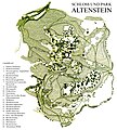 Karte Schloss und Park Altenstein.jpg 2,275 × 2,524; 3.96 MB
-
 Karte um Kyffhäuser-Denkmal 20210914 HOF05996 RAW-Export 20220415002126.jpg 9,504 × 6,336; 40.91 MB
-

-
 Gebietsreform Thüringen Bogumil.png 2,000 × 1,569; 559 KB
-
 Gebietsreform Thüringen Innenministerium 2.png 2,000 × 1,569; 544 KB
-
 Kreisreform Thüringen Expertenkommission.png 2,000 × 1,569; 640 KB
-
 Vorschläge-Kreisreform-Thüringen.png 658 × 543; 157 KB
-
 Landschaften Thueringens.png 2,146 × 1,813; 5.59 MB
-
 Lv thüringen.gif 266 × 216; 3 KB
-
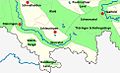
 Längwitzgau.jpg 616 × 670; 179 KB
-
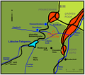 Lütsche mit Umgebung.png 656 × 580; 26 KB
-
 Lütsche u. Umgebung.jpg 715 × 605; 139 KB
-
 Mdv-gebiet landkreise.png 726 × 490; 41 KB
-
 DDR-Bezirk-Suhl-Kreis-Meiningen.png 886 × 664; 33 KB
-
 Mitteldeutschland.png 188 × 235; 8 KB
-
 Naturraumkarte Harz.png 1,410 × 1,033; 1.87 MB
-
 Naturraumkarte Obermainisches Huegelland.png 1,401 × 913; 1.49 MB
-
 Naturraumkarte Oestliches Rhoenvorland.png 521 × 420; 376 KB
-
 Naturraumkarte Rhoen.png 1,090 × 1,248; 2.25 MB
-
 Naturraumkarte Thueringer Becken.png 1,935 × 1,461; 3.78 MB
-
 Naturraumkarte Thueringer Wald.png 934 × 898; 1.21 MB
-
 Naturschutzgebiet Grosser Horn.jpg 1,381 × 687; 70 KB
-
 NLRon-Plan.png 400 × 395; 35 KB
-
 Saxonia, Thuringia, Misnia (NYPL b15404146-1632175).jpg 7,230 × 5,428; 6.52 MB
-
 Optonet regionale-Verteilung 2008.png 1,864 × 1,558; 354 KB
-
 Ortsnamen Dorf.png 1,492 × 1,171; 2.76 MB
-
 Ortsnamen Hausen Feld.png 1,492 × 1,171; 2.76 MB
-
 Ortsnamen Hausen.png 1,492 × 1,171; 2.74 MB
-
 Ortsnamen Ic.png 1,492 × 1,171; 2.75 MB
-
 Ortsnamen Ingen Ungen Heim.png 1,492 × 1,171; 2.76 MB
-
 Ortsnamen Leben.png 1,492 × 1,171; 2.74 MB
-
 Ortsnamen Roda.png 1,492 × 1,171; 2.75 MB
-
 Ortsnamen Städt.png 1,492 × 1,171; 2.74 MB
-
 Physische Uebersichtkarte Rhoen.png 417 × 365; 303 KB
-
 Plan-Geraradwanderweg.svg 1,827 × 2,467; 158 KB
-
 Ruine Markersdorf.png 1,029 × 833; 1.35 MB
-
 DDR-Bezirk-Suhl-Kreis-Schmalkalden.png 886 × 664; 33 KB
-
 Siedlungsstruktur Thüringen.png 1,492 × 1,171; 3.13 MB
-
 SLF BevDi.PNG 618 × 597; 24 KB
-
 SPA Karte Geschaeftsstellen 2013-08 HGS rot.jpg 2,571 × 2,371; 950 KB
-
 SpkMTH Geschaeftsstellen.jpg 1,068 × 1,050; 150 KB
-
 Staatenkarte-grz2.svg 1,520 × 2,200; 40 KB
-

-
 Städte Thüringen.png 2,218 × 1,734; 3.29 MB
-
 Thueringen-topo.jpg 240 × 196; 27 KB
-
 THUERINGEN1952.png 1,389 × 1,208; 72 KB
-
 Thueringer Becken - geologische Struktur.jpg 1,352 × 1,181; 389 KB
-
 Thueringer Becken - Schollengliederung.jpg 1,349 × 1,019; 295 KB
-
 Thueringer Becken - Stoerungen.jpg 1,337 × 1,184; 417 KB
-
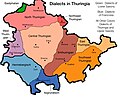 Thuringian Dialects EN.jpg 783 × 636; 120 KB
-
 Thür-01.jpg 800 × 662; 154 KB
-
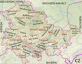 Thüringen Kreise Namen.png 2,076 × 1,630; 6.29 MB
-
 Thüringen, Neuordnungsvorschlag.png 2,251 × 1,758; 240 KB
-
 Thüringer Becken.png 1,492 × 1,171; 2.74 MB
-
 Thüringer Wald (Relief) - Deutsche Mittelgebirge, Serie A-de.png 2,200 × 1,850; 4.8 MB
-
 Tourismusregionen Thüringen Süd.jpg 970 × 587; 235 KB
-
 Tourismusregionen Thüringen.png 2,000 × 1,569; 644 KB
-
 Uebersichtskarte Rhoen Tann.jpg 800 × 971; 112 KB
-
 Uebersichtskarte Rhoen.jpg 800 × 971; 216 KB
-
 Wanderungssaldo Thüringen 2010.png 1,000 × 825; 185 KB
.jpg)
.jpg)

.jpg)
.jpg)
.jpg)
.jpg)
.jpg)
.jpg)


._Weiterer_Vorschlag_zum_territorialen_Austausch_von_Bundesl%C3%A4ndern_im_Bereich_Naturressourcen-Management.jpg)


.png)

.png)

.png)


.jpg)
.jpg)


.jpg)


_-_Deutsche_Mittelgebirge,_Serie_A-de.png)


