Category:Maps of Niagara County, New York
Counties of New York (state): Albany · Allegany · Bronx · Broome · Cattaraugus · Cayuga · Chautauqua · Chemung · Chenango · Clinton · Columbia · Cortland · Delaware · Dutchess · Erie · Essex · Franklin · Fulton · Genesee · Greene · Hamilton · Herkimer · Jefferson · Kings · Lewis · Livingston · Madison · Monroe · Montgomery · Nassau · New York · Niagara · Oneida · Onondaga · Ontario · Orange · Orleans · Oswego · Otsego · Putnam · Queens · Rensselaer · Richmond · Rockland · Saratoga · Schenectady · Schoharie · Schuyler · Seneca · St. Lawrence · Steuben · Suffolk · Sullivan · Tioga · Tompkins · Ulster · Warren · Washington · Wayne · Westchester · Wyoming · Yates
Wikimedia category | |||||
| Upload media | |||||
| Instance of | |||||
|---|---|---|---|---|---|
| Category combines topics | |||||
| Niagara County | |||||
county in New York, United States   | |||||
| Instance of | |||||
| Location | New York | ||||
| Capital | |||||
| Headquarters location | |||||
| Inception |
| ||||
| Population |
| ||||
| Area |
| ||||
| Different from | |||||
| official website | |||||
 | |||||
Subcategories
This category has the following 6 subcategories, out of 6 total.
N
Media in category "Maps of Niagara County, New York"
The following 12 files are in this category, out of 12 total.
-
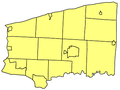 Map of municipalities in Niagara County, New York.png 1,420 × 1,068; 45 KB
-
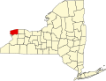 Map of New York highlighting Niagara County.svg 6,599 × 5,030; 112 KB
-
 Map of Niagara County, New York.png 4,000 × 2,107; 570 KB
-
 Map of the US side of the Niagara Falls.jpg 2,048 × 1,536; 960 KB
-

-

-
 Niagara County Highways Map Highlighted.jpg 715 × 583; 37 KB
-
 Niagara County NY map.svg 1,450 × 860; 662 KB
-
 Niagara County.jpg 615 × 439; 175 KB
-
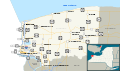
 Niagara Falls NY area road network map.png 1,138 × 852; 42 KB
-
 Niagara map.jpg 2,205 × 1,319; 522 KB
-
 New York State Senate District 62 (2012).png 3,259 × 2,492; 399 KB


.jpg)


.png)