Category:Maps of Oswego County, New York
Counties of New York (state): Albany · Allegany · Bronx · Broome · Cattaraugus · Cayuga · Chautauqua · Chemung · Chenango · Clinton · Columbia · Cortland · Delaware · Dutchess · Erie · Essex · Franklin · Fulton · Genesee · Greene · Hamilton · Herkimer · Jefferson · Kings · Lewis · Livingston · Madison · Monroe · Montgomery · Nassau · New York · Niagara · Oneida · Onondaga · Ontario · Orange · Orleans · Oswego · Otsego · Putnam · Queens · Rensselaer · Richmond · Rockland · Saratoga · Schenectady · Schoharie · Schuyler · Seneca · St. Lawrence · Steuben · Suffolk · Sullivan · Tioga · Tompkins · Ulster · Warren · Washington · Wayne · Westchester · Wyoming · Yates
Wikimedia category | |||||
| Upload media | |||||
| Instance of | |||||
|---|---|---|---|---|---|
| Category combines topics | |||||
| Oswego County | |||||
county in New York, United States ,_Oswego,_New_York.jpg)  | |||||
| Instance of | |||||
| Named after | |||||
| Location | New York | ||||
| Located in or next to body of water | |||||
| Capital | |||||
| Inception |
| ||||
| Population |
| ||||
| Area |
| ||||
| Different from | |||||
| official website | |||||
 | |||||
Subcategories
This category has the following 2 subcategories, out of 2 total.
Media in category "Maps of Oswego County, New York"
The following 67 files are in this category, out of 67 total.
-
 ... History of Oswego County, New York (1877) (14577863578).jpg 2,832 × 2,164; 689 KB
-
 122-FIG 1.jpg 1,388 × 2,394; 1.15 MB
-

-
 Cleveland, N.Y. LOC 2009584347.jpg 11,072 × 7,850; 9.02 MB
-
 Cleveland, N.Y. LOC 2009584347.tif 11,072 × 7,850; 248.67 MB
-
 Inner Harbor Oswego, New York - NARA - 128215717.jpg 4,944 × 3,991; 1.07 MB
-
 Map of New York highlighting Oswego County.svg 1,100 × 838; 66 KB
-
 Map of Towns in Oswego County, New York.svg 607 × 545; 805 KB
-
 New York- Fort Ontario- Water Distribution - DPLA - 06909b7a58bc29e6b51b16dc1109bd6a.jpg 10,166 × 14,551; 12.13 MB
-
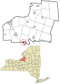
 Oswego County New York incorporated and unincorporated areas Albion highlighted.svg 712 × 1,000; 6.47 MB
-
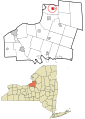
 Oswego County New York incorporated and unincorporated areas Altmar highlighted.svg 712 × 1,000; 6.47 MB
-
 Oswego County New York incorporated and unincorporated areas Amboy highlighted.svg 712 × 1,000; 6.47 MB
-

-

-

-

-
-

-
 Oswego County New York incorporated and unincorporated areas Fulton highlighted.svg 712 × 1,000; 6.47 MB
-
 Oswego County New York incorporated and unincorporated areas Granby highlighted.svg 712 × 1,000; 6.47 MB
-
-

-

-
 Oswego County New York incorporated and unincorporated areas Lacona highlighted.svg 712 × 1,000; 6.47 MB
-

-
 Oswego County New York incorporated and unincorporated areas Mexico highlighted.svg 712 × 1,000; 6.47 MB
-

-
 Oswego County New York incorporated and unincorporated areas Minetto highlighted.svg 712 × 1,000; 6.47 MB
-

-
 Oswego County New York incorporated and unincorporated areas Orwell highlighted.svg 712 × 1,000; 6.47 MB
-

-
 Oswego County New York incorporated and unincorporated areas Oswego highlighted.svg 712 × 1,000; 6.47 MB
-
 Oswego County New York incorporated and unincorporated areas Palermo highlighted.svg 712 × 1,000; 6.47 MB
-

-
 Oswego County New York incorporated and unincorporated areas Parish highlighted.svg 712 × 1,000; 6.47 MB
-
 Oswego County New York incorporated and unincorporated areas Phoenix highlighted.svg 712 × 1,000; 6.47 MB
-
 Oswego County New York incorporated and unincorporated areas Pulaski highlighted.svg 712 × 1,000; 6.47 MB
-

-

-

-

-
-

-
 Oswego County New York incorporated and unincorporated areas Scriba highlighted.svg 712 × 1,000; 6.47 MB
-

-
 Oswego County New York incorporated and unincorporated areas Volney highlighted.svg 712 × 1,000; 6.47 MB
-

-

-
 Oswego County New York incorporated and unincorporated areas.svg 712 × 1,000; 6.47 MB
-
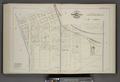
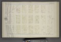
 Part of Ward 1. (Plate E.) NYPL1582643.tiff 7,230 × 4,944; 102.27 MB
-
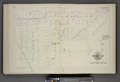
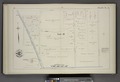
 Part of Ward 1. (Plate S.) NYPL1582657.tiff 5,428 × 6,688; 103.86 MB
-
 Part of Ward 2. 4. 6. and 8. (Plate J.) NYPL1582648.tiff 7,230 × 4,944; 102.27 MB
-
 Part of Ward 3. (Plate F.) NYPL1582644.tiff 7,230 × 4,944; 102.27 MB
-
 Part of Ward 3. and 5. (Plate Q.) NYPL1582655.tiff 7,230 × 4,944; 102.27 MB
-
 Part of Ward 3. and 5. (Plate R.) NYPL1582656.tiff 7,230 × 4,944; 102.27 MB
-
 Part of Ward 4. (Plate A.) NYPL1582639.tiff 7,230 × 4,944; 102.27 MB
-
 Part of Ward 4. (Plate C.) NYPL1582641.tiff 7,230 × 4,944; 102.27 MB
-
 Part of Ward 5 and 7. (Plate N.) NYPL1582652.tiff 7,230 × 4,944; 102.27 MB
-
 Part of Ward 6. (Plate B.) NYPL1582640.tiff 7,230 × 4,944; 102.27 MB
-
 Part of Ward 6. (Plate D.) NYPL1582642.tiff 7,230 × 4,944; 102.27 MB
-
 Part of Ward 7. (Plate M.) NYPL1582651.tiff 7,230 × 4,944; 102.27 MB
-
 Part of Ward 7. (Plate P.) NYPL1582654.tiff 7,230 × 4,944; 102.27 MB
-
 Part of Ward 8. (Plate I.) NYPL1582647.tiff 7,230 × 4,944; 102.27 MB
-
 Part of Ward 8. (Plate K.) NYPL1582649.tiff 7,230 × 4,944; 102.27 MB
-
 SandyIslandBeachSP topo.jpg 649 × 503; 158 KB
-
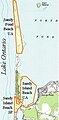 SandyPondBeachUA topo.jpg 281 × 572; 60 KB
-
 New York State Senate District 48 (2012).png 3,259 × 2,492; 404 KB
_(14577863578).jpg)

.jpg)


_highlighted.svg)


_highlighted.svg)


_highlighted.svg)

_highlighted.svg)


_highlighted.svg)


_highlighted.svg)


_highlighted.svg)
_highlighted.svg)


.png)