Category:Maps of the history of Mali
Countries of Africa: Algeria · Angola · Benin · Botswana · Burkina Faso · Burundi · Cameroon · Central African Republic · Chad · Democratic Republic of the Congo · Republic of the Congo · Djibouti · Egypt‡ · Equatorial Guinea · Eritrea · Eswatini · Ethiopia · Gabon · The Gambia · Ghana · Guinea · Guinea-Bissau · Ivory Coast · Kenya · Lesotho · Liberia · Libya · Madagascar · Malawi · Mali · Mauritania · Morocco · Mozambique · Namibia · Niger · Nigeria · Rwanda · Senegal · Sierra Leone · Somalia · South Africa · South Sudan · Sudan · Tanzania · Togo · Tunisia · Uganda · Zambia · Zimbabwe
Limited recognition: Ambazonia · Azawad · Somaliland – Other areas: Ceuta · Melilla · Réunion · Western Sahara
‡: partly located in Africa
Limited recognition: Ambazonia · Azawad · Somaliland – Other areas: Ceuta · Melilla · Réunion · Western Sahara
‡: partly located in Africa
Subcategories
This category has the following 9 subcategories, out of 9 total.
A
- Maps of Almoravid dynasty (50 F)
M
- Maps of French Sudan (14 F)
- Maps of the Ghana Empire (18 F)
- Maps of the Mali Empire (37 F)
- Maps of the Songhai Empire (29 F)
- Maps of the Wassoulou Empire (2 F)
Media in category "Maps of the history of Mali"
The following 33 files are in this category, out of 33 total.
-
 Africa de l'Oèst en 1875-es.svg 1,588 × 771; 750 KB
-
 Africa de l'Oèst en 1875-hu.svg 1,588 × 771; 263 KB
-
 Africa de l'Oèst en 1875.png 1,192 × 596; 195 KB
-
 AgadezMNJattacks0807.png 363 × 300; 105 KB
-
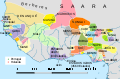
 AOFmap1936 Soudan français.png 2,200 × 1,600; 3.76 MB
-
 Colonizacion de l'Africa Occidentala.png 1,268 × 561; 311 KB
-
 Conquêtes des Saadiens1592.png 624 × 600; 71 KB
-
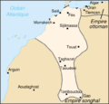
 Empèri de Mali.png 1,412 × 786; 123 KB
-
 Empèri Songai.png 1,104 × 727; 124 KB
-
 French Sudan map.png 2,000 × 2,000; 330 KB
-
 French Sudan.png 2,000 × 2,000; 529 KB
-
 Fula jihad states map general c1830-es.svg 1,332 × 796; 251 KB
-
 Fula jihad states map general c1830-pt.svg 1,332 × 796; 252 KB
-
 Fula jihad states map general c1830.png 694 × 408; 94 KB
-
 Ghana successor map 1200 ru.jpg 428 × 448; 34 KB
-
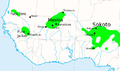
 LocationMaliFederation.png 250 × 115; 5 KB
-
 LocationMaliFederation1959.png 250 × 115; 5 KB
-
 Mali Federation in its region (1959).svg 443 × 282; 257 KB
-
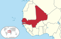 Mali Federation in its region.svg 443 × 282; 261 KB
-
 Mali federation.png 2,000 × 2,000; 327 KB
-
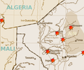
 Mali historic places.PNG 943 × 922; 32 KB
-
 Mali niger border un.png 453 × 262; 148 KB
-
 Maliempire.png 500 × 315; 65 KB
-
 Map saadi.jpg 2,048 × 1,958; 332 KB
-
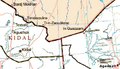
 Mourgoula fortress.png 1,268 × 739; 1.09 MB
-
 Mourgoula-Kita.png 1,276 × 1,750; 1.88 MB
-
 Reich Songhai.png 3,518 × 3,351; 958 KB
-
 Stein 1861 Africa Umars Jihad State.jpg 761 × 535; 183 KB
-
 Umars jihad state map general c1864.png 450 × 228; 52 KB
-
 WestAfrica1625-es.svg 606 × 397; 637 KB
-
 WestAfrica1625-pt.svg 606 × 397; 637 KB
-
 WestAfrica1625.png 498 × 306; 31 KB
-
 África occidental en 1625.svg 606 × 397; 637 KB


.svg)


