Category:Old county maps of Dorset
Ceremonial counties of England: Bedfordshire · Berkshire · Buckinghamshire · Cambridgeshire · Cheshire · Cornwall · Derbyshire · Devon · Dorset · Durham · East Riding of Yorkshire · Essex · Gloucestershire · Hampshire · Herefordshire · Hertfordshire · Kent · Lancashire · Leicestershire · Lincolnshire · Norfolk · Northamptonshire · Northumberland · Nottinghamshire · Oxfordshire · Rutland · Shropshire · Somerset · Staffordshire · Suffolk · Surrey · Warwickshire · Wiltshire · Worcestershire
City-counties:
Former historic counties: Cumberland · Huntingdonshire · Middlesex · North Riding of Yorkshire · Sussex · West Riding of Yorkshire · Westmorland · Yorkshire
Other former counties:
City-counties:
Former historic counties: Cumberland · Huntingdonshire · Middlesex · North Riding of Yorkshire · Sussex · West Riding of Yorkshire · Westmorland · Yorkshire
Other former counties:
Media in category "Old county maps of Dorset"
The following 25 files are in this category, out of 25 total.
-
 Dorcestriae Comitatus Vicinarumque Regionum nova veraq' Descriptio…. 1575.jpg 4,765 × 3,372; 4.27 MB
-
 Dorcestriae Comitatus Vicinarumque Regionum nova veraq' Descriptio…. 1575.tif 9,529 × 6,743; 106.4 MB
-
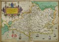
 John Speed - Map of Dorsetshire - 1610 - 001.jpg 3,000 × 2,247; 3.17 MB
-
 Dorsetshyre... - Jodocus Hondius caelavit - btv1b53056397t (1 of 2).jpg 6,880 × 5,360; 6.65 MB
-
 Comitatus Dorcestria. Vulgo Anglice Dorsetshire - btv1b530569041 (1 of 2).jpg 6,088 × 4,672; 4.76 MB
-
 Comitatus Dorcestria, sive Dorsettia ; vulgo anglice Dorset Shire (5384791913).jpg 2,000 × 1,584; 3.07 MB
-
 Comitatus Dorcestria vulgo Anglice Dorset Shire (8643591330).jpg 800 × 659; 122 KB
-
-
 "Comitatus Dorcestria sive Dorsettia vulgo Anglice Dorset Shire." (22239683852).jpg 3,984 × 3,087; 2.22 MB
-

-
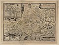
 Maps of England circa 1670, Dorset 12 of 40 (13433715094).jpg 6,402 × 4,971; 4.34 MB
-
 Dorset-Morden-1695.jpg 3,027 × 2,635; 4.51 MB
-
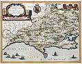
 Comitatus Dorcestria vulgo anglice Dorset Shire - CBT 6599290.jpg 5,554 × 4,346; 6.59 MB
-
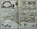
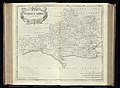
 Dorset Shire - By H. Moll Geographer - btv1b53056183v.jpg 4,000 × 2,600; 1.77 MB
-

-

-
 An accurate map of Dorset Shire, divided into its hundreds (5384790645).jpg 2,000 × 1,519; 3.35 MB
-
 An accurate map of Dorset Shire divided into hundreds (5384791285).jpg 2,000 × 1,605; 3.24 MB
-
 Aikin(1800) p381 - Dorset.jpg 1,952 × 1,070; 346 KB
-

-
 A topographical dictionary of the United Kingdom (1808) (14762117066).jpg 2,766 × 1,680; 1.25 MB
-
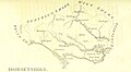
 Gray1824.dorset.jpg 832 × 978; 157 KB
-
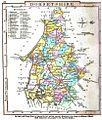
 CAPPER(1825) p01.324 - Dorsetshire.jpg 2,368 × 1,364; 894 KB
-

-
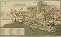
 Pigot and Co (1842) p1.166 - Map of Dorsetshire.jpg 2,160 × 1,359; 852 KB


.jpg)
.jpg)
.jpg)
.jpg)

.jpg)
.5.(6).jpg)
.jpg)


.jpg)
.jpg)
_p381_-_Dorset.jpg)

_(14762117066).jpg)

_p01.324_-_Dorsetshire.jpg)
.jpg)
_p1.166_-_Map_of_Dorsetshire.jpg)