Category:Old county maps of Hertfordshire
Ceremonial counties of England: Bedfordshire · Berkshire · Buckinghamshire · Cambridgeshire · Cheshire · Cornwall · Derbyshire · Devon · Dorset · Durham · East Riding of Yorkshire · Essex · Gloucestershire · Hampshire · Herefordshire · Hertfordshire · Kent · Lancashire · Leicestershire · Lincolnshire · Norfolk · Northamptonshire · Northumberland · Nottinghamshire · Oxfordshire · Rutland · Shropshire · Somerset · Staffordshire · Suffolk · Surrey · Warwickshire · Wiltshire · Worcestershire
City-counties:
Former historic counties: Cumberland · Huntingdonshire · Middlesex · North Riding of Yorkshire · Sussex · West Riding of Yorkshire · Westmorland · Yorkshire
Other former counties:
City-counties:
Former historic counties: Cumberland · Huntingdonshire · Middlesex · North Riding of Yorkshire · Sussex · West Riding of Yorkshire · Westmorland · Yorkshire
Other former counties:
Hertfordshire Maps before 1900 edit
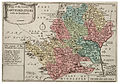
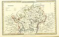
A large number of maps were published of Hertfordshire before 1900, the first being by Christopher Saxton in 1577 and they are documented in detail in The Printed Maps of Hertfordshire, by D. Hodson[1]. In the examples of maps shown here the final numeric reference is the one given in his book.
Subcategories
This category has only the following subcategory.
Media in category "Old county maps of Hertfordshire"
The following 28 files are in this category, out of 28 total.
-
 John Speed - Map of Hertfordshire - 1610 - 001.jpg 3,500 × 2,623; 3.37 MB
-

-
 Wenceslas Hollar - Hertfordshire (State 6).jpg 2,650 × 1,851; 1.67 MB
-
 "Hertfordia comitatus, vernacule Hertfordshire" (22073373849).jpg 3,860 × 3,037; 2.1 MB
-
 A Mapp of the County of Hartford shire with its Hundreds (BM 1850,0223.273).jpg 2,500 × 1,738; 1.35 MB
-

-
 Maps of England circa 1670, Hartford Shire 18 of 40 (13433335073).jpg 6,507 × 4,936; 3.88 MB
-

-

-
 Hertfordshire-Maps-Bowen-1759-39.jpg 2,457 × 2,120; 2.26 MB
-
 Hertfordshire-Maps-Condor-1784-48ii.jpg 1,954 × 2,397; 957 KB
-
 Hertfordshire-Maps-Cary-1787-49.jpg 3,128 × 2,572; 3.86 MB
-
 John Cary - Map of Hertfordshire - 001.jpg 3,000 × 2,448; 4.79 MB
-

-
 Ordnance Survey Drawings - Ware (OSD 141).jpg 4,000 × 2,718; 5 MB
-
 Aikin(1800) p303 - Herefordshire.jpg 1,920 × 1,142; 324 KB
-
 Gray1824.herts.jpg 787 × 974; 147 KB
-

-
 Pigot and Co (1842) p1.276 - Map of Hertfordshire.jpg 2,160 × 1,362; 804 KB
-
 The Victoria history of the County of Hertford BHL22082893.jpg 2,248 × 3,412; 1.03 MB
-
 The Victoria history of the County of Hertford BHL22082950.jpg 2,248 × 3,412; 667 KB
-
 The Victoria history of the County of Hertford BHL22082677.jpg 2,248 × 3,412; 1.11 MB
-
 The Victoria history of the County of Hertford BHL22082678.jpg 2,248 × 3,412; 1.1 MB
-

-
 CAPPER(1813) p524 - Hertfordshire.jpg 2,320 × 1,359; 681 KB
-
 H. Chauncy, The historical antiquities of of Hertfordshire Wellcome L0020612.jpg 1,550 × 1,186; 1.2 MB
-
 Hertford Shire - By H. Moll Geographer - btv1b530569867.jpg 4,112 × 3,032; 2.03 MB
-
 Hertfordshire (1722).png 5,293 × 4,375; 52.97 MB

.jpg)
.jpg)
.jpg)
.jpg)
.5.(18).jpg)
.jpg)
_-_btv1b8445049z.jpg)


.jpg)
_p303_-_Herefordshire.jpg)

.jpg)
_p1.276_-_Map_of_Hertfordshire.jpg)


_p524_-_Hertfordshire.jpg)


.png)