Category:Old county maps of Lancashire
Ceremonial counties of England: Bedfordshire · Berkshire · Buckinghamshire · Cambridgeshire · Cheshire · Cornwall · Derbyshire · Devon · Dorset · Durham · East Riding of Yorkshire · Essex · Gloucestershire · Hampshire · Herefordshire · Hertfordshire · Kent · Lancashire · Leicestershire · Lincolnshire · Norfolk · Northamptonshire · Northumberland · Nottinghamshire · Oxfordshire · Rutland · Shropshire · Somerset · Staffordshire · Suffolk · Surrey · Warwickshire · Wiltshire · Worcestershire
City-counties:
Former historic counties: Cumberland · Huntingdonshire · Middlesex · North Riding of Yorkshire · Sussex · West Riding of Yorkshire · Westmorland · Yorkshire
Other former counties:
City-counties:
Former historic counties: Cumberland · Huntingdonshire · Middlesex · North Riding of Yorkshire · Sussex · West Riding of Yorkshire · Westmorland · Yorkshire
Other former counties:
Media in category "Old county maps of Lancashire"
The following 39 files are in this category, out of 39 total.
-

-
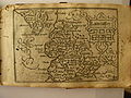
 Map of Lancashire c1590.jpg 635 × 1,035; 276 KB
-
 William Smith Lancashire 1598.jpg 885 × 712; 291 KB
-
 William Smith map of Lancashire 1598 Harley 6159 ff 3v-4.jpg 1,500 × 1,183; 792 KB
-
 Lancashire 1610 Speed Hondius - Restoration.jpg 2,610 × 2,000; 7.34 MB
-
 Lancashire 1610 Speed Hondius - Restoration.png 2,610 × 2,000; 11.37 MB
-
 Lancashire 1610 Speed Hondius.jpg 6,456 × 4,971; 9.9 MB
-
 Lancashire 1610 Speed Hondius.png 6,456 × 4,971; 55.97 MB
-
 Southwest.Lancashire.1610.jpg 1,265 × 1,800; 276 KB
-
 Speed's Map of Lancashire, 1623.jpg 2,560 × 1,920; 1.29 MB
-
 17th Century map pf Lancashire.JPG 3,456 × 2,592; 4.64 MB
-
 Lancastria Palatinatus Anglis Lancaster & Lancas Shire - btv1b53056180h (1 of 2).jpg 6,760 × 5,256; 5.09 MB
-

-
 "Lancastria Palatinatus, anglis Lancaster et Lancashire" (22072804229).jpg 3,830 × 3,097; 2.11 MB
-

-
 Maps of England circa 1670, Lancashire 21 of 40 (13432454715).jpg 4,983 × 6,333; 4.18 MB
-
 Lancashire-Morden-1695.jpg 2,667 × 3,000; 1.97 MB
-
 Lancastria palatinatus anglis Lancaster & Lancasshire - CBT 6596161.jpg 5,773 × 4,370; 6.76 MB
-

-

-
 Lancashire.jpg 2,194 × 2,359; 1.87 MB
-
 The antiquities of England and Wales. By Francis Grose, - Fleuron T147669-36.png 1,667 × 1,277; 114 KB
-
 Aikin(1800) p099 - Lancashire.jpg 1,070 × 1,835; 373 KB
-

-
 CAPPER(1813) p630 - Lancashire.jpg 1,359 × 2,326; 877 KB
-
 Cary map lancashire 1814.jpg 1,008 × 1,450; 681 KB
-
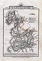
 Gray1824.lancs.jpg 806 × 946; 169 KB
-

-

-
 A map of the county palatine of Lancaster - PR-R-88146-000-00001.jpg 1,395 × 2,000; 544 KB
-
 BAINES(1836) p01.121 - Map of Lancashire according to the Doomsday Survey.jpg 3,053 × 4,731; 2.91 MB
-
 BAINES(1836) p02.160 - Lancashire.jpg 2,895 × 4,452; 2.83 MB
-
 C1840s Lancashire County Map Chapman & Hall Print Liverpool Lancaster.jpg 4,976 × 6,408; 10.47 MB
-
 Pigot and Co (1842) p2.138 - Map of Lancashire.jpg 1,310 × 2,158; 881 KB
-
 HARDWICK(1857) p01.8 - Lancashire.jpg 3,077 × 4,410; 3.08 MB
-
 BAINES(1888) p01.58 - Map of Lancashire according to the Doomday Survey.jpg 2,198 × 3,107; 1.37 MB
-
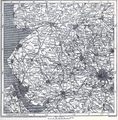
 Lancashire in Pre-turnpike times.jpg 1,875 × 2,398; 1.04 MB
-
 1911 Britannica - Lancashire.png 2,172 × 2,200; 9.52 MB
-
 Victoriahistory01farr 0384.jpg 1,931 × 2,759; 2.61 MB
,_ff.15v-16_-_BL_Royal_MS_18_D_III.png)


.jpg)

.jpg)
.5.(52).jpg)
.jpg)


_p099_-_Lancashire.jpg)

_p630_-_Lancashire.jpg)


.jpg)
%27_(11007139926).jpg)

_p01.121_-_Map_of_Lancashire_according_to_the_Doomsday_Survey.jpg)
_p02.160_-_Lancashire.jpg)

_p2.138_-_Map_of_Lancashire.jpg)
_p01.8_-_Lancashire.jpg)
_p01.58_-_Map_of_Lancashire_according_to_the_Doomday_Survey.jpg)


