Category:Old maps of Bochum
Use the appropriate category for maps showing all or a large part of Bochum. See subcategories for smaller areas:
| If the map shows | Category to use |
|---|---|
| Bochum on a recently created map | Category:Maps of Bochum or its subcategories |
| Bochum on a map created more than 70 years ago | Category:Old maps of Bochum or its subcategories |
| the history of Bochum on a recently created map | Category:Maps of the history of Bochum or its subcategories |
| the history of Bochum on a map created more than 70 years ago | Category:Old maps of the history of Bochum or its subcategories |
Media in category "Old maps of Bochum"
The following 21 files are in this category, out of 21 total.
-
 Bochum Dahlhausen Linden 1843.png 884 × 676; 1.56 MB
-
 Messtischblatt 4508 Essen 1894 (Eiberg).jpg 1,775 × 1,421; 653 KB
-
 Messtischblatt 4508 Essen 1894.jpg 7,261 × 7,427; 13.22 MB
-
 Messtischblatt 4508 Essen 1898.jpg 1,654 × 1,792; 954 KB
-
-
 BZSG - Eingemeindung - Mittelstadt Langendreer-Werne.jpg 3,000 × 4,000; 3.39 MB
-
 Carl Arnold Kortum - Grundriss der Stadt Bochum 1790.png 1,200 × 932; 893 KB
-
 Ehrenfeld auf dem Bochumer Stadtplan von 1927.jpg 1,506 × 1,229; 1.17 MB
-

-
 Kreis bochum-land (1907).png 565 × 759; 243 KB
-
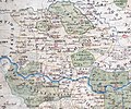
 Le Coq 1805 - Nordwestdeutschland - Ruhrgebiet.jpg 12,000 × 8,000; 17.91 MB
-

-
 Messtischblatt 4509 Bochum 1899.jpg 1,654 × 1,774; 1,004 KB
-
 Messtischblatt 4509 Bochum 193x.jpg 10,336 × 7,960; 15.75 MB
-
 PKA4809 Bochum 1840.jpg 4,640 × 4,564; 4.28 MB
-
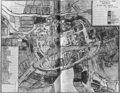
 Plan der Stadt Bochum und der zu ihrer Jurisdiktion gehörende Landstraßen, 1755.jpg 6,552 × 4,782; 7.08 MB
-

-

-
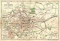 Plan der Stadt Bochum, Stadtbauamt, 1897.jpg 3,863 × 2,648; 4.27 MB
-
 Planung für das Ehrenfeld auf dem Bochumer Stadtplan von 1905.jpg 1,506 × 1,229; 1.4 MB
-
 Preussische Generalstabskarte Essen around 1820.jpg 9,866 × 8,417; 19.54 MB

.jpg)


.jpg)


.png)

_Brenschede.jpg)


.jpg)
.jpg)


