Category:Old maps of Kreis Kleve
Use the appropriate category for maps showing all or a large part of Kleve. See subcategories for smaller areas:
| If the map shows | Category to use |
|---|---|
| Kleve on a recently created map | Category:Maps of Kreis Kleve or its subcategories |
| Kleve on a map created more than 70 years ago | Category:Old maps of Kreis Kleve or its subcategories |
| the history of Kleve on a recently created map | Category:Maps of the history of Kreis Kleve or its subcategories |
| the history of Kleve on a map created more than 70 years ago | Category:Old maps of the history of Kreis Kleve or its subcategories |
Subcategories
This category has the following 7 subcategories, out of 7 total.
Media in category "Old maps of Kreis Kleve"
The following 130 files are in this category, out of 130 total.
-
 "Clivia ducatus et Ravenstein Dominium" (21636756523).jpg 3,853 × 2,930; 2.23 MB
-
 419 Neuaufnahme Kornmühle Wachtendonk.jpg 600 × 400; 73 KB
-
 419 Tranchot Kornmühle Wachtendonk.jpg 600 × 400; 45 KB
-
 419 Urkataster Kornmühle Wachtendonk.jpg 600 × 400; 55 KB
-
 420 Neuaufnahme Ölmühle Wachtendonk.jpg 600 × 400; 78 KB
-
 420 Tranchot Ölmühle Wachtendonk.jpg 542 × 343; 56 KB
-
 420 Urkataster Ölmühle Wachtendonk.jpg 600 × 400; 56 KB
-
 421 Neuaufnahme Lohmühle Wachtendonk.jpg 600 × 400; 75 KB
-
 421 Tranchot Lohmühle Wachtendonk.jpg 600 × 400; 63 KB
-
 421 Urkataster Lohmühle Wachtendonk.jpg 600 × 400; 60 KB
-
 422 Neuaufnahme Holtheyder Ölmühle.jpg 600 × 400; 73 KB
-
 422 Tranchot Holtheyder Ölmühle.jpg 600 × 400; 54 KB
-
 422 Urkataster Holtheyder Ölmühle.jpg 528 × 363; 56 KB
-
 423 Neuaufnahme Kornmühle Caen.jpg 600 × 400; 95 KB
-
 423 Tranchot Kornmühle Caen.jpg 600 × 400; 58 KB
-
 423 Urkataster Kornmühle Caen.jpg 600 × 400; 66 KB
-
 424 Neuaufnahme Ölmühle Caen.jpg 600 × 400; 90 KB
-
 424 Tranchot Ölmühle Caen.jpg 600 × 400; 61 KB
-
 424 Urkataster Ölmühle Caen.jpg 600 × 400; 66 KB
-
 425 Neuaufnahme Walkmühle Caen.jpg 600 × 400; 93 KB
-
 425 Tranchot Walkmühle Caen.jpg 600 × 400; 59 KB
-
 425 Urkataster Walkmühle Caen.jpg 600 × 400; 64 KB
-
 426 Neuaufnahme Herrenmühle Straelen.jpg 600 × 400; 63 KB
-
 426 Tranchot Herrenmühle Straelen.jpg 600 × 400; 44 KB
-
 426 Urkataster Herrenmühle Straelen.jpg 600 × 400; 51 KB
-
 428 Neuaufnahme Paesmühle Straelen-Damm.jpg 600 × 400; 74 KB
-
 428 Tranchot Paesmühle Straelen-Dam.jpg 600 × 400; 68 KB
-
 428 Urkataster Paesmühle Straelen-Dam.jpg 600 × 400; 69 KB
-
 429 Neuaufnahme Maesemühle Straelen-Auwel.jpg 600 × 400; 86 KB
-
 429 Tranchot Maesemühle Straelen Auwel.jpg 600 × 400; 53 KB
-
 429 Urkataster Maesemühle Straelen-Auwel.jpg 600 × 400; 63 KB
-
 430 Neuaufnahme Vlaßrather Korn- u. Ölmühle Straelen - Vlaßrath.jpg 600 × 400; 84 KB
-
 430 Tranchot Vlaßrather Korn- u. Ölmühle Straelen - Vlaßrath.jpg 600 × 400; 45 KB
-
 430 Urkataster Vlaßrather Korn- u. Ölmühle Straelen - Vlaßrath.jpg 600 × 400; 61 KB
-
 431 Neuaufnahme Ponter Mühle Geldern-Pont.jpg 600 × 400; 89 KB
-
 431 Tranchot Ponter Mühle Geldern-Pont.jpg 600 × 400; 56 KB
-
 431 Urkataster Ponter Mühle Geldern-Pont.jpg 600 × 400; 53 KB
-
 432 Neuaufnahme Burgmühle Geldern.jpg 600 × 400; 77 KB
-
 432 Tranchot Burgmühle Geldern.jpg 600 × 400; 69 KB
-
 432 Urkataster Burgmühle Geldern.jpg 600 × 400; 73 KB
-
 436 a Neuaufnahme Alte Willicksche Mühle Geldern-Veert.jpg 600 × 400; 59 KB
-
 436 a Tranchot Alte Willicksche Mühle Geldern-Veert.jpg 600 × 400; 60 KB
-
 436 a Urkataster Alte Willicksche Mühle Geldern-Veert.jpg 600 × 400; 85 KB
-
 436 b Neuaufnahme Willicksche Mühle Geldern-Veert.jpg 600 × 400; 72 KB
-
 436 b Tranchot Willicksche Mühle Geldern-Veert.jpg 600 × 400; 77 KB
-
 436 b Urkataster Willicksche Mühle Geldern-Veert.jpg 600 × 400; 84 KB
-
 437 Neuverkartung Pletzmühle Geldern-Bersdonk.jpg 600 × 400; 103 KB
-
 437 Tranchot Pletzmühle Geldern-Baersdonk.jpg 600 × 400; 61 KB
-
 437 Urkataster Pletzmühle Geldern-Baersdonk.jpg 600 × 400; 74 KB
-
 438 Neuaufnahme Wyemühle Kevelaer-Wetten.jpg 600 × 400; 66 KB
-
 438 Tranchot Wyemühle Kevelaer-Wetten.jpg 600 × 400; 62 KB
-
 438 Urkataster Wyemühle Kevelaer-Wetten.jpg 600 × 400; 86 KB
-
 439 Neuaufnahme Mühlen von Hs. Gesselen Kevelaer-Wetten.jpg 600 × 400; 68 KB
-
 439 Tranchot Mühlen von Hs. Gesselen Kevelaer-Wetten.jpg 600 × 400; 63 KB
-
 439 Urkataster Mühlen von Hs. Gesselen Kevelaer-Wetten.jpg 600 × 400; 71 KB
-
 440 Neuaufnahme Neumühle Kevelaer-Wetten.jpg 600 × 400; 73 KB
-
 440 Tranchot Neumühle Kevelaer-Wetten.jpg 600 × 400; 64 KB
-
 440 Urkataster Neumühle Kevelaer-Wetten.jpg 600 × 400; 74 KB
-
 441 Neuaufnahme Langendonker Mühle Geldern-Aengenesch.jpg 600 × 400; 70 KB
-
 441 Tranchot Langendonker Mühle Geldern-Aengenesch.jpg 600 × 400; 53 KB
-
 441 Urkataster Langendonker Mühle Geldern-Aengenesch.jpg 600 × 400; 67 KB
-
 442 Neuaufnahme Kapellener Mühle Geldern-Kapellen.jpg 600 × 400; 102 KB
-
 442 Tranchot Kapellener Mühle Geldern-Kapellen.jpg 600 × 400; 62 KB
-
 442 Urkataster Kapellener Mühle Geldern-Kapellen.jpg 600 × 400; 67 KB
-
 443 Neuaufnahme Honselaerer Mühle Kevelaer-Wetten.jpg 600 × 400; 64 KB
-
 443 Tranchot Honselaerer Mühle Kevelaer-Wetten.jpg 600 × 400; 61 KB
-
 443 Urkataster Honselaerer Mühle Kevelaer-Wetten.jpg 600 × 400; 74 KB
-
 444 Neuaufnahme Windvonderer Mühle Straelen.jpg 600 × 400; 73 KB
-
 444 Tranchot Windvonderer Mühle Straelen.jpg 600 × 400; 55 KB
-
 444 Urkataster Windvonderer Mühle Straelen.jpg 600 × 400; 77 KB
-
 445 Neuaufnahme Schravelsche Mühle Kevelaer - Schravelen.jpg 600 × 400; 71 KB
-
 445 Tranchot Schravelsche Mühle Kevelaer - Schravelen.jpg 600 × 400; 58 KB
-
 445 Urkataster Schravelsche Mühle Kevelaer - Schravelen.jpg 600 × 400; 68 KB
-
 446 Neuaufnahme Schlossmühle Wissen Weeze.jpg 600 × 400; 86 KB
-
 446 Tranchot Schlossmühle Wissen Weeze.jpg 600 × 400; 52 KB
-
 446 Urkataster Schlossmühle Wissen Weeze.jpg 600 × 400; 49 KB
-
 451 Neuaufnahme Fallmühle Sonsbeck-Balberg.jpg 600 × 400; 91 KB
-
 451 Tranchot Fallmühle Sonsbeck-Balberg.jpg 600 × 400; 65 KB
-
 451 Urkataster Fallmühle Sonsbeck-Balberg.jpg 600 × 400; 83 KB
-
 452 Neuaufnahme Kervenheimer (Floth Mühle Kevelaer-Kerverheim).jpg 600 × 400; 85 KB
-
 452 Tranchot Kervenheimer (Floth Mühle Kevelaer-Kerverheim).jpg 600 × 400; 51 KB
-
 452 Urkataster Kervenheimer (Floth Mühle Kevelaer-Kerverheim).jpg 600 × 400; 50 KB
-
 453 Neuaufnahme Höster Mühle Weeze.jpg 600 × 400; 65 KB
-
 453 Tranchot Höster Mühle Weeze.jpg 600 × 400; 42 KB
-
 453 Urkataster Höster Mühle Weeze.jpg 600 × 400; 43 KB
-
 454 Neuaufnahme Kornmühle Goch.jpg 600 × 400; 88 KB
-
 454 Tranchot Kornmühle Goch.jpg 600 × 400; 52 KB
-
 454 Urkataster Kornmühle Goch.jpg 600 × 400; 81 KB
-
 455 Neuaufnahme Ölmühle Goch.jpg 600 × 400; 90 KB
-
 455 Tranchot Ölmühle Goch.jpg 600 × 400; 52 KB
-
 455 Urkataster Ölmühle Goch.jpg 600 × 400; 80 KB
-
 456 Neuaufnahme Walkmühle Goch.jpg 600 × 400; 90 KB
-
 456 Tranchot Walkmühle Goch.jpg 600 × 400; 52 KB
-
 456 Urkataster Walkmühle Goch.jpg 600 × 400; 80 KB
-
 457 Neuaufnahme Lohmühle Goch.jpg 600 × 400; 89 KB
-
 457 Tranchot Lohmühle Goch.jpg 600 × 400; 52 KB
-
 457 Urkataster Lohmühle Goch.jpg 600 × 400; 80 KB
-
 458 Neuaufnahme Susmühle Goch.jpg 600 × 400; 90 KB
-
 458 Tranchot Susmühle Goch.jpg 600 × 400; 53 KB
-
 458 Urkataster Susmühle Goch.jpg 600 × 400; 80 KB
-
 460 Neuaufnahme Aspermühle Goch-Asperden.jpg 600 × 400; 82 KB
-
 460 Tranchot Aspermühle Goch-Asperden.jpg 600 × 400; 64 KB
-
 460 Urkataster Aspermühle Goch-Asperden.jpg 600 × 400; 94 KB
-
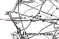
 461 Neuaufnahme Viller Mühle Goch-Hommersum.jpg 600 × 400; 80 KB
-
 461 Tranchot Viller Mühle Goch-Hommersum.jpg 600 × 400; 54 KB
-
 461 Urkataster Viller Mühle Goch-Hommersum.jpg 600 × 400; 96 KB
-
 462 Neuaufnahme Yshövel´sche Mühle Goch-Hommersum.jpg 600 × 400; 54 KB
-
 462 Tranchot Yshövel´scheMühle Goch-Hommersum.jpg 600 × 400; 55 KB
-
 462 Urkataster Yshövel´scheMühle Goch-Hommersum.jpg 600 × 400; 60 KB
-
 463 Neuaufnahme Mühle zu Müll Goch-Hommersum.jpg 600 × 400; 68 KB
-
 463 Tranchot Mühle zu Müll Goch-Hommersum.jpg 600 × 400; 62 KB
-
 463 Urkataster Mühle zu Müll Goch-Hommersum.jpg 600 × 400; 70 KB
-
 Blaeu 1645 - Clivia Ducatus et Ravenstein Dominium.jpg 3,611 × 3,015; 1.35 MB
-

-

-
 Franz Johann Joseph von Reilly, Das Herzogthum Kleve (Nro. 267, 1794–1795).jpg 1,371 × 1,059; 610 KB
-
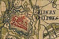
 Geldern - Gelre (1649).jpg 5,500 × 4,435; 4.03 MB
-
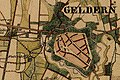
 Geldern 1703.jpg 1,600 × 1,200; 479 KB
-
 Kaart van de streek tussen Doetinchem en Venlo, NG-1985-7-1-15.jpg 4,250 × 4,900; 2.98 MB
-

-
 LouisendorfGrundriss.jpg 951 × 666; 294 KB
-
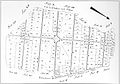
 LouisendorfUrkarte.jpg 927 × 1,058; 620 KB
-
 Map - Special Collections University of Amsterdam - OTM- HB-KZL I 2 A 8 (37).jpg 7,779 × 6,370; 18.03 MB
-
 NeulouisendorfGrundriss.jpg 935 × 592; 173 KB
-
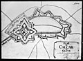 Plattegrond van vestingwerken - Calcar - 20408768 - RCE.jpg 827 × 615; 99 KB
-
 Schneider Kreis Rees unter den Römern.png 2,185 × 1,305; 2.32 MB
-

-
 Wachtendonck (Atlas van Loon).jpg 3,760 × 2,745; 1.2 MB
-
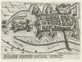 Wachtendonk 1603.png 1,154 × 872; 2.04 MB
-
 Wallfahrtsbildchen Kevelaer.png 258 × 353; 219 KB
.jpg)


.jpg)
.jpg)
.jpg)


.jpg)
.jpg)


.jpg)


.jpg)

