Category:OpenStreetMap maps of Paris 1er arrondissement
Media in category "OpenStreetMap maps of Paris 1er arrondissement"
The following 24 files are in this category, out of 24 total.
-
 1er Arrondissement, Paris, France - Open Street Map.png 1,259 × 1,011; 1.6 MB
-
 1st arrondissement of Paris - OSM 2020.svg 1,879 × 1,546; 1.25 MB
-
 Canal Saint-Martin, Paris - OSM 2022.svg 1,694 × 2,206; 7.59 MB
-
 Les Halles - OpenStreetMap 2020.svg 2,000 × 1,000; 230 KB
-
 Louvre Access Map.png 2,000 × 1,333; 2.17 MB
-
 Map of the 1st arrondissement of Paris - OSM 2020.svg 1,879 × 1,546; 1.28 MB
-
 Map of Île de la Cité - OpenStreetMap 2015.svg 2,000 × 1,050; 678 KB
-
 Map of Île de la Cité with monuments - OpenStreetMap 2015.svg 2,401 × 1,637; 564 KB
-
 OSM Paris sample.png 256 × 256; 133 KB
-
 Palais-Royal - OSM 2021 01.svg 1,800 × 1,050; 276 KB
-
 Palais-Royal - OSM 2021 02.svg 1,050 × 1,800; 281 KB
-
 Paris - Île de la Cité 2011.svg 2,670 × 1,841; 5.05 MB
-
 Paris 1st Arrondissement.png 1,257 × 859; 1.33 MB
-
 Paris 1st map.png 3,008 × 1,730; 501 KB
-
 Place Dauphine, Paris (EN) - OSM 2021.svg 512 × 349; 88 KB
-
 Place Dauphine, Paris (FR) - OSM 2021.svg 512 × 349; 88 KB
-
 Place Dauphine, Paris - OSM 2021.svg 1,600 × 1,200; 84 KB
-
 Place des Victoires, Paris - OpenStreetMap 2020.svg 512 × 346; 56 KB
-
 Place Vendôme - OpenStreetMap 2014.png 961 × 943; 200 KB
-
 Place Vendôme 2015.svg 2,100 × 1,880; 33 KB
-
 Place Vendôme, Paris - OSM 2021 01.svg 2,000 × 1,850; 106 KB
-
 Place Vendôme, Paris - OSM 2021 02.svg 512 × 422; 41 KB
-
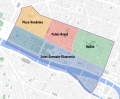 Quarters of the 1st arrondissement of Paris - OSM 2020.svg 1,879 × 1,546; 1.26 MB
-
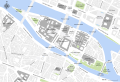
 Île de la Cité and Île Saint-Louis - OSM 2021.svg 2,260 × 1,271; 1.26 MB


_-_OSM_2021.svg)
_-_OSM_2021.svg)


