Category:OpenStreetMap maps of Paris 5e arrondissement
Media in category "OpenStreetMap maps of Paris 5e arrondissement"
The following 15 files are in this category, out of 15 total.
-
 2014 collegiale Saint-Marcel emplacement.jpg 533 × 446; 235 KB
-
 5e Arrondissement, Paris, France - Open Street Map.png 1,227 × 1,100; 1.88 MB
-
 5th arrondissement of Paris - OSM 2020.svg 1,833 × 1,663; 1.26 MB
-
 Champ-de-Mars - OpenStreetMap 1.svg 586 × 555; 2.33 MB
-
 Jardin des plantes de Paris - OpenStreetMap 2020 - Clos.png 1,280 × 957; 679 KB
-
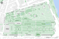
 Jardin des plantes de Paris - OpenStreetMap 2020.svg 1,600 × 1,196; 587 KB
-
 Jardin des Plantes de Paris - OpenStreetMap.svg 873 × 821; 1.92 MB
-
 Jardin des plantes de Paris - OSM 2020.svg 1,320 × 860; 446 KB
-
 Map of the 5th arrondissement of Paris - OSM 2020.svg 1,833 × 1,663; 1.29 MB
-
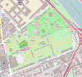
 Ménagerie du Jardin des plantes, EN - OSM 2020.svg 2,200 × 1,500; 241 KB
-
 Ménagerie du Jardin des plantes, FR - OSM 2020.svg 2,200 × 1,500; 247 KB
-
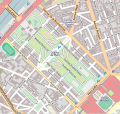
 Place du Panthéon - OpenStreetMap 2015.svg 512 × 366; 99 KB
-
 Place du Panthéon, Paris - OSM 2020.svg 512 × 410; 118 KB
-
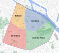 Quarters of the 5th arrondissement of Paris - OSM 2020.svg 1,833 × 1,663; 1.27 MB
-
 Val-de-Grâce - OpenStreetMap 1.svg 531 × 408; 746 KB


