Category:OpenStreetMap maps of Paris 7e arrondissement
Media in category "OpenStreetMap maps of Paris 7e arrondissement"
The following 13 files are in this category, out of 13 total.
-
 7e Arrondissement, Paris, France - Open Street Map.png 1,820 × 1,136; 2.48 MB
-
 7th arrondissement of Paris - OSM 2020.svg 2,114 × 1,396; 1.75 MB
-
 Champ-de-Mars, Paris - OSM 2020.svg 1,920 × 790; 462 KB
-
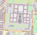
 Les Invalides - OpenStreetMap 1.svg 566 × 1,141; 2 MB
-
 Les Invalides - OpenStreetMap 2.svg 498 × 471; 745 KB
-
 Map of the 7th arrondissement of Paris - OSM 2020.svg 2,114 × 1,396; 1.78 MB
-
 Musée du Quai Branly, Paris (en) - OSM 2022.svg 1,920 × 1,080; 254 KB
-
 Musée du Quai Branly, Paris (fr) - OSM 2022.svg 1,920 × 1,080; 254 KB
-
 Musée Rodin, Paris - OSM 2022 01.svg 1,600 × 1,000; 153 KB
-
 Musée Rodin, Paris - OSM 2022 02.svg 1,100 × 1,600; 157 KB
-
 Place de Fontenoy-UNESCO - OSM 2022.svg 1,400 × 850; 249 KB
-
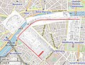 Plans of l'Expo Universelle 1889 Decauville Railway.jpg 923 × 711; 219 KB
-
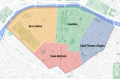 Quarters of the 7th arrondissement of Paris - OSM 2020.svg 2,114 × 1,396; 1.77 MB


_-_OSM_2022.svg)
_-_OSM_2022.svg)


