Category:SVG labeled maps of administrative divisions of Latvia (location map scheme)


.svg)


_(Paris_zoom).svg)
.svg)
,_administrative_divisions_-_de_-_colored_(multizoom).svg)
_-_colored.svg)
.svg)
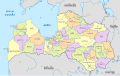
,_administrative_divisions_-_Nmbrs_(multizoom).svg)
,_administrative_divisions_-_de_-_colored.svg)
_-_de_-_colored.svg)

.svg)

.svg)
Media in category "SVG labeled maps of administrative divisions of Latvia (location map scheme)"
The following 12 files are in this category, out of 12 total.
-
 Latvia municipalities labelled pl.svg 4,880 × 2,880; 693 KB
-
 Latvia, administrative divisions - de - colored.svg 1,304 × 821; 806 KB
-
 Latvia, administrative divisions - de+Nmbrs - colored.svg 1,304 × 821; 536 KB
-
 Latvia, administrative divisions - de+Nmbrs.svg 1,304 × 821; 533 KB
-
 Latvia, administrative divisions - de.svg 1,304 × 821; 803 KB
-
 Latvia, administrative divisions - et - colored (until 2009).svg 1,305 × 822; 541 KB
-
 Latvia, administrative divisions - et - colored.svg 1,304 × 821; 1.21 MB
-
 Latvia, administrative divisions - Nmbrs - colored.svg 1,304 × 821; 669 KB
-
 Latvia, administrative divisions - Nmbrs.svg 1,304 × 821; 506 KB
-
 Latvia, administrative divisions 2021 - de - colored.svg 1,304 × 821; 485 KB
-
 Latvia, administrative divisions 2021 - et - colored.svg 1,304 × 821; 545 KB
-
 Latvia, administrative divisions 2021 - th - colored.svg 1,304 × 821; 726 KB


.svg)


