| Location
|
Upload
|
Photo
|
Object
|
Cat.
|
Coordinates
|
KGS-Nr
|
| Altdorf
|

|
yes
|


|
Haus im Eselmätteli
|
A
|
46°52′58″N 8°38′24″E / 46.882655°N 8.640103°E / 46.882655; 8.640103
|
5789
|
| Altdorf
|
|
yes
|
|
Fremdenspital mit Kapelle
|
A
|
46°52′59″N 8°38′29″E / 46.883001°N 8.641436°E / 46.883001; 8.641436
|
5775
|
| Altdorf
|
|
yes
|
|
Haus Jauch
|
A
|
46°52′50″N 8°38′47″E / 46.880636°N 8.646435°E / 46.880636; 8.646435
|
5776
|
| Altdorf
|
|
yes
|
|
Bannersammlung im Rathaus
|
B
|
46°52′55″N 8°38′39″E / 46.882029°N 8.644086°E / 46.882029; 8.644086
|
11991
|
| Altdorf
|
|
yes
|
|
Grabmäler auf dem Friedhof gemäss Verzeichnis der Kirchgemeinde
|
B
|
46°52′59″N 8°38′31″E / 46.883166°N 8.641965°E / 46.883166; 8.641965
|
11296
|
| Altdorf
|
|
yes
|
|
Kapuzinerkloster Altdorf
|
B
|
46°53′03″N 8°38′37″E / 46.88429°N 8.643735°E / 46.88429; 8.643735
|
5779
|
| Altdorf
|
|
yes
|
|
Rathaus
|
B
|
46°52′55″N 8°38′39″E / 46.882037°N 8.644078°E / 46.882037; 8.644078
|
5782
|
| Altdorf
|
|
yes
|
|
Kapelle beim Suworowhaus
|
B
|
46°52′50″N 8°38′48″E / 46.880453°N 8.646706°E / 46.880453; 8.646706
|
11299
|
| Altdorf
|
|
yes
|
|
Josefsbrunnen beim Fremdenspital
|
B
|
46°52′59″N 8°38′29″E / 46.883054°N 8.641477°E / 46.883054; 8.641477
|
5777
|
| Altdorf
|
|
yes
|
|
Haus von Roll (früher UKB)
|
B
|
46°52′54″N 8°38′36″E / 46.881776°N 8.643285°E / 46.881776; 8.643285
|
5793
|
| Altdorf
|
|
yes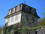
|
|
Haus Waldegg (mit Baumbestand)
|
B
|
46°53′04″N 8°38′34″E / 46.884543°N 8.642796°E / 46.884543; 8.642796
|
11339
|
| Altdorf
|
|
yes
|
|
Kantonales Zeughaus
|
B
|
46°52′50″N 8°38′40″E / 46.880593°N 8.644571°E / 46.880593; 8.644571
|
5796
|
| Altdorf
|
|
yes
|
|
Kapelle St. Anna
|
A
|
46°52′59″N 8°38′32″E / 46.88305°N 8.64218°E / 46.88305; 8.64218
|
5772
|
| Altdorf
|
|
yes
|
|
Ankenwaage mit Hexenturm
|
B
|
46°52′55″N 8°38′35″E / 46.882048°N 8.643029°E / 46.882048; 8.643029
|
5784
|
| Altdorf
|
|
yes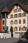
|
|
Haus Zieri
|
B
|
46°52′56″N 8°38′38″E / 46.88229°N 8.643979°E / 46.88229; 8.643979
|
11297
|
| Altdorf
|
|
yes
|
|
Kapelle Unter-Heiligkreuz mit ehemaligem Schützenhaus und Haus Muheim beim Spital
|
B
|
46°53′00″N 8°38′15″E / 46.883457°N 8.637418°E / 46.883457; 8.637418
|
5797
|
| Altdorf
|
|
yes
|
|
Tellspielhaus
|
B
|
46°52′51″N 8°38′40″E / 46.880952°N 8.644579°E / 46.880952; 8.644579
|
5803
|
| Altdorf
|
|
yes
|
|
Besslerbrunnen
|
B
|
46°52′54″N 8°38′38″E / 46.881769°N 8.643941°E / 46.881769; 8.643941
|
5773
|
| Altdorf
|
|
yes
|
|
Besslerhaus (Dr. Christen)
|
B
|
46°53′00″N 8°38′18″E / 46.883421°N 8.638231°E / 46.883421; 8.638231
|
5785
|
| Altdorf
|
|
yes
|
|
Crivellihaus
|
B
|
46°53′00″N 8°38′20″E / 46.883279°N 8.638923°E / 46.883279; 8.638923
|
11331
|
| Altdorf
|
|
yes[[File:|150x150px|Dätwyler-Stiftung]]
|
|
Dätwyler-Stiftung
|
A
|
46°52′40″N 8°38′49″E / 46.877834°N 8.646831°E / 46.877834; 8.646831
|
8582
|
| Altdorf
|
|
yes
|
|
Eidgenössisches Sackmagazin
|
A
|
46°52′15″N 8°37′57″E / 46.870869°N 8.632415°E / 46.870869; 8.632415
|
9057
|
| Altdorf
|
|
yes
|
|
Eidgenössisches Getreidesilo Altdorf
|
A
|
46°52′12″N 8°37′58″E / 46.870119°N 8.632753°E / 46.870119; 8.632753
|
5786
|
| Altdorf
|
|
yes
|
|
Fabrikgebäude Dätwyler
|
B
|
46°52′40″N 8°38′46″E / 46.87768°N 8.64615°E / 46.87768; 8.64615
|
5787
|
| Altdorf
|
|
yes
|
|
Haus Martin Gamma mit Oekonomiegebäude
|
B
|
46°52′58″N 8°38′27″E / 46.88288°N 8.640948°E / 46.88288; 8.640948
|
5792
|
| Altdorf
|
|
yes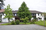
|
|
Haus Dr. Hirzel
|
B
|
46°53′00″N 8°38′18″E / 46.883421°N 8.638231°E / 46.883421; 8.638231
|
11333
|
| Altdorf
|
|
yes
|
|
Haus Huon
|
B
|
46°52′36″N 8°38′23″E / 46.876623933°N 8.639726967°E / 46.876623933; 8.639726967
|
11336
|
| Altdorf
|
|
yes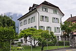
|
|
Haus Blumenfeld mit Granitbrunnen
|
B
|
46°52′27″N 8°38′55″E / 46.8741°N 8.64861°E / 46.8741; 8.64861
|
11338
|
| Altdorf
|
|
yes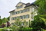
|
|
Haus oberer Vogelsang (mit Baumbestand)
|
B
|
46°53′05″N 8°38′27″E / 46.88476°N 8.640924°E / 46.88476; 8.640924
|
11341
|
| Altdorf
|
|
yes
|
|
Haus Walker-Kesselbach
|
B
|
46°52′49″N 8°38′36″E / 46.880155°N 8.64338°E / 46.880155; 8.64338
|
5794
|
| Altdorf
|
|
yes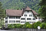
|
|
Haus Lusser an der Gotthardstrasse
|
B
|
46°52′46″N 8°38′39″E / 46.879427°N 8.644151°E / 46.879427; 8.644151
|
5791
|
| Altdorf
|
|
yes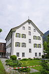
|
|
Haus in der Stoffelmatte
|
B
|
46°52′42″N 8°38′36″E / 46.878268°N 8.643207°E / 46.878268; 8.643207
|
5790
|
| Altdorf
|
|
yes[[File:|150x150px|Historisches Museum]]
|
|
Historisches Museum
|
B
|
46°52′40″N 8°38′42″E / 46.877835°N 8.644968°E / 46.877835; 8.644968
|
5795
|
| Altdorf
|
|
yes
|
|
Kirchenschatz-Museum St. Martin (Altdorf)
|
B
|
46°52′58″N 8°38′30″E / 46.882871°N 8.641735°E / 46.882871; 8.641735
|
8562
|
| Altdorf
|
|
yes
|
|
Kapuzinerinnenkloster St. Karl
|
B
|
46°52′44″N 8°38′37″E / 46.878985°N 8.643485°E / 46.878985; 8.643485
|
5798
|
| Altdorf
|
|
yes
|
|
Kollegium St. Karl Borromäus
|
B
|
46°52′29″N 8°39′03″E / 46.87468°N 8.650735°E / 46.87468; 8.650735
|
5799
|
| Altdorf
|
|
yes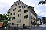
|
|
Haus Dr. F. Schmid (Korporationsarchiv Uri)
|
B
|
46°52′48″N 8°38′37″E / 46.87999°N 8.64372°E / 46.87999; 8.64372
|
5788
|
| Altdorf
|
|
yes[[File:|150x150px|Historisches Museum Uri]]
|
|
Historisches Museum Uri
|
A
|
46°52′40″N 8°38′42″E / 46.877835°N 8.644968°E / 46.877835; 8.644968
|
8579
|
| Altdorf
|
|
yes
|
|
Oelberg-Kapelle bei der kath. Kirche
|
B
|
46°53′01″N 8°38′31″E / 46.88356°N 8.64185°E / 46.88356; 8.64185
|
5781
|
| Altdorf
|
|
yes
|
|
Personalhaus der ehem. Draht- und Gummiwerke AG
|
B
|
46°52′40″N 8°38′49″E / 46.877834°N 8.646831°E / 46.877834; 8.646831
|
9058
|
| Altdorf
|
|
yes
|
|
Katholische Kirche St. Martin
|
A
|
46°53′00″N 8°38′32″E / 46.883299°N 8.642138°E / 46.883299; 8.642138
|
5778
|
| Altdorf
|
|
yes
|
|
Postgebäude
|
B
|
46°52′51″N 8°38′31″E / 46.880945234°N 8.642014689°E / 46.880945234; 8.642014689
|
5800
|
| Altdorf
|
|
yes
|
|
Staatsarchiv Uri
|
A
|
46°52′51″N 8°38′29″E / 46.88096°N 8.64128°E / 46.88096; 8.64128
|
8791
|
| Altdorf
|
|
yes
|
|
Kantonale Kunst und Kulturgutsammlung Uri
|
B
|
46°52′51″N 8°38′26″E / 46.880725°N 8.640506°E / 46.880725; 8.640506
|
8463
|
| Altdorf
|
|
yes
|
|
Telldenkmal und Türmli
|
A
|
46°52′54″N 8°38′39″E / 46.881666666°N 8.644166666°E / 46.881666666; 8.644166666
|
5783
|
| Altdorf
|
|
yes
|
|
Haus Winterberg
|
B
|
46°52′56″N 8°38′28″E / 46.882232°N 8.640986°E / 46.882232; 8.640986
|
11334
|
| Altdorf
|
|
yes
|
|
Altdorf
|
ISOS
|
46°52′50″N 8°38′22″E / 46.880555555°N 8.639444444°E / 46.880555555; 8.639444444
|
|


.jpg)


_%C3%BCber_die_Gotthardreuss,_Hospental_UR_20160826-jag9889.jpg)


