File:A New map of part of the United States of North America, exhibiting the Western Territory, Kentucky, Pennsylvania, Maryland and Virginia etc. Also, the Lakes Superior, Michigan, Huron, Ontario & Erie (IA bp 33672).pdf

Original file (3,750 × 3,010 pixels, file size: 3.24 MB, MIME type: application/pdf)
Captions
Captions
Summary
edit| Title |
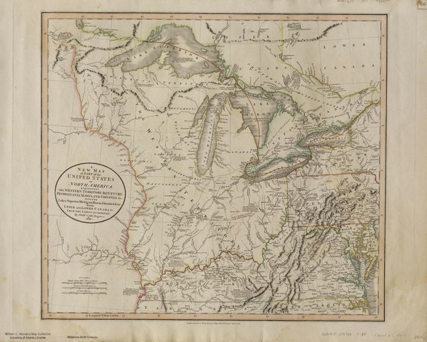
A New map of part of the United States of North America, exhibiting the Western Territory, Kentucky, Pennsylvania, Maryland and Virginia &c. Also, the Lakes Superior, Michigan, Huron, Ontario & Erie; with Upper and Lower Canada &c. From the Latest Authorities. By John Cary, Engraver, 1811. |
| Publisher |
J. Cary, London |
| Description |
Relief shown pictorially.;[Plate] '56' affixed in upper right.;Includes place names, hydrology, geographical features, historical/descriptive notations, treaty boundary lines, exploration routes, roads, etc.;Copper engraving, hand col. outlines on sheet 52 x 65 cm.;From the Whistance-Smith collection.;Probable source: Cary's New Universal Atlas, containing distinct maps of all the principal states and kingdoms throughout the world" 1811 (reissue of 1808). Subjects: United States--Political geography |
| Language | English |
| Publication date | April 21, 1811 |
| Current location |
IA Collections: wcw_gale; wcw; university_of_alberta_libraries; toronto |
| Accession number |
bp_33672 |
| Notes | Scale: Ca. 1:3,379,200 |
| Source |
Licensing
edit|
This work is in the public domain in its country of origin and other countries and areas where the copyright term is the author's life plus 70 years or fewer.
| |
| This file has been identified as being free of known restrictions under copyright law, including all related and neighboring rights. | |
File history
Click on a date/time to view the file as it appeared at that time.
| Date/Time | Thumbnail | Dimensions | User | Comment | |
|---|---|---|---|---|---|
| current | 13:12, 27 August 2021 |  | 3,750 × 3,010 (3.24 MB) | Fæ (talk | contribs) | IA Query "collection:(wcw) date:[1000 TO 1899]" bp_33672 Category:William C. Wonders Map Collection (COM:IA books#query) (1811 #332) |
You cannot overwrite this file.
File usage on Commons
The following page uses this file: