File:BRIDGE PLATE LOCATED ON WESTERN BRIDGE APPROACH - Fourteenth Street Bridge, Spanning Chattahoochee River, Columbus, Muscogee County, GA HAER GA-61-7.tif

Size of this JPG preview of this TIF file: 477 × 599 pixels. Other resolutions: 191 × 240 pixels | 382 × 480 pixels | 611 × 768 pixels | 815 × 1,024 pixels | 1,630 × 2,048 pixels | 4,278 × 5,375 pixels.
Original file (4,278 × 5,375 pixels, file size: 21.93 MB, MIME type: image/tiff)
Captions
Captions
Add a one-line explanation of what this file represents
Summary edit
| BRIDGE PLATE LOCATED ON WESTERN BRIDGE APPROACH - Fourteenth Street Bridge, Spanning Chattahoochee River, Columbus, Muscogee County, GA | ||||
|---|---|---|---|---|
| Photographer |
Fowler, Sam Related names:
|
|||
| Title |
BRIDGE PLATE LOCATED ON WESTERN BRIDGE APPROACH - Fourteenth Street Bridge, Spanning Chattahoochee River, Columbus, Muscogee County, GA |
|||
| Depicted place | Georgia; Muscogee County; Columbus | |||
| Date | 1982 | |||
| Dimensions | 4 x 5 in. | |||
| Current location |
Library of Congress Prints and Photographs Division Washington, D.C. 20540 USA http://hdl.loc.gov/loc.pnp/pp.print |
|||
| Accession number |
HAER GA-61-7 |
|||
| Credit line |
|
|||
| Notes |
|
|||
| Source | https://www.loc.gov/pictures/item/ga0491.photos.195256p | |||
| Permission (Reusing this file) |
|
|||

| Object location | | View this and other nearby images on: OpenStreetMap |
|---|
File history
Click on a date/time to view the file as it appeared at that time.
| Date/Time | Thumbnail | Dimensions | User | Comment | |
|---|---|---|---|---|---|
| current | 12:56, 14 July 2014 | 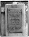 | 4,278 × 5,375 (21.93 MB) | Fæ (talk | contribs) | GWToolset: Creating mediafile for Fæ. HABS 09 July 2014 (801:1000) |
You cannot overwrite this file.
File usage on Commons
The following page uses this file: