File:CRUSHING MILL, LOOKING OVER GEARS TO TURBINES, EAST WALL IN BACKGROUND. VIEW FROM SOUTHWEST - Kekaha Sugar Company, Sugar Mill Building, 8315 Kekaha Road, Kekaha, Kauai County, HI HAER HI-83-30.tif

Size of this JPG preview of this TIF file: 486 × 600 pixels. Other resolutions: 194 × 240 pixels | 389 × 480 pixels | 622 × 768 pixels | 830 × 1,024 pixels | 1,660 × 2,048 pixels | 4,280 × 5,281 pixels.
Original file (4,280 × 5,281 pixels, file size: 21.56 MB, MIME type: image/tiff)
Captions
Captions
Add a one-line explanation of what this file represents
Summary
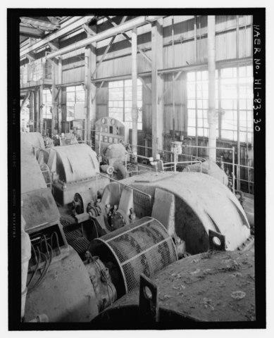
edit| CRUSHING MILL, LOOKING OVER GEARS TO TURBINES, EAST WALL IN BACKGROUND. VIEW FROM SOUTHWEST - Kekaha Sugar Company, Sugar Mill Building, 8315 Kekaha Road, Kekaha, Kauai County, HI | ||||
|---|---|---|---|---|
| Photographer |
Franzen, David |
|||
| Title |
CRUSHING MILL, LOOKING OVER GEARS TO TURBINES, EAST WALL IN BACKGROUND. VIEW FROM SOUTHWEST - Kekaha Sugar Company, Sugar Mill Building, 8315 Kekaha Road, Kekaha, Kauai County, HI |
|||
| Depicted place | Hawaii; Kauai County; Kekaha | |||
| Date | 2008 | |||
| Dimensions | 4 x 5 in. | |||
| Current location |
Library of Congress Prints and Photographs Division Washington, D.C. 20540 USA http://hdl.loc.gov/loc.pnp/pp.print |
|||
| Accession number |
HAER HI-83-30 |
|||
| Credit line |
|
|||
| Notes |
|
|||
| Source | https://www.loc.gov/pictures/item/hi0881.photos.365939p | |||
| Permission (Reusing this file) |
|
|||

| Object location | | View this and other nearby images on: OpenStreetMap |
|---|
File history
Click on a date/time to view the file as it appeared at that time.
| Date/Time | Thumbnail | Dimensions | User | Comment | |
|---|---|---|---|---|---|
| current | 05:07, 13 July 2014 |  | 4,280 × 5,281 (21.56 MB) | Fæ (talk | contribs) | GWToolset: Creating mediafile for Fæ. HABS 11 July 2014 (1001:1200) |
You cannot overwrite this file.
File usage on Commons
The following page uses this file: