File:Carquinez Bridge Toll Plaza and approach signage on east I-80 looking north.tiff

Size of this JPG preview of this TIF file: 747 × 599 pixels. Other resolutions: 299 × 240 pixels | 598 × 480 pixels | 957 × 768 pixels | 1,276 × 1,024 pixels | 2,553 × 2,048 pixels | 5,040 × 4,044 pixels.
Original file (5,040 × 4,044 pixels, file size: 19.44 MB, MIME type: image/tiff)
Captions
Captions
Add a one-line explanation of what this file represents
Summary
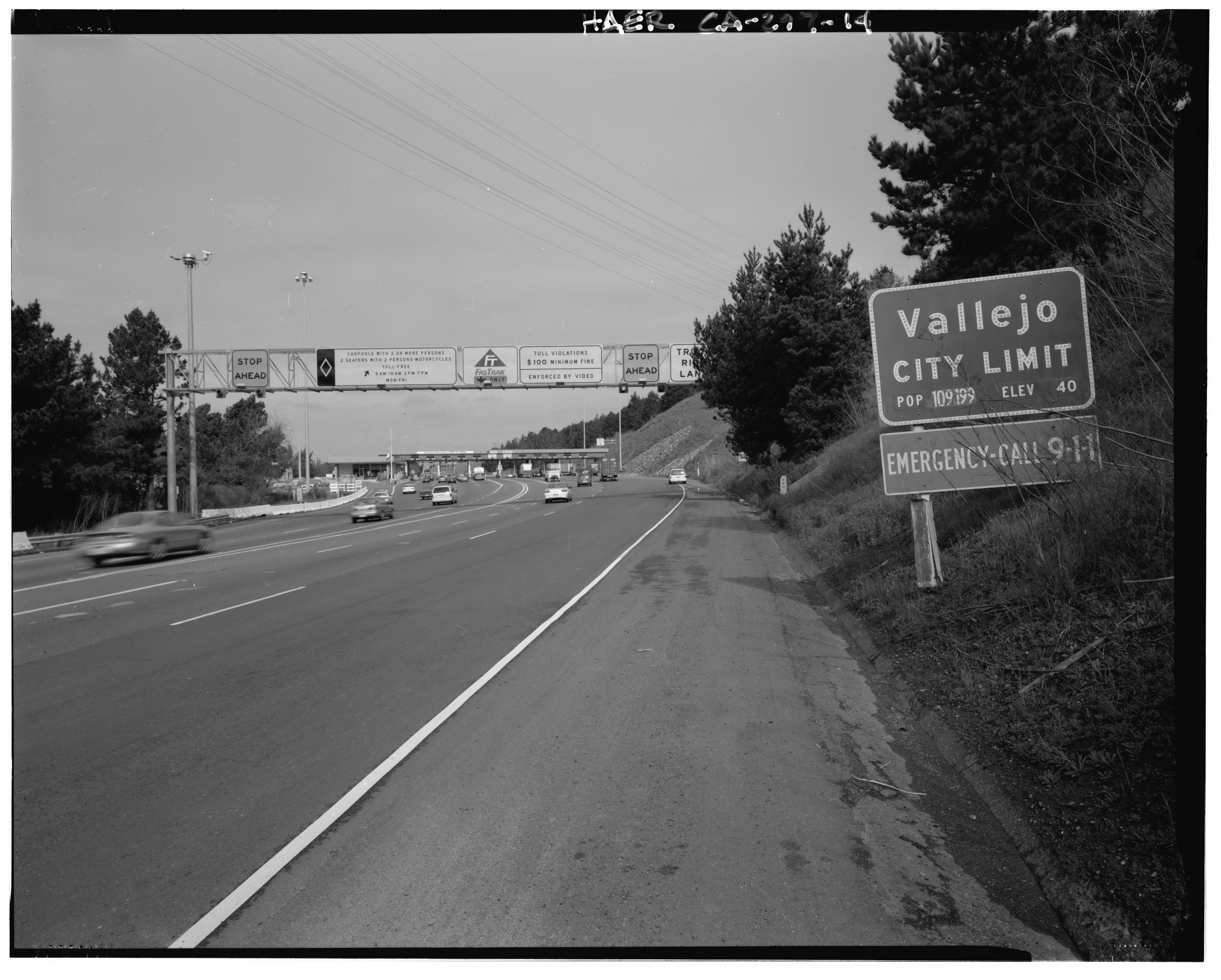
edit| Toll Plaza and approach signage on 1-80 looking north (East 1-80). Photo taken from 250 feet north of 1959 bridge (east-bound 1-80). - Carquinez Bridge, Spanning Carquinez Strait at Interstate 80, Vallejo, Solano County, CA | ||||
|---|---|---|---|---|
| Photographer |
Hall, William, creator |
|||
| Title |
Toll Plaza and approach signage on 1-80 looking north (East 1-80). Photo taken from 250 feet north of 1959 bridge (east-bound 1-80). - Carquinez Bridge, Spanning Carquinez Strait at Interstate 80, Vallejo, Solano County, CA |
|||
| Depicted place | California; Solano County; Vallejo | |||
| Date | 2000 | |||
| Dimensions | 4 x 5 in. | |||
| Current location |
Library of Congress Prints and Photographs Division Washington, D.C. 20540 USA http://hdl.loc.gov/loc.pnp/pp.print |
|||
| Accession number |
HAER CAL,48-VALL,1-14 |
|||
| Credit line |
|
|||
| Source | https://www.loc.gov/pictures/item/ca3089.photos.383417p | |||
| Permission (Reusing this file) |
|
|||

File history
Click on a date/time to view the file as it appeared at that time.
| Date/Time | Thumbnail | Dimensions | User | Comment | |
|---|---|---|---|---|---|
| current | 06:37, 6 July 2014 |  | 5,040 × 4,044 (19.44 MB) | Fæ (talk | contribs) | GWToolset: Creating mediafile for Fæ. HABS 05 July 2014 (501:600) |
You cannot overwrite this file.
File usage on Commons
The following 2 pages use this file:
- File:Carquinez Bridge Toll Plaza and approach signage on east I-80 looking north.tiff
- File:Toll Plaza and approach signage on 1-80 looking north (East 1-80). Photo taken from 250 feet north of 1959 bridge (east-bound 1-80). - Carquinez Bridge, Spanning Carquinez Strait HAER CAL,48-VALL,1-14.tif (file redirect)