File:Cover Sheet and Site Plan - Cedric and Patricia Boulter House, 1 Rawson Woods Circle, Cincinnati, Hamilton County, OH HABS OH-2482 (sheet 1 of 8).tif

Size of this JPG preview of this TIF file: 800 × 532 pixels. Other resolutions: 320 × 213 pixels | 640 × 425 pixels | 1,024 × 681 pixels | 1,280 × 851 pixels | 2,560 × 1,702 pixels | 14,408 × 9,579 pixels.
Original file (14,408 × 9,579 pixels, file size: 1.45 MB, MIME type: image/tiff)
Captions
Captions
Add a one-line explanation of what this file represents
Summary edit
| Warning | The original file is very high-resolution. It might not load properly or could cause your browser to freeze when opened at full size. |
|---|
| Cover Sheet and Site Plan - Cedric and Patricia Boulter House, 1 Rawson Woods Circle, Cincinnati, Hamilton County, OH | ||||
|---|---|---|---|---|
| Photographer |
Related names:
|
|||
| Title |
Cover Sheet and Site Plan - Cedric and Patricia Boulter House, 1 Rawson Woods Circle, Cincinnati, Hamilton County, OH |
|||
| Depicted place | Ohio; Hamilton County; Cincinnati | |||
| Date | Documentation compiled after 1933 | |||
| Current location |
Library of Congress Prints and Photographs Division Washington, D.C. 20540 USA http://hdl.loc.gov/loc.pnp/pp.print |
|||
| Accession number |
HABS OH-2482 (sheet 1 of 8) |
|||
| Credit line |
|
|||
| Notes |
|
|||
| References |
|
|||
| Source | https://www.loc.gov/pictures/item/oh1974.sheet.00001a | |||
| Permission (Reusing this file) |
|
|||
| Other versions |
.png) .png) .png) .png) |
|||

| Object location | | View this and other nearby images on: OpenStreetMap |
|---|
File history
Click on a date/time to view the file as it appeared at that time.
| Date/Time | Thumbnail | Dimensions | User | Comment | |
|---|---|---|---|---|---|
| current | 02:18, 2 August 2014 | 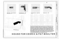 | 14,408 × 9,579 (1.45 MB) | Fæ (talk | contribs) | GWToolset: Creating mediafile for Fæ. HABS 2014-08-01 2601-2900 missing |
You cannot overwrite this file.
File usage on Commons
The following page uses this file: