File:DETAIL, BASE OF ARCH NEAR KELLY DRIVE, LOOKING WEST. - Philadelphia and Reading Railroad, Schuylkill River Viaduct, Spanning Schuylkill River, southeast of Roosevelt Boulevard HAER PA,51-PHILA,697-14.tif
Size of this JPG preview of this TIF file: 478 × 599 pixels. Other resolutions: 191 × 240 pixels | 383 × 480 pixels | 613 × 768 pixels | 817 × 1,024 pixels | 1,635 × 2,048 pixels | 3,991 × 5,000 pixels.
Original file (3,991 × 5,000 pixels, file size: 19.03 MB, MIME type: image/tiff)
Captions
Captions
Add a one-line explanation of what this file represents
Summary edit
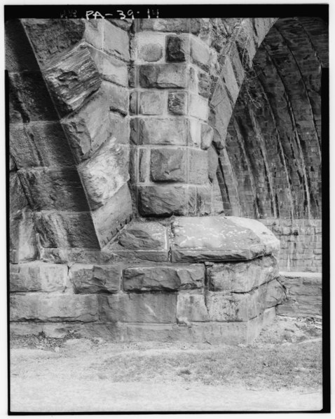
| DETAIL, BASE OF ARCH NEAR KELLY DRIVE, LOOKING WEST. - Philadelphia and Reading Railroad, Schuylkill River Viaduct, Spanning Schuylkill River, southeast of Roosevelt Boulevard Bridge, Philadelphia, Philadelphia County, PA | ||||
|---|---|---|---|---|
| Photographer |
Eliott, Joseph Related names:
|
|||
| Title |
DETAIL, BASE OF ARCH NEAR KELLY DRIVE, LOOKING WEST. - Philadelphia and Reading Railroad, Schuylkill River Viaduct, Spanning Schuylkill River, southeast of Roosevelt Boulevard Bridge, Philadelphia, Philadelphia County, PA |
|||
| Description |
Nicolls, Gustavus A; Philadelphia and Reading Railroad; Consolidated Rail Corporation; CSX Transportation; Denison, Scoville, Candee and Company; Pennsylvania Historical and Museum Commission, sponsor; DeLony, Eric N, project manager; Consolidated Rail Corporation (Conrail), sponsor; Spivey, Justin M, historian; Borchers, Perry E, photographer; Elliott, Joseph E, B, photographer |
|||
| Depicted place | Pennsylvania; Philadelphia County; Philadelphia | |||
| Date | 1999 | |||
| Dimensions | 4 x 5 in. | |||
| Current location |
Library of Congress Prints and Photographs Division Washington, D.C. 20540 USA http://hdl.loc.gov/loc.pnp/pp.print |
|||
| Accession number |
HAER PA,51-PHILA,697-14 |
|||
| Credit line |
|
|||
| Notes |
|
|||
| Source | https://www.loc.gov/pictures/item/pa1647.photos.355704p | |||
| Permission (Reusing this file) |
|
|||

| Object location | | View this and other nearby images on: OpenStreetMap |
|---|
File history
Click on a date/time to view the file as it appeared at that time.
| Date/Time | Thumbnail | Dimensions | User | Comment | |
|---|---|---|---|---|---|
| current | 14:58, 30 July 2014 |  | 3,991 × 5,000 (19.03 MB) | Fæ (talk | contribs) | GWToolset: Creating mediafile for Fæ. HABS 30 July 2014 (2901:3000) |
You cannot overwrite this file.
File usage on Commons
The following page uses this file: