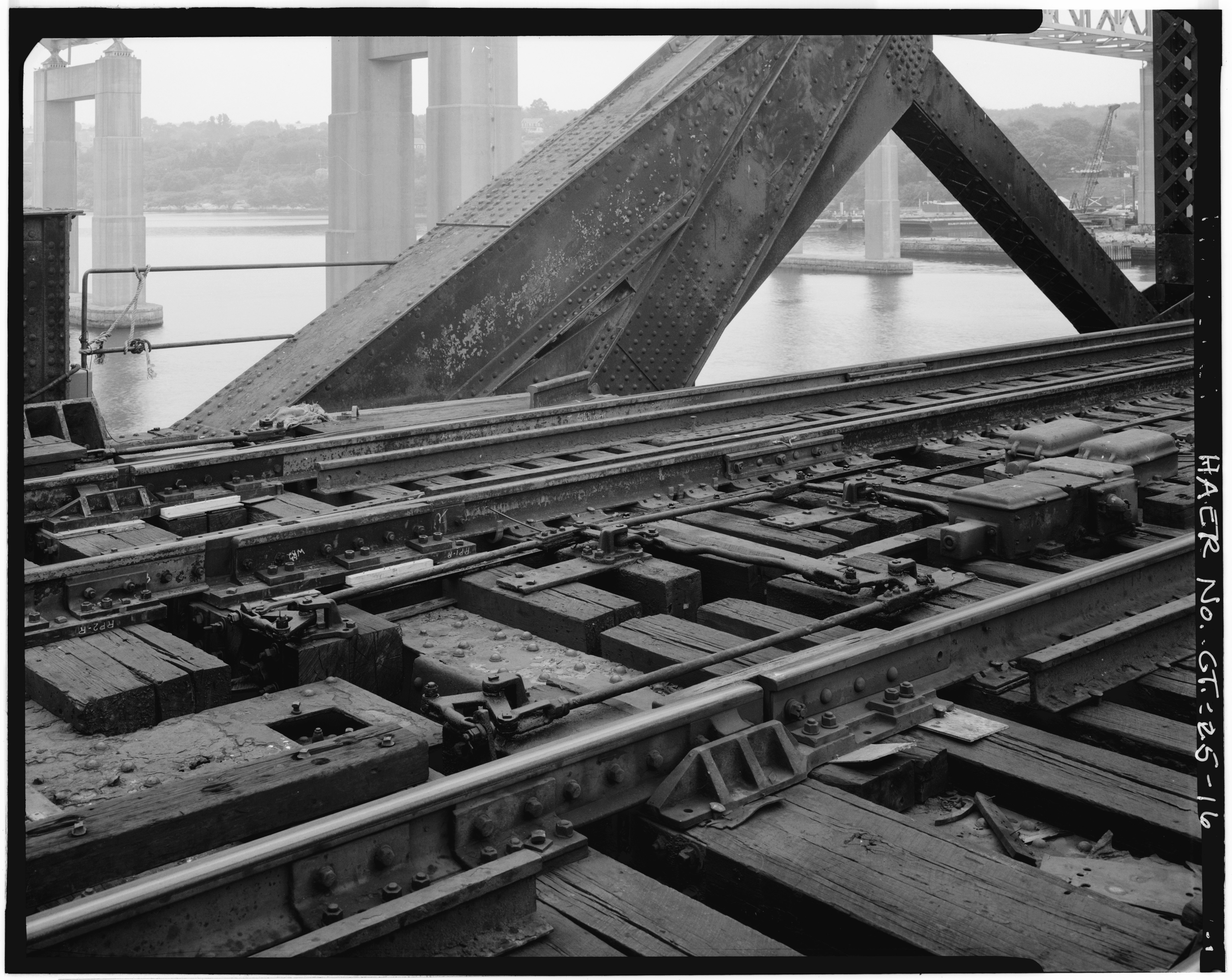
File:DETAIL, RAILS AND LOCK MECHANISM - New York, New Haven and Hartford Railroad, Groton Bridge, Spanning Thames River between New London and Groton, New London, New London County, HAER CONN,6-NEWLO,11-16.tif

Size of this JPG preview of this TIF file: 754 × 599 pixels. Other resolutions: 302 × 240 pixels | 604 × 480 pixels | 966 × 768 pixels | 1,280 × 1,018 pixels | 2,560 × 2,035 pixels | 5,036 × 4,004 pixels.
Original file (5,036 × 4,004 pixels, file size: 19.23 MB, MIME type: image/tiff)
Captions
Captions
Add a one-line explanation of what this file represents
Summary edit
| DETAIL, RAILS AND LOCK MECHANISM - New York, New Haven and Hartford Railroad, Groton Bridge, Spanning Thames River between New London and Groton, New London, New London County, CT | ||||
|---|---|---|---|---|
| Photographer |
Related names:
|
|||
| Title |
DETAIL, RAILS AND LOCK MECHANISM - New York, New Haven and Hartford Railroad, Groton Bridge, Spanning Thames River between New London and Groton, New London, New London County, CT |
|||
| Depicted place | Connecticut; New London County; New London | |||
| Date | Documentation compiled after 1968 | |||
| Dimensions | 4 x 5 in. | |||
| Current location |
Library of Congress Prints and Photographs Division Washington, D.C. 20540 USA http://hdl.loc.gov/loc.pnp/pp.print |
|||
| Accession number |
HAER CONN,6-NEWLO,11-16 |
|||
| Credit line |
|
|||
| Notes |
|
|||
| Source | https://www.loc.gov/pictures/item/ct0395.photos.024606p | |||
| Permission (Reusing this file) |
|
|||

| Object location | | View this and other nearby images on: OpenStreetMap |
|---|
File history
Click on a date/time to view the file as it appeared at that time.
| Date/Time | Thumbnail | Dimensions | User | Comment | |
|---|---|---|---|---|---|
| current | 07:57, 8 July 2014 |  | 5,036 × 4,004 (19.23 MB) | Fæ (talk | contribs) | GWToolset: Creating mediafile for Fæ. HABS 06 July 2014 (611:700) |
You cannot overwrite this file.
File usage on Commons
The following page uses this file: