File:EAST FRONT ELEVATION FROM SOUTHEAST - Comly Rich House, 4276 Orchard Street, Philadelphia, Philadelphia County, PA HABS PA,51-PHILA,534-3.tif

Size of this JPG preview of this TIF file: 432 × 600 pixels. Other resolutions: 173 × 240 pixels | 345 × 480 pixels | 553 × 768 pixels | 737 × 1,024 pixels | 1,474 × 2,048 pixels | 3,600 × 5,000 pixels.
Original file (3,600 × 5,000 pixels, file size: 17.17 MB, MIME type: image/tiff)
Captions
Captions
Add a one-line explanation of what this file represents
Summary
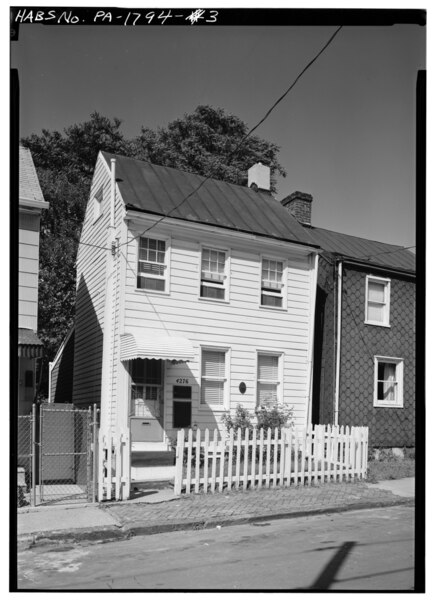
edit| EAST FRONT ELEVATION FROM SOUTHEAST - Comly Rich House, 4276 Orchard Street, Philadelphia, Philadelphia County, PA | ||||
|---|---|---|---|---|
| Photographer |
Boucher, Jack E. |
|||
| Title |
EAST FRONT ELEVATION FROM SOUTHEAST - Comly Rich House, 4276 Orchard Street, Philadelphia, Philadelphia County, PA |
|||
| Depicted place | Pennsylvania; Philadelphia County; Philadelphia | |||
| Date | 1977 | |||
| Dimensions | 5 x 7 in. | |||
| Current location |
Library of Congress Prints and Photographs Division Washington, D.C. 20540 USA http://hdl.loc.gov/loc.pnp/pp.print |
|||
| Accession number |
HABS PA,51-PHILA,534-3 |
|||
| Credit line |
|
|||
| Notes |
|
|||
| Source | https://www.loc.gov/pictures/item/pa0780.photos.139024p | |||
| Permission (Reusing this file) |
|
|||

| Object location | | View this and other nearby images on: OpenStreetMap |
|---|
File history
Click on a date/time to view the file as it appeared at that time.
| Date/Time | Thumbnail | Dimensions | User | Comment | |
|---|---|---|---|---|---|
| current | 02:27, 3 August 2014 |  | 3,600 × 5,000 (17.17 MB) | Fæ (talk | contribs) | GWToolset: Creating mediafile for Fæ. HABS 2014-08-01 2601-2900 missing |
You cannot overwrite this file.
File usage on Commons
The following page uses this file: